Ondrò Verdebio - Colle Valdobbia
4.7 km
+1081 m
−0 m
4 h
Nível físico
Mapa e percurso
Traço GPX — verifique no terreno antes de caminhar
Descrição
Pontos-chave
Partida
Ondrò Verdebio · 1427 m
Chegada
Colle Valdobbia · 2480 m
Trilho
S34
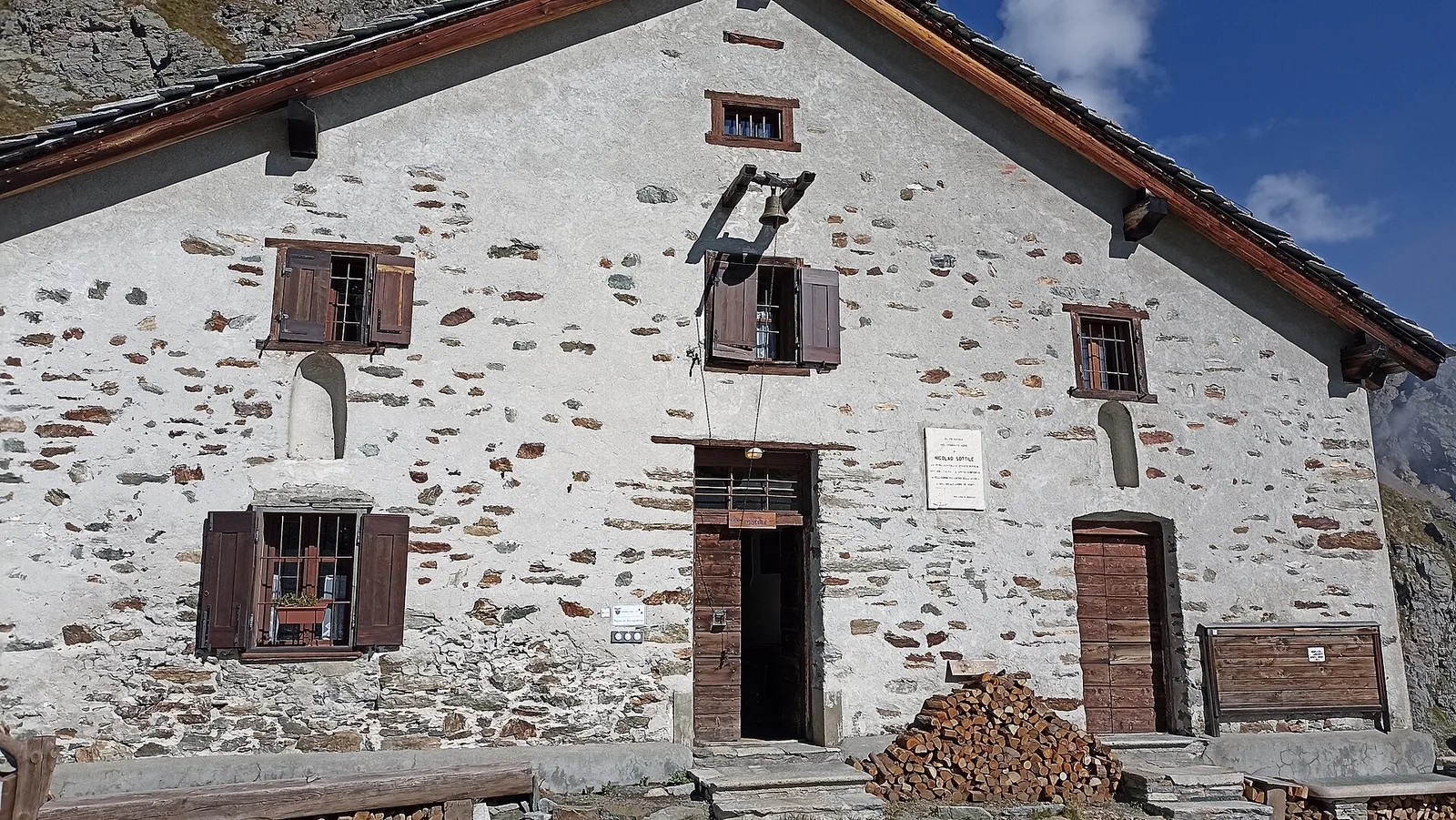
A climb to the broad Colle Valdobbia (2,480 m), a historic pass between the Lys valley and Valsesia guarded by the Ospizio Sottile, a 19th-century hospice founded by the canon Nicolao Sottile to aid travellers. The trail climbs the high pastures above Gressoney in a solemn setting, a centuries-old crossroads of the Walser migrations between Gressoney and Riva Valdobbia.
Ciências da Terra
Geologia e paisagem
The bedrock is that of the Monte Rosa nappe — continental-crust gneisses and granites, greenstones of the Alpine ocean — carved and polished by the Lys glaciers, among recent moraines and roches moutonnées.
História e cultura
This is Walser country: the Alemannic settlers who crossed the Monte Rosa glaciers from Valais in the 13th century left Gressoney the Töitschu language, timber-and-stone stadel and the German names of the peaks.
Estacionamento
Galeria de fotos
Photos are published immediately. JPG/PNG/WebP, max 6 MB.
Fauna para observar
AEditado e verificado por Andrea Rama
Fonte dos dados: Catasto Sentieri Regione Autonoma VdA · Open data — DGR 899/2014
Última verificação:
Valle del Lys
Trilhos relacionados
Mesmo vale ou percursos semelhantes — mais caminhadas para descobrir.

Valle del Lys
Anello dei Gemelli della Mologna
8.9 km · +996 m · EEA — from Niel to Niel (Great St Bernard Valley).

Valle del Lys
Balmeto - Leck Albezò
1.2 km · +287 m · E — from Balmeto to Leck Albezò (Champorcher Valley).

Valle del Lys
Bino - Passo di Valnera
4.5 km · +1280 m · E — from Bino to Alpe Jatza (Champorcher Valley).

Valle del Lys
Cascate di Niel
0.6 km · +80 m · E — from Start 7B to Cascate di Niel (Great St Bernard Valley).