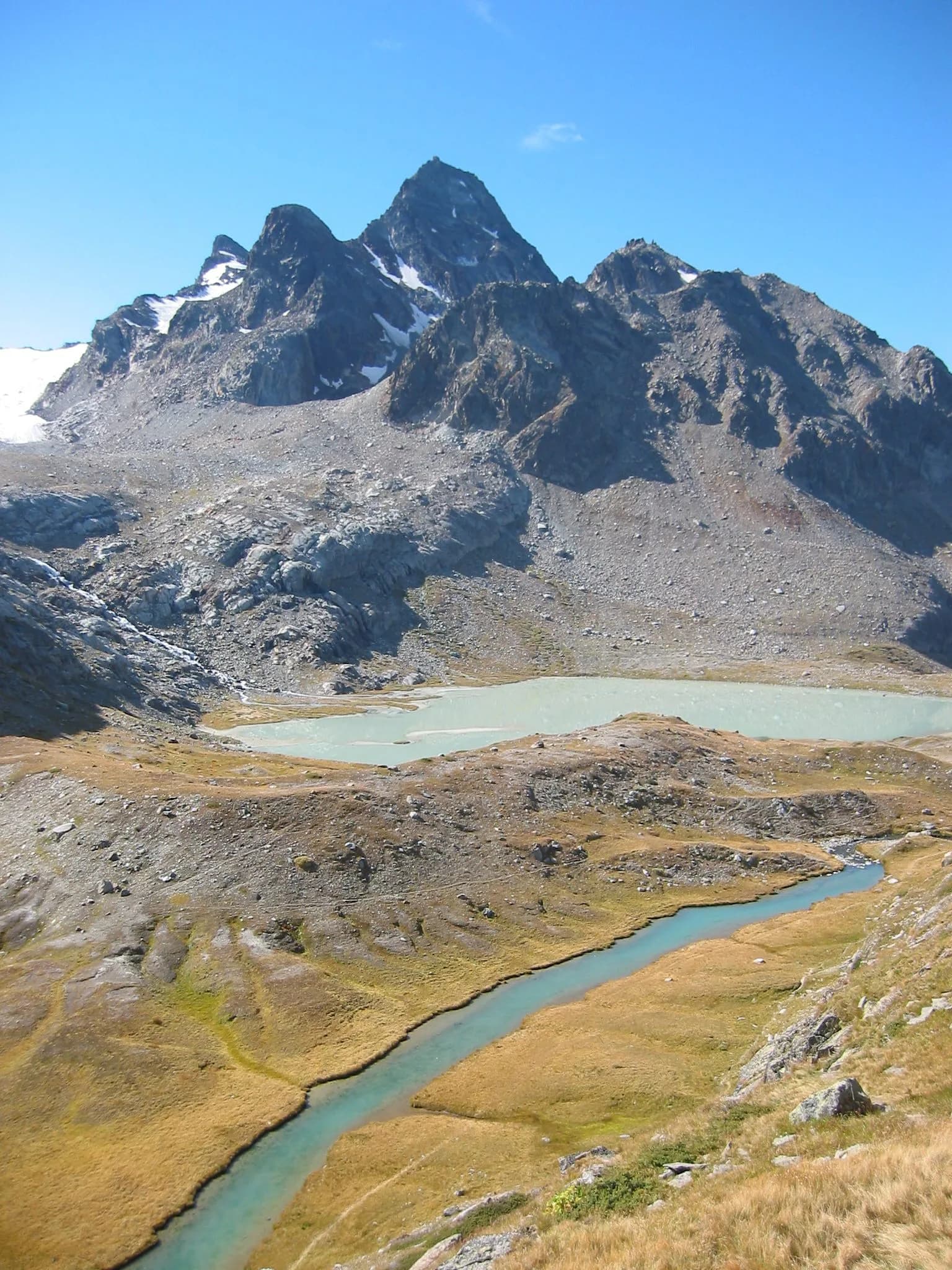
The Rutor massif above La Thuile is a natural glaciological laboratory in the heart of the western Graian Alps. Dôme de Rutor (3,486 m) and the glacial lakes of the namesake tour clearly illustrate alpine thaw dynamics: glacier retreat, proglacial lakes and vegetation colonising moraines.
At a glance
- Rutor Tour and glacial lakes
- La Thuile and Franco-Valdostan traditions
- Regional glacier monitoring
3D view of the massif
Interactive map with MapTiler terrain. Rotate and tilt to explore the mountain group.
Geology
Austroalpine basement gneiss and micaschists dominate the substrate. Würm moraines and glacio-lacustrine deposits fill cirques below the Dôme. La Thuile, on the Franco-historic flank, shows contacts between metamorphic rocks and limestone cover. Active glaciological monitoring by the Region and universities.
History and alpine culture
La Thuile was a border village and passage toward Maurienne. Iron mines and pastoral activity shaped the valley. The Rutor Tour, hiking rather than mountaineering, is among the most popular routes for observing rapidly evolving glaciers and lakes.
Trails and routes
The Rutor Tour (2–3 days) links La Thuile, Rifugio Deffeyes, glacial lakes and Rifugio Verney. Alta Via 2 starts from La Thuile toward Gran Paradiso National Park. T/E sections suitable for families in the lower part; watch for fords and spring snow.
All summits
Dôme de Rutor
3486m
Glacial dome above La Thuile, focal point of the Rutor Tour. One of the most accessible glaciers for observing thaw dynamics in Aosta Valley.