Staffal - Rifugio del Lys
3.4 km
+539 m
−0 m
2 h
Nivel físico
Mapa y ruta
Traza GPX — verifica sobre el terreno antes de caminar
Descripción
Puntos clave
Salida
Staffal · 1840 m
Llegada
Rifugio del Lys · 2365 m
Sendero
S6
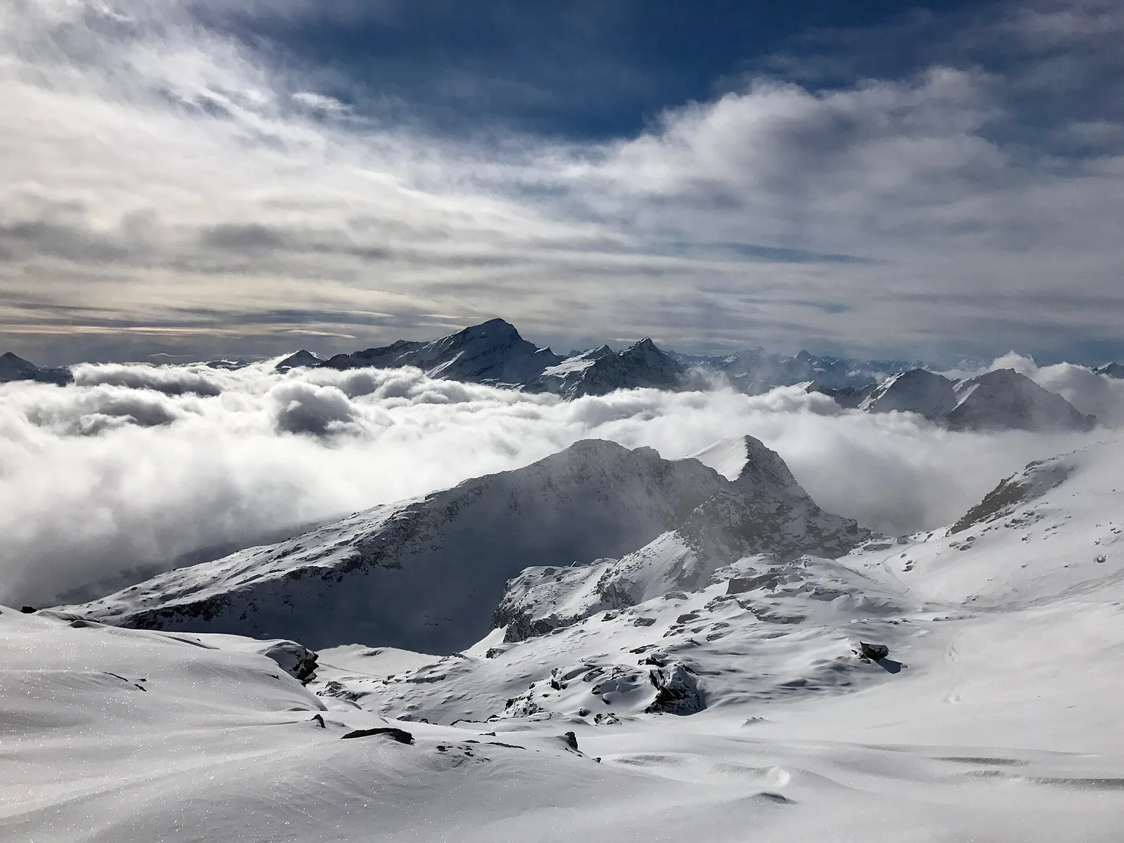
From Staffal you climb the head of the Lys valley towards the Città di Mantova hut at the Lys (also known as Rifugio del Lys), a classic base for the Monte Rosa four-thousanders. The trail crosses pastures, scree and moraines, with the icefalls of the Lys glacier ever closer and the Lyskamm wall dominating the basin. A high-mountain approach on a good path but in a severe setting: a must for those aiming at the Gnifetti and the Margherita hut.
Ciencias de la Tierra
Geología y paisaje
The bedrock is that of the Monte Rosa nappe — continental-crust gneisses and granites, greenstones of the Alpine ocean — carved and polished by the Lys glaciers, among recent moraines and roches moutonnées.
Historia y cultura
This is Walser country: the Alemannic settlers who crossed the Monte Rosa glaciers from Valais in the 13th century left Gressoney the Töitschu language, timber-and-stone stadel and the German names of the peaks.
Aparcamiento
Galería de fotos
Photos are published immediately. JPG/PNG/WebP, max 6 MB.
Flora del sendero
Fauna que observar
AEditado y verificado por Andrea Rama
Fuente de datos: Catasto Sentieri Regione Autonoma VdA · Open data — DGR 899/2014
Última verificación:
Valle del Lys
Senderos relacionados
Mismo valle o rutas similares — más excursiones por descubrir.

Valle del Lys
Anello dei Gemelli della Mologna
8.9 km · +996 m · EEA — from Niel to Niel (Great St Bernard Valley).

Valle del Lys
Balmeto - Leck Albezò
1.2 km · +287 m · E — from Balmeto to Leck Albezò (Champorcher Valley).

Valle del Lys
Bino - Passo di Valnera
4.5 km · +1280 m · E — from Bino to Alpe Jatza (Champorcher Valley).

Valle del Lys
Cascate di Niel
0.6 km · +80 m · E — from Start 7B to Cascate di Niel (Great St Bernard Valley).