Vedun - Echarlod (La Salle)
5.2 km
+0 m
−578 m
2.5 h
Nível físico
Mapa e percurso
Traço GPX — verifique no terreno antes de caminhar
Descrição
Pontos-chave
Partida
Vedun · 1519 m
Chegada
Echarlod · 1013 m
Trilho
S1
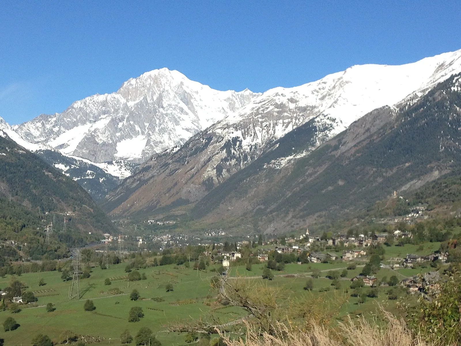
A descending route through the Valdigne, linking La Salle and La Thuile from Vedun (1519 m) down to Echarlod (1013 m). Over 5.2 km the route loses 578 m through larch and fir forests and open pastures, with views toward the Mont Blanc massif and the surrounding peaks. The gradient is sustained but manageable, making this a pleasant descent for walkers comfortable on mountain terrain. Rated E. A pleasant descent best combined with a higher-altitude outing, or walked as a relaxed spring traverse when mid-elevations clear of snow.
Estacionamento
Galeria de fotos
Photos are published immediately. JPG/PNG/WebP, max 6 MB.
Flora do trilho
Fauna para observar
AEditado e verificado por Andrea Rama
Fonte dos dados: Catasto Sentieri Regione Autonoma VdA · Open data — DGR 899/2014
Última verificação:
Valle centrale
Trilhos relacionados
Mesmo vale ou percursos semelhantes — mais caminhadas para descobrir.

Valle centrale
Anello del Verrand
2.6 km · +233 m · E — from Château Verrand to Château Verrand (Rhêmes Valley).

Valle centrale
Area giochi Croux - Parleyaz
4.1 km · +476 m · E — from Area giochi Croux to Parleyaz (Central Valley).

Valle centrale
Arlier - Cloutraz (Pontey)
From Arlier (603m) to Cloutraz (1067m) on the Châtillon hillside: 3.5 km E through vineyards, woodland and views over the Dora Baltea.

Valle centrale
Arpilles - Champromenty
2.1 km · +333 m · E — from Arpilles to Champromenty (Lys Valley).