Avise - Ravoire - Cerellaz
3 km
+479 m
−0 m
2 h
Nível físico
Mapa e percurso
Traço GPX — verifique no terreno antes de caminhar
Descrição
Pontos-chave
Partida
Avise · 782 m
Chegada
Cerellaz · 1255 m
Trilho
S16
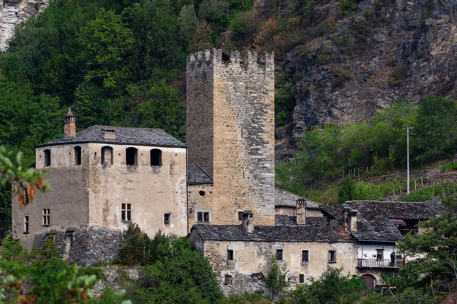
The trail links Avise, a small commune with a medieval castle at the entrance to the Valgrisenche, to the hamlet of Cerellaz in the La Salle municipality, climbing the sunny Valdigne hillside via the hamlet of Ravoire. The 3 km route gains 479 metres through a landscape that blends historic agrarian scenery with mountain terrain: terraced vineyards in the lower section, mixed downy oak and chestnut woodland in the middle, open meadows near Cerellaz. The Valdigne is the uppermost section of the Aosta Valley, with the Mont Blanc massif rising to the north. This section is also part of the Via Alpina trans-European route. Difficulty E, open April to October.
Estacionamento
Galeria de fotos
Photos are published immediately. JPG/PNG/WebP, max 6 MB.
AEditado e verificado por Andrea Rama
Fonte dos dados: Catasto Sentieri Regione Autonoma VdA · Open data — DGR 899/2014
Última verificação:
Valle centrale
Trilhos relacionados
Mesmo vale ou percursos semelhantes — mais caminhadas para descobrir.

Valle centrale
Anello del Verrand
2.6 km · +233 m · E — from Château Verrand to Château Verrand (Rhêmes Valley).

Valle centrale
Area giochi Croux - Parleyaz
4.1 km · +476 m · E — from Area giochi Croux to Parleyaz (Central Valley).

Valle centrale
Arlier - Cloutraz (Pontey)
From Arlier (603m) to Cloutraz (1067m) on the Châtillon hillside: 3.5 km E through vineyards, woodland and views over the Dora Baltea.

Valle centrale
Arpilles - Champromenty
2.1 km · +333 m · E — from Arpilles to Champromenty (Lys Valley).