Saint-Jacques - Rifugio Quintino Sella
Avisos
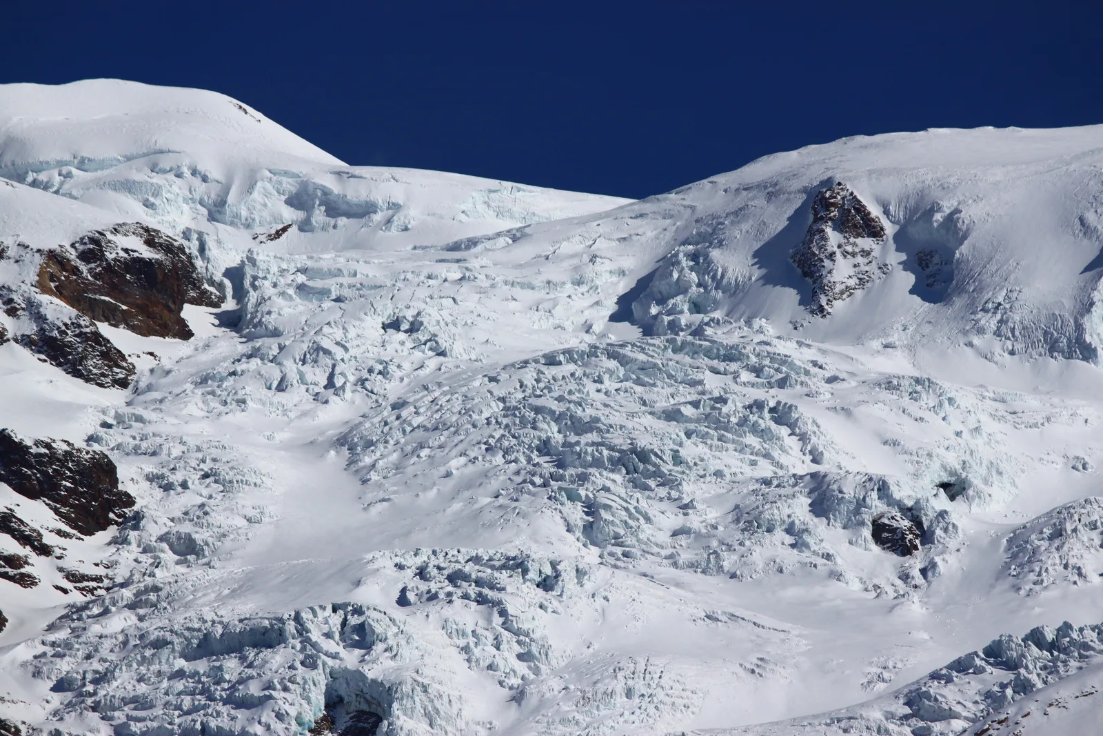
- Glacial terrain in the final section: ice axe, crampons and harness mandatory.
- Assess snow and weather conditions before departure.
- EEA rating: for alpinists with glacier experience only.
- High elevation gain (1907 m): start in the early morning.
9.5 km
+1907 m
−0 m
7 h
Nível físico
Mapa e percurso
Traço GPX — verifique no terreno antes de caminhar
Descrição
Pontos-chave
Partida
Saint-Jacques · 1719 m
Chegada
Rifugio Quintino Sella · 3602 m
Trilho
S36
A serious mountaineering route rated EEA (expert hikers with equipment), climbing from Saint-Jacques (1719 m) to the Rifugio Quintino Sella at 3602 m on the Felik Glacier — 1907 m of gain over 9.5 km. The lower sections cross high pastures and moraines, but the final approach involves glacier travel requiring crampons, ice axe, and harness. The Quintino Sella hut commands sweeping views of the Monte Rosa massif. Assess snow and glacier conditions before departure; this route is strictly for experienced alpinists.
Estacionamento
Galeria de fotos
Photos are published immediately. JPG/PNG/WebP, max 6 MB.
Flora do trilho
Fauna para observar
AEditado e verificado por Andrea Rama
Fonte dos dados: Catasto Sentieri Regione Autonoma VdA · Open data — DGR 899/2014
Última verificação:
Val d'Ayas
Trilhos relacionados
Mesmo vale ou percursos semelhantes — mais caminhadas para descobrir.

Val d'Ayas
Amponey - Becca Trecare
A demanding EE ascent from Amponey to Becca Trecare at 3032m — nearly 1500m of gain on varied terrain with sweeping summit views.

Val d'Ayas
Amponey - Alpe Mascognaz
1.8 km · +309 m · E — from Amponey to Alpe Mascognaz (Central Valley).

Val d'Ayas
Amponey - Bec de Nannaz
In the Val d'Ayas, Ayas: an E-rated climb toward a high-altitude objective through pastures and rock with views of Monte Rosa.

Val d'Ayas
Amponey - Mont Facebelle
In the Val d'Ayas, Ayas: an E/EE-rated climb toward a high-altitude objective in the alpine landscape.