Place Moulin - Rifugio Nacamuli
8.3 km
+866 m
−0 m
4 h
Nível físico
Mapa e percurso
Traço GPX — verifique no terreno antes de caminhar
Descrição
Pontos-chave
Partida
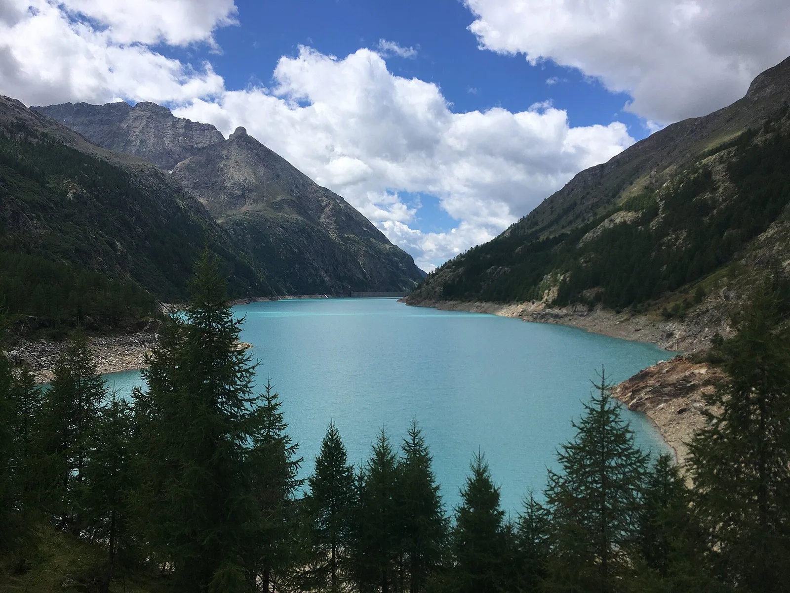
Place Moulin · 1978 m
Chegada
Rifugio Nacamuli · 2817 m
Trilho
S11
From the Place Moulin dam at the head of Valpelline, the path skirts the large reservoir and then climbs south up the valley, into a high-mountain amphitheatre closed off by the border glaciers. It gains height steadily, from 1,978 to 2,817 metres, leaving the last larches for high pastures, moraines and scree. The goal is the Nacamuli refuge, a historic base on the way to Col Collon and the surrounding peaks, looking out over a stark landscape of ice-smoothed rock and snowfields. The route runs 8.3 km with 866 metres of ascent on experienced-hiker terrain: the scree and uneven ground call for a sure foot. Best walked from summer to autumn, once the lingering snowfields have melted back.
Estacionamento
Galeria de fotos
Photos are published immediately. JPG/PNG/WebP, max 6 MB.
Flora do trilho
AEditado e verificado por Andrea Rama
Fonte dos dados: Catasto Sentieri Regione Autonoma VdA · Open data — DGR 899/2014
Última verificação:
Valpelline
Trilhos relacionados
Mesmo vale ou percursos semelhantes — mais caminhadas para descobrir.

Valpelline
Bionaz (Plan Praz) - Place Moulin
Upper Valpelline, Bionaz: an E-rated route toward a glacial objective over open terrain.

Valpelline
Chamin - Bivacco della Sassa
From Chamin (1,732 m) to the Bivacco della Sassa (2,964 m) in the quiet Valpelline: 7.1 km and 1,246 m of ascent.

Valpelline
Champillon - Rifugio Letey - Col Champillon
3.1 km · +643 m · E — from Champillon to Col Champillon (Valtournenche).

Valpelline
Chanté - Mont Saron
From Allein toward Valpelline across the panoramic ridge between the two valleys: an E-rated route over open pastures with views of the Gran San Bernardo.