Lod - Pointe de Falinière
Avisos
- EE: rocky terrain in the upper section, sure footing required.
3.7 km
+740 m
−0 m
3 h
Nível físico
Mapa e percurso
Traço GPX — verifique no terreno antes de caminhar
Descrição
Pontos-chave
Partida
Lod · 2017 m
Chegada
Pointe de Falinière · 2763 m
Trilho
S6
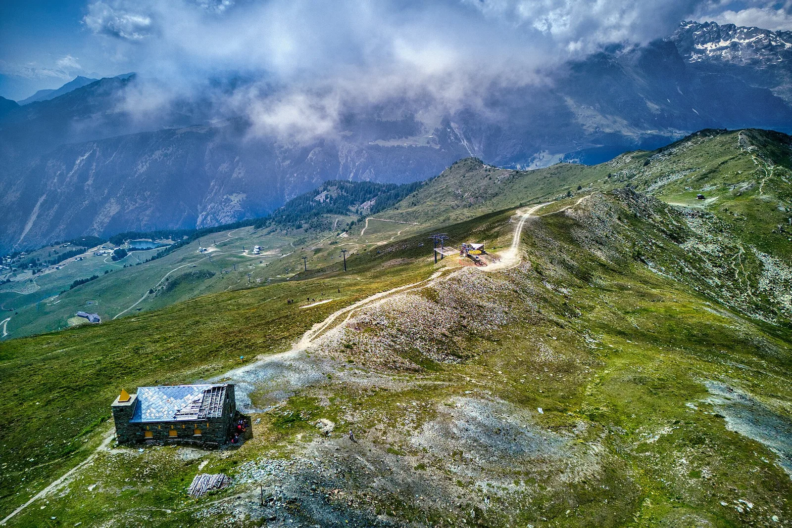
From Lod (2017 m) the trail climbs directly to Pointe de Falinière (2763 m), covering 3.7 km and 740 m of ascent in one of the fastest ascents in the Champdepraz area. The already-high starting elevation immediately places the hiker in open alpine terrain, bypassing the long forested approach typical of valley-floor starts. The EE route develops on progressively more unstable and rocky ground approaching the summit, with sections requiring sure footing. Pointe de Falinière at 2763 m offers a viewpoint over the Aosta central valley and surrounding ridges. Season: July–September.
Estacionamento
Galeria de fotos
Photos are published immediately. JPG/PNG/WebP, max 6 MB.
AEditado e verificado por Andrea Rama
Fonte dos dados: Catasto Sentieri Regione Autonoma VdA · Open data — DGR 899/2014
Última verificação:
Valtournenche
Trilhos relacionados
Mesmo vale ou percursos semelhantes — mais caminhadas para descobrir.

Valtournenche
Anello Area sportiva-Fiernaz-Area sportiva
2.9 km · +28 m · T — from Area sportiva to Area sportiva (Valtournenche).

Valtournenche
Anello dei Villaggi di Antey ( Ruvère, Liesse,Fontaney, Villettaz)
A loop through the sunlit hamlets of Antey and Torgnon: traditional Aosta Valley architecture, vineyards and mid-mountain forest, 5.2 km from Ruvère.

Valtournenche
Anello di Champlève
1.9 km · +140 m · E — from Champlève to Champlève (Central Valley).

Valtournenche
Area Pic Nic Champlong - Becca d'Aver e Cima Longhede
6.4 km · +913 m · E — from Area Pic Nic Champlong to Cima Longhede (Valsavarenche).