Veulla - Lac Gelé
Avisos
- High-altitude route: start early, plan time and water, and turn back before early afternoon.
- Residual snow may linger in gullies and on north-facing slopes into early summer: assess current conditions.
- In fog the path across pastures and boulder fields can be hard to follow: rely on waymarks and a map.
6.1 km
+1311 m
−0 m
5 h
Nível físico
Mapa e percurso
Traço GPX — verifique no terreno antes de caminhar
Descrição
Pontos-chave
Partida
Veulla · 1286 m
Chegada
Lac Gelé · 2606 m
Trilho
S12
Lac Gelé — Frozen Lake — at 2606 m near Charvensod earns its name: a glacial tarn set in a rocky cirque where snow lingers well into summer. The trail departs from Veulla at 1286 m and climbs 1311 metres in 6.1 km, one of the most sustained elevation gains among E-rated routes in the Aosta Valley. The ascent is unrelenting — conifer forest low down, open alp pastures in the middle section, then austere rock and scree near the lake. Charvensod borders the city of Aosta, making this one of the valley's most accessible high-mountain objectives.
Estacionamento
Galeria de fotos
Photos are published immediately. JPG/PNG/WebP, max 6 MB.
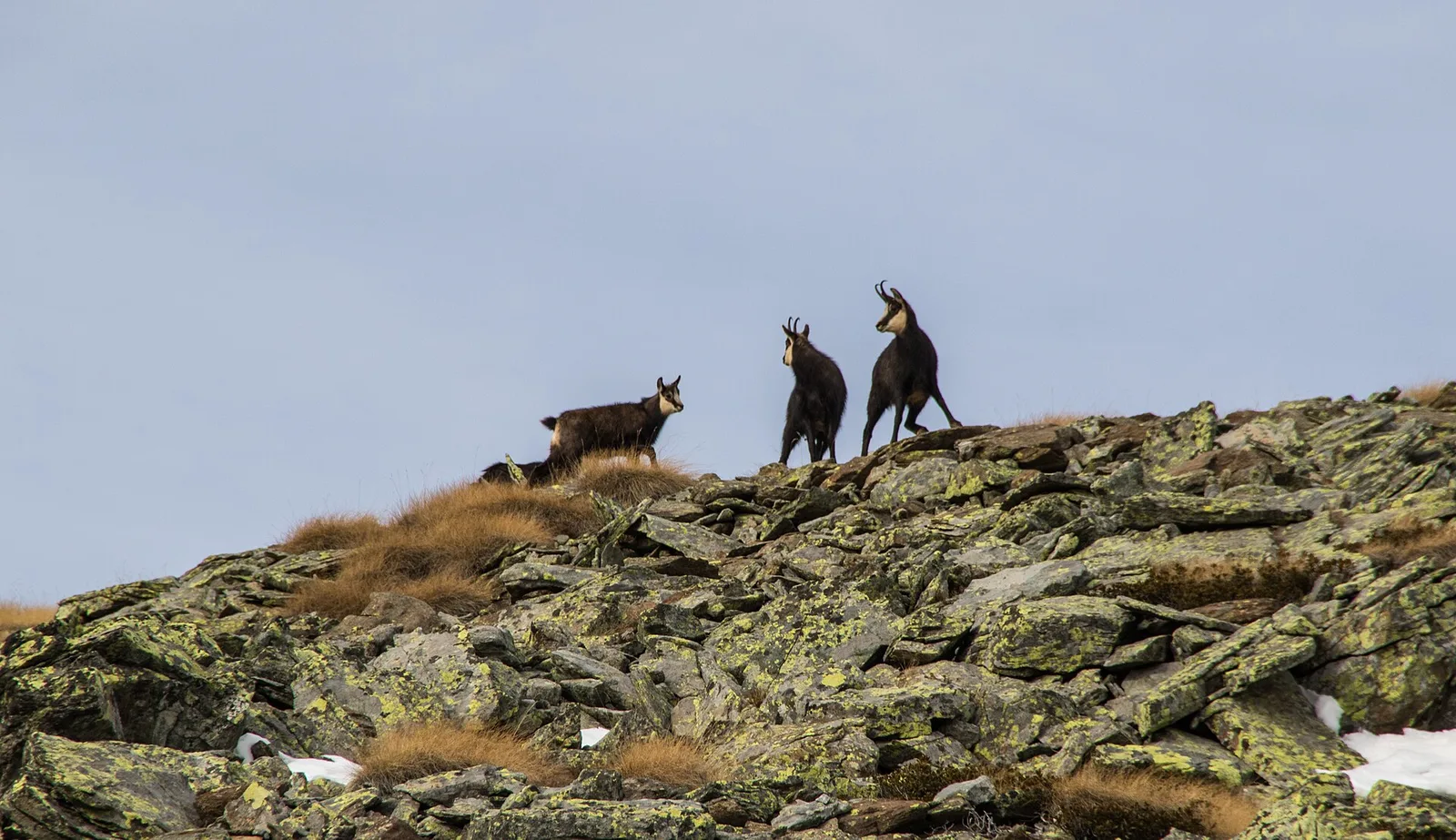
Fauna para observar
AEditado e verificado por Andrea Rama
Fonte dos dados: Catasto Sentieri Regione Autonoma VdA · Open data — DGR 899/2014
Última verificação:
Valle di Champorcher
Trilhos relacionados
Mesmo vale ou percursos semelhantes — mais caminhadas para descobrir.

Valle di Champorcher
Barche - Plan Clavalité - Grand Alpe
13.9 km · +1540 m · E — from Barche to Grand Alpe (Lys Valley).

Valle di Champorcher
Castagnot - Col de Pofouey
3.8 km · +903 m · E — from Castagnot to Colle d'Arcomy (Central Valley).

Valle di Champorcher
Champorcher - Col de la Fricolla
8.8 km · +1350 m · EE — from Champorcher to Col de la Fricolla (Valtournenche).

Valle di Champorcher
Champorcher - Col Laris
10.1 km · +1406 m · E — from Champrocher to Col Laris (Valtournenche).