High Route 1 — Stage 2: Perloz → Rifugio Coda
Avisos
- Sustained, relentless ascent throughout the stage
- Residual snow possible until mid-June above 2000 m
 1 / 2
1 / 211 km
+1150 m
−80 m
5.5 h
Nível físico
~2800 kcal estimadas
Mapa e percurso
Traço GPX oficial — Região Vale de Aosta / lovevda.it
Descrição
Pontos-chave
Partida
Perloz · 1372 m
Chegada
Rifugio Coda · 2250 m
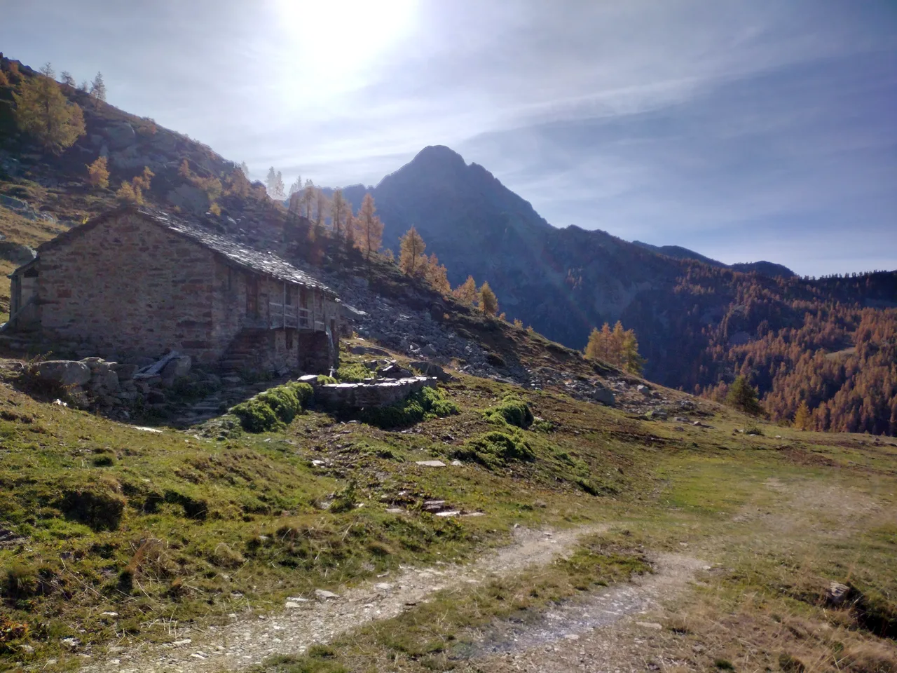
Stage two of High Route 1 begins with a brief descent from Perloz toward Lillianes before committing to a long, sustained climb into the Regional Nature Reserve of Mont Mars. The path winds upward through mixed woodland — birch, larch and Scots pine — where road noise fades quickly and the sound of side-streams takes over. As altitude accumulates the forest opens onto high pastures scattered with emerald glacial tarns, the celebrated Mont Mars lakes that have drawn pilgrims and walkers for centuries. Rifugio Coda, at 2280 metres in the heart of the reserve, is run by the CAI section of Pont-Saint-Martin and offers a genuine mountain-hut experience well away from mainstream tourism. Every year in early July the surrounding meadows host the traditional alpine procession of Mont Mars, a ceremony weaving together religious devotion and the pastoral memory of Walser communities. The stage involves no technical difficulty but demands steady, unrelenting ascent: an early departure allows walkers to enjoy the raking morning light on the eastern peaks and to arrive at the hut with comfortable time to spare before evening.
Pontos-chave
Perloz
1148 m · 0 km from start
Stage start, last bar before the nature reserve
Lillianes
565 m · 2.5 km from start
Brief descent to valley floor, springs near the stream
Mont Mars
2600 m · 8.5 km from start
Panoramic ridge with emerald glacial tarns
Ciências da Terra
Geologia e paisagem
The Mont Mars slope belongs to the Austroalpine domain, with outcrops of augen gneiss and garnet micaschists typical of the Sesia-Lanzo metamorphic basement. Glacial tarns on the summer pastures occupy cirques carved by the Würm glacier, with well-preserved lateral moraines and proglacial sand-gravel deposits. Above 1800 m, quartzites and mica phyllites appear with bands of quartz-feldspar pegmatites. Alpine bogs along the trail indicate post-glacial lacustrine deposits on impermeable substrate. Penninic ophiolites (serpentinites and basalts) are visible only distantly toward the Lys valley. Differential erosion has cut deep gorges in micaschists, with erratic gneiss boulders on terminal moraines.
História e cultura
The Mont Mars Regional Nature Reserve protects alpine ecosystems and glacial lakes. In early July the Mont Mars alpine procession takes place, blending devotion and Walser pastoral memory.
Pontos de água
Reliable springs at Lillianes and along streams below 1500 m. Potable water at Rifugio Coda; few intermediate points above 1800 m.
Como chegar
Access to Perloz via municipal road from Pont-Saint-Martin. VITA buses to Pont-Saint-Martin with limited connections to upland villages.
Estacionamento
Parcheggio limitato a Perloz centro; evitare di lasciare auto su strada comunale stretta.
Cumes próximos
Refúgios e abrigos
Galeria de fotos
Photos are published immediately. JPG/PNG/WebP, max 6 MB.
Flora do trilho
Fauna para observar
Temas e características
Etapas adjacentes
AEditado e verificado por Andrea Rama
Fonte dos dados: Catasto Sentieri Regione VdA + lovevda.it · Open data — DGR 899/2014
Última verificação:
Bassa Valle — Mont Mars
Trilhos relacionados
Mesmo vale ou percursos semelhantes — mais caminhadas para descobrir.
Bassa Valle
High Route 2 — Stage 14: Crest → Donnas
Final AV2 stage: from Retempio sanctuary to Donnas in the valley floor.

Bassa Valle
Arsines - Col Fenetre
A short woodland climb from Arsines, above Arnad, to Col Fenêtre: a scenic pass of the lower Aosta Valley.

Bassa Valle
Bard - Tête de Cou
In the commune of Cogne, Gran Paradiso National Park: a climb toward a high-altitude objective in an environment of exceptional natural quality.

Bassa Valle
Barme - Carogne
1.6 km · +397 m · E — from Barme to Carogne (Valtournenche).