Tour du Mont Blanc — Stage 1: Courmayeur → Rifugio Giorgio Bertone
Avisos
- Book overnight stops in peak season
 1 / 2
1 / 24.7 km
+767 m
−36 m
3 h
Nível físico
Mapa e percurso
Traço GPX — verifique no terreno antes de caminhar
Descrição
Pontos-chave
Partida
Courmayeur · 1227 m
Chegada
Rifugio Giorgio Bertone · 1992 m
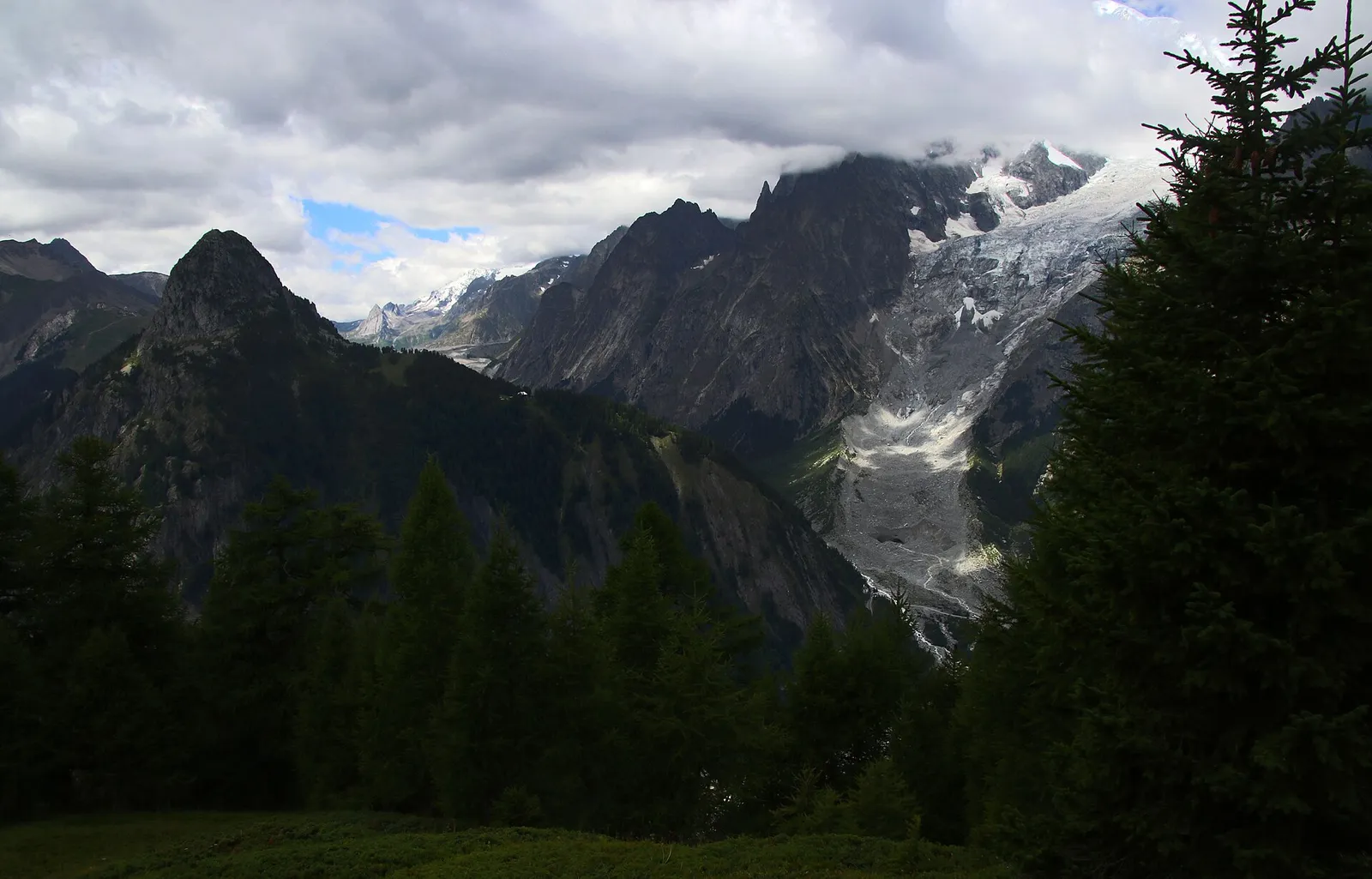
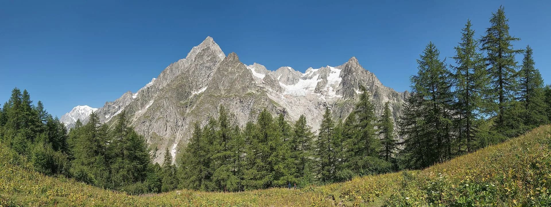
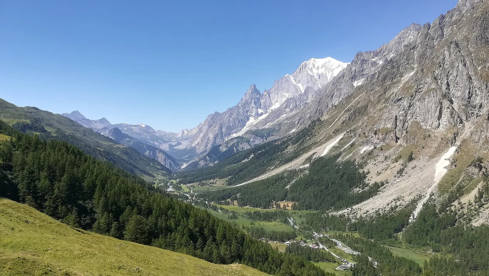
From the centre of Courmayeur (1,224 m) the TMB trail climbs steadily through the Villair woods to Rifugio Bertone (1,989 m), overlooking Mont Chétif and the Mont Blanc chain. A short but steep stage, ideal for finding your trekking rhythm.
The trail leaves from Villair, Courmayeur’s old upper hamlet, and gains height through fir forest on an endless series of well-graded switchbacks: nearly 800 metres of steady climbing, best tackled early in the cool hours. At every bend the view widens, until the trees thin out and the Bertone terrace appears, with the Dent du Géant and the Grandes Jorasses suddenly within reach. Water and food only at the hut, so start well supplied. Early arrivals can climb half an hour to Mont de la Saxe for sunset over the massif.
Ciências da Terra
Geologia e paisagem
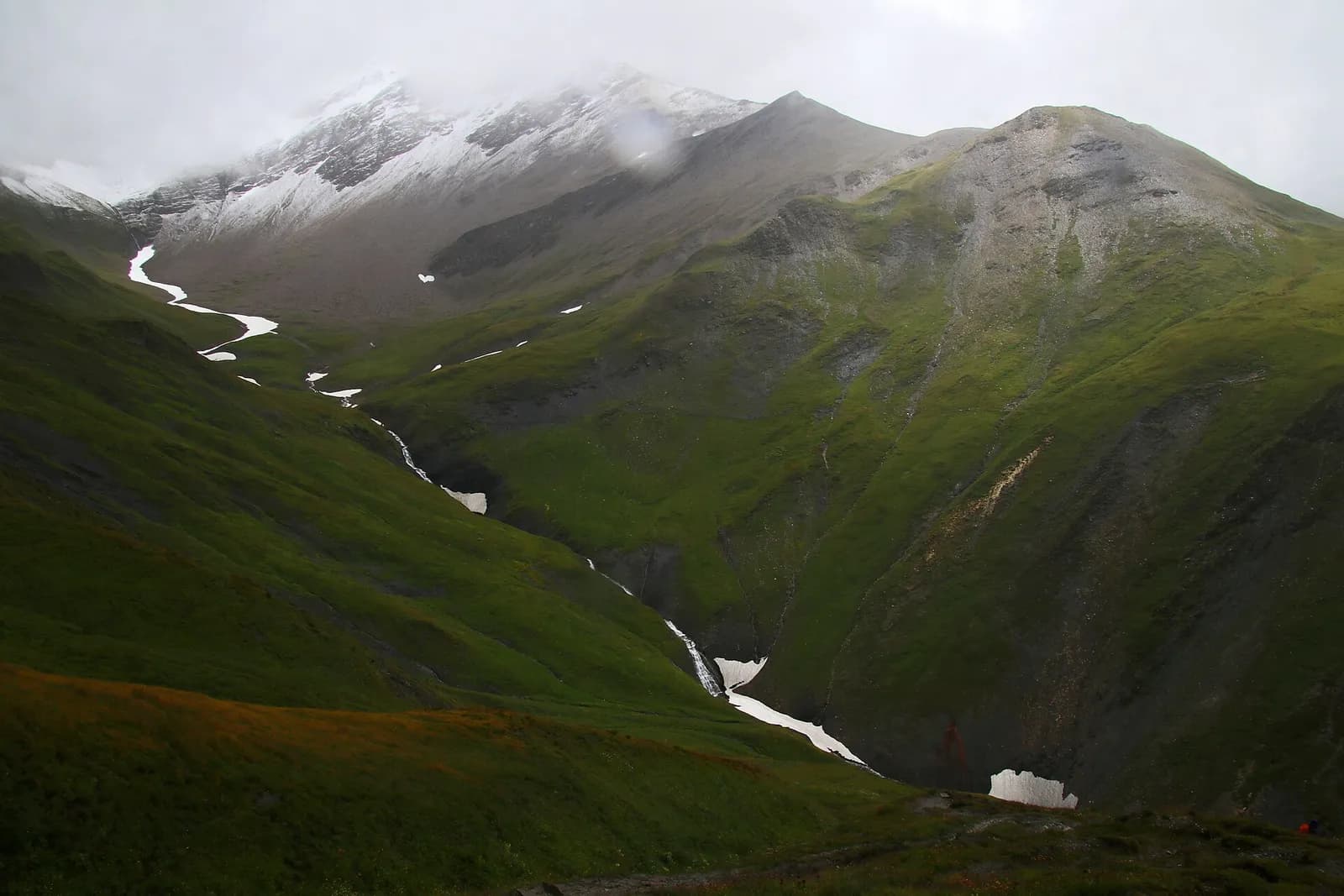
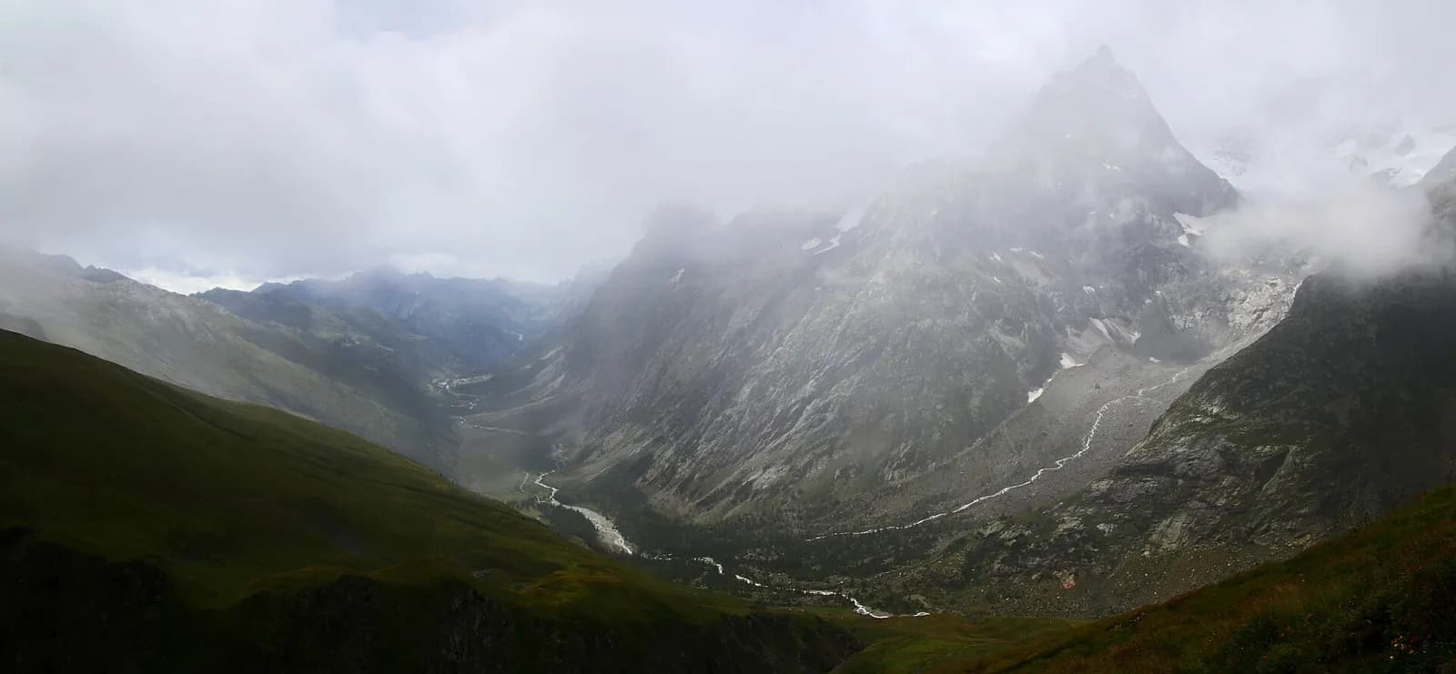
Mont Blanc hanging valley: gneiss, granites and Miage moraines; glaciological views of the Italian flank of the massif.
História e cultura
The hut is dedicated to Giorgio Bertone, a Courmayeur guide central to the great Mont Blanc climbs of the 1970s; Villair was the guides’ and muleteers’ quarter.
Pontos de água
Water at the stage's support points (Courmayeur, Rifugio Bertone, Rifugio Giorgio Bertone). On the high ground and at the passes springs are not guaranteed: fill bottles in the valley and at the huts.
Como chegar
VITA buses and connections from Aosta; check seasonal timetables at vita.it.
Estacionamento
Refúgios e abrigos
Galeria de fotos
Photos are published immediately. JPG/PNG/WebP, max 6 MB.
Flora do trilho
Etapas adjacentes
AEditado e verificado por Andrea Rama
Fonte dos dados: Tour du Mont Blanc — itinerario internazionale segnalato · Traccia calcolata su rete sentieri OpenStreetMap (ODbL); verificare sul terreno
Última verificação:
Val Ferret
Trilhos relacionados
Mesmo vale ou percursos semelhantes — mais caminhadas para descobrir.
Val Ferret
Tour du Mont Blanc — Stage 3: Rifugio Walter Bonatti → Rifugio Elena
Towards the head of Val Ferret, below the Pré de Bar glacier.
Val Ferret — Val Ferret svizzera
Tour du Mont Blanc — Stage 4: Rifugio Elena → La Fouly
The Grand Col Ferret: leaving Italy, entering Switzerland.
Val Ferret
High Route 1 — Stage 16: Rifugio Frassati → Rifugio Bonatti via Col Malatrà
Col Malatrà at 2925 m is the rooftop of Alta Via 1: from the panoramic crest above Mont Blanc the trail descends into Val Ferret to the legendary Rifugio Walter Bonatti.
Val Ferret
High Route 1 — Stage 17: Rifugio Bonatti → Courmayeur
The final AV1 stage: the Val Ferret balcony trail with Mont Blanc and Grandes Jorasses always in sight, ending at Courmayeur, Italy's alpine capital.