Tour Monte Rosa — Stage 7: Europahütte → Zermatt
Avisos
- Exposed equipped sections: surefootedness and a head for heights required
- Book overnight stops in peak season
13.3 km
+233 m
−1013 m
5.5 h
Nível físico
Mapa e percurso
Traço GPX — verifique no terreno antes de caminhar
Descrição
Pontos-chave
Partida
Europahütte · 2267 m
Chegada
Zermatt · 1601 m
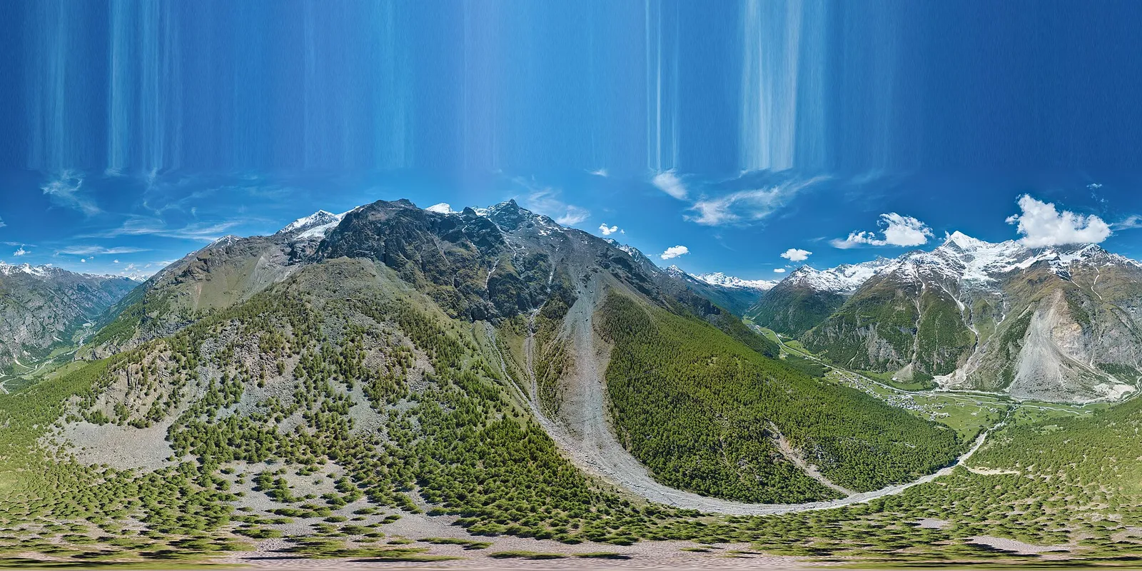
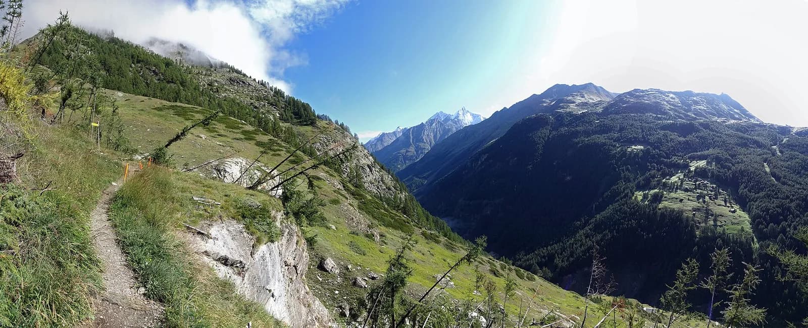
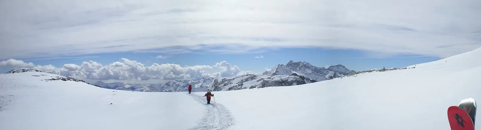
From the Europahütte cross the Charles Kuonen suspension bridge, 494 metres long — the longest in the Alps — and continue along the Europaweg via Täschalp and Tufteren until the Matterhorn appears, towering over Zermatt (1,608 m).
Minutes after setting out you cross the Charles Kuonen Hängebrücke: 494 metres of walkway suspended 85 metres above the Grabengufer gully, the longest pedestrian suspension bridge in the Alps — guaranteed thrills, with solid handrails and a grid deck. The Europaweg then continues more gently to the Täschalp, where chapel and restaurant invite a pause, and finally traverses to the hay meadows of Tufteren: from here the Matterhorn commands every step of the descent to Zermatt, among ancient stone pines and the blackened barns of Zmutt. You arrive in the village’s pedestrian heart.
Ciências da Terra
Geologia e paisagem
Monte Rosa is the core of the Penninic nappe of the same name: gneisses and granites of subducted, exhumed European continental crust. Around it the tour crosses the Zermatt-Saas ophiolite zone — green serpentinites, metabasalts and metagabbros, the floor of a vanished Jurassic ocean — outcropping at the Olen, Theodul and Cime Bianche passes. The 2,600-metre Macugnaga east face is the highest wall in the Alps and exposes the nappe in full section.
História e cultura
The Charles Kuonen bridge (2017) replaced a walkway destroyed by rockfall within months: its 494 metres make it the longest pedestrian suspension bridge in the Alps. Zmutt preserves Zermatt’s oldest Walser core.
Pontos de água
Water at the stage's support points (Europahütte, Zermatt). On the high ground and at the passes springs are not guaranteed: fill bottles in the valley and at the huts.
Como chegar
Cross-border stage: on the foreign sides local public transport applies (PostAuto in Switzerland, line buses in France/Piedmont). Check seasonal timetables; in peak season several access links run by reservation only.
Estacionamento
Galeria de fotos
Photos are published immediately. JPG/PNG/WebP, max 6 MB.
Etapas adjacentes
AEditado e verificado por Andrea Rama
Fonte dos dados: Tour del Monte Rosa — itinerario internazionale segnalato (TMR) · Traccia calcolata su rete sentieri OpenStreetMap (ODbL); verificare sul terreno
Última verificação:
Mattertal (Vallese)
Trilhos relacionados
Mesmo vale ou percursos semelhantes — mais caminhadas para descobrir.
Mattertal (Vallese)
Tour of the Matterhorn — Stage 7: St. Niklaus → Zermatt
Along the Vispa to the Matterhorn’s village.
Valle del Lys
Tour Monte Rosa — Stage 1: Gressoney-Saint-Jean → Lago Gabiet
From the Walser capital to Lake Gabiet.
Val d’Ayas — Valle del Lys
Tour Monte Rosa — Stage 10: Saint-Jacques → Gressoney-Saint-Jean
The Pinter pass closes the Aosta Valley loop of the Rosa.
Valle del Lys — Valsesia (Piemonte)
Tour Monte Rosa — Stage 2: Lago Gabiet → Alagna Valsesia
The Col d’Olen and the descent into Valsesia, beyond the Aosta Valley.