Trail guide
The best hikes in Valgrisenche
The best hikes in Valgrisenche: 13 selected trails with difficulty, distance, elevation gain and links to the route pages. Sentieri VdA guide.
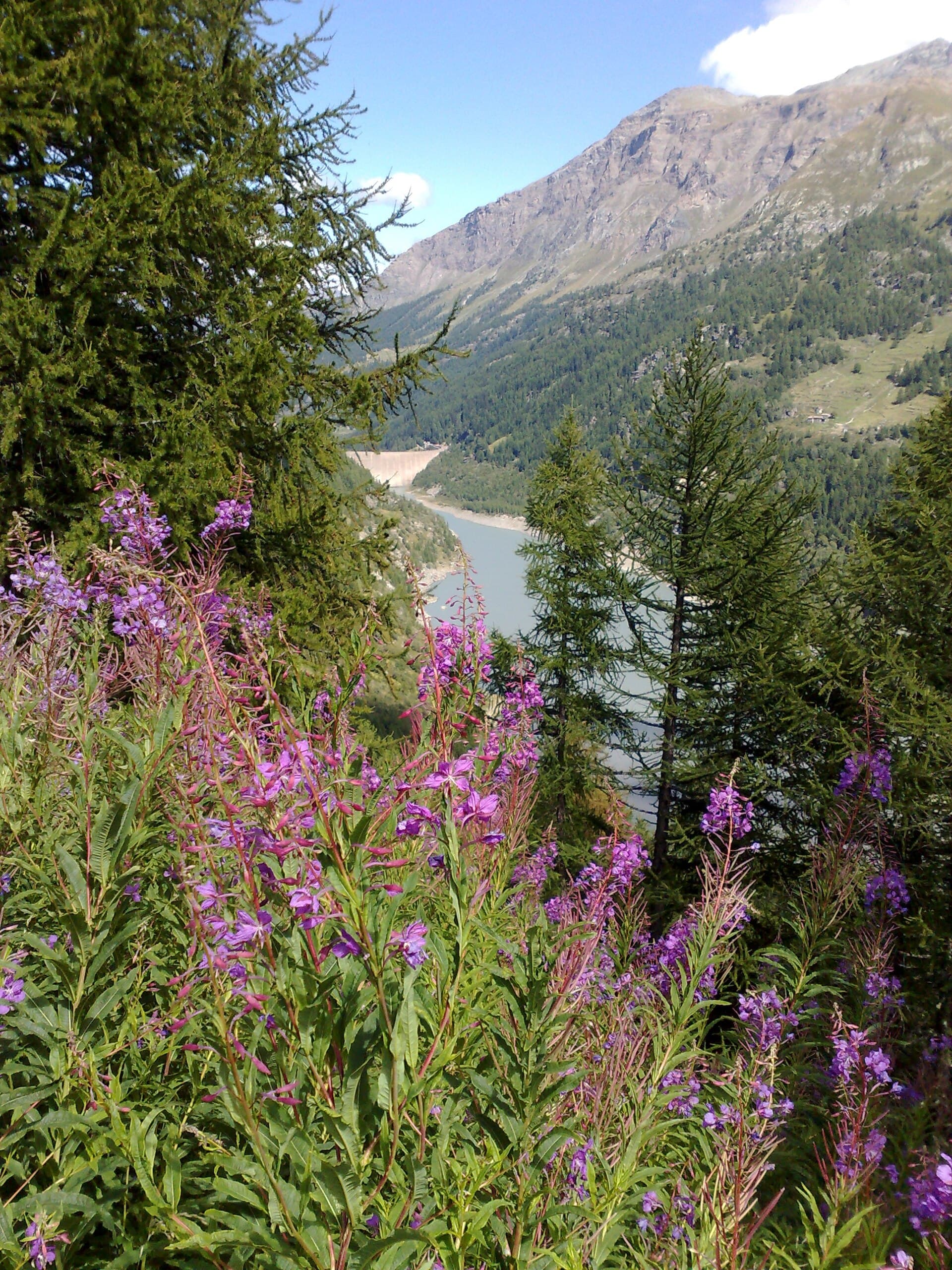
The narrowest and wildest of the Aosta valleys, Valgrisenche is the land of drap wool and deep silence: Lake Beauregard, the Bezzi and Chalet de l’Epée refuges, the Grande Sassière and Rutor glaciers.
This guide gathers the best trails in the area, all from the Sentieri VdA catalogue: for each one you get the CAI difficulty, distance, elevation gain and a direct link to the route page with map, elevation profile, photos and the day’s weather.
Every itinerary below uses real data from the Aosta Valley trail registry — waymark numbers, distances and elevation gain — and links to the full page with satellite map, GPX track, elevation profile and the nearest town’s weather. Always check conditions before setting off: at altitude the weather changes fast and some passes stay snow-covered into early summer.
Selected trails
Tour du Rutor — Stage 4: Valgrisenche → Sainte-Foy-Tarentaise
23.1 km · +1138 m · EE — from Valgrisenche to Sainte-Foy-Tarentaise.
From Valgrisenche climb past the Beauregard reservoir to the Col du Mont (2,639 m), a pass of shepherds, smugglers and soldiers between Italy and France. The long descent on the French side drops through the Mercuel valley to Sainte-Foy-Tarentaise (1,051 m); just north, the alp-village of Le Monal is worth the detour.
High Route 2 — Stage 5: Planaval → Rifugio Chalet de l'Épée
12 km · +915 m · E — from Planaval to Rifugio Chalet de l'Épée.
Follow Valgrisenche valley floor via La Frassy and Gerbelle before the final climb to Chalet de l'Épée hut.
High Route 2 — Stage 6: Rifugio Chalet de l'Épée → Rhêmes-Notre-Dame
10 km · +475 m · E — from Rifugio Chalet de l'Épée to Rhêmes-Notre-Dame.
Brief climb to Col Fenêtre (2840 m) and descent through pastures and woods to the Park visitor centre at Rhêmes-Notre-Dame.
Tour du Rutor — Stage 3: Planaval → Valgrisenche
5.7 km · +162 m · E — from Planaval to Valgrisenche.
A short valley stage: from Planaval ascend the Valgrisenche between woods, meadows and stone villages to the head village (1,664 m), home of drap, the loom-woven wool cloth. Time to visit the village and the Beauregard dam.
Mondanges - Col de Feleumaz
9.2 km · +1353 m · E — from Mondanges to Col de Feleumaz.
Mondanges - Col de Feleumaz is an official trail from the Aosta Valley trail registry (code 68_S5). The route lies in the municipality of Valtournenche, in the Valtournenche. From Mondanges (1652 m) to Col de Feleumaz (3024 m): 9.2 km with +1353 m of elevation change, difficulty E (CAI scale).
Col Bassac Déré
10.9 km · +1302 m · E — from Surrier to Col Bassac Déré.
Col Bassac Déré is an official trail from the Aosta Valley trail registry (code 68_S36). The route lies in the municipality of Valtournenche, in the Valtournenche. From Surrier (1785 m) to Col Bassac Déré (3096 m): 10.9 km with +1302 m of elevation change, difficulty E (CAI scale).
La Béthaz - Rifugio degli Angeli al Morion
7.6 km · +1281 m · E — from La Béthaz to Rifugio degli Angeli al Morion.
La Béthaz - Rifugio degli Angeli al Morion is an official trail from the Aosta Valley trail registry (code 68_S35). The route lies in the municipality of Valtournenche, in the Valtournenche. From La Béthaz (1656 m) to Rifugio degli Angeli al Morion (2913 m): 7.6 km with +1281 m of elevation change, difficulty E (CAI scale).
Menthieu - Ricovero Capitano Ricci - Lago San Grato
7.6 km · +1124 m · E — from Menthieu to Lago San Grato.
Menthieu - Ricovero Capitano Ricci - Lago San Grato is an official trail from the Aosta Valley trail registry (code 68_S30). The route lies in the municipality of Valtournenche, in the Valtournenche. From Menthieu (1864 m) to Lago San Grato (2454 m): 7.6 km with +1124 m of elevation change, difficulty E (CAI scale).
Surrier , bivio poderali - Bivacco Ravelli
6.3 km · +1091 m · E — from Surrier, bivio poderali to Bivacco Ravelli.
Surrier , bivio poderali - Bivacco Ravelli is an official trail from the Aosta Valley trail registry (code 68_S15). The route lies in the municipality of Valtournenche, in the Valtournenche. From Surrier, bivio poderali (1785 m) to Bivacco Ravelli (2850 m): 6.3 km with +1091 m of elevation change, difficulty E (CAI scale).
Menthieu, partenza poderale - Rifugio degli Angeli al Morion
5.5 km · +1059 m · E — from Menthieu, partenza poderale to Rifugio degli Angeli al Morion.
Menthieu, partenza poderale - Rifugio degli Angeli al Morion is an official trail from the Aosta Valley trail registry (code 68_S33). The route lies in the municipality of Valtournenche, in the Valtournenche.
Rifugio Bezzi - Col Bassac
4.5 km · +877 m · E — from Rifugio Bezzi to Col Bassac.
Rifugio Bezzi - Col Bassac is an official trail from the Aosta Valley trail registry (code 68_S19). The route lies in the municipality of Valtournenche, in the Valtournenche. From Rifugio Bezzi (2298 m) to Col Bassac (3164 m): 4.5 km with +877 m of elevation change, difficulty E (CAI scale).
Bivio strada per Grand Alpe - Col du Mont
5 km · +706 m · E — from Bivio strada per Grand Alpe to Col du Mont.
Bivio strada per Grand Alpe - Col du Mont is an official trail from the Aosta Valley trail registry (code 68_S26). The route lies in the municipality of Valtournenche, in the Valtournenche. From Bivio strada per Grand Alpe (1933 m) to Col du Mont (2635 m): 5 km with +706 m of elevation change, difficulty E (CAI scale).
Balconata dal Belvedere al lago di San Grato
4.9 km · +705 m · E — from Bois de Grillet to Lago di San Grato.
Balconata dal Belvedere al lago di San Grato is an official trail from the Aosta Valley trail registry (code 68_S37). The route lies in the municipality of Valtournenche, in the Valtournenche. From Bois de Grillet (1974 m) to Lago di San Grato (2465 m): 4.9 km with +705 m of elevation change, difficulty E (CAI scale).
Explore the full catalogue on the Trails page and plan your next hike in the Aosta Valley.
Cover photo: Giovanni-P · CC BY-SA 3.0