Rutor Tour — Stage 2: Rifugio Deffeyes → Lago Rutor
6 km
+150 m
−250 m
3 h
Fitness level
~693 kcal estimated
Elevation profile
Map & route
Download GPXGPX track — verify on the ground before hiking
Description
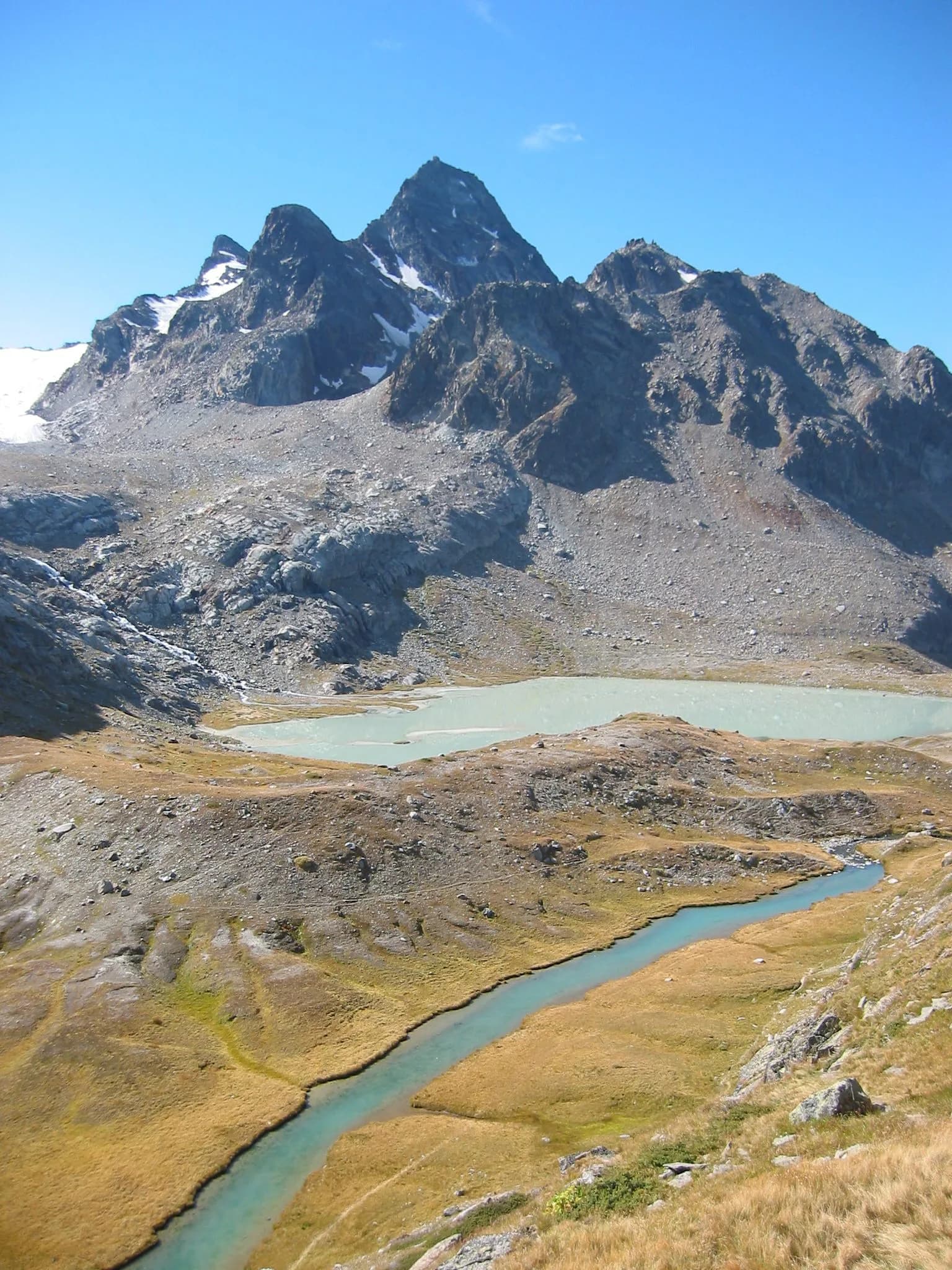
Panoramic stage among glacial lakes and active moraines of the Rutor massif.
Key points
Lago Rutor
2380 m · 6 km from start
Earth sciences
Geology & landscape
Rutor valley: metamorphic bedrock and active glacial deposits. Retreating Rutor glaciers with proglacial lakes and recent moraines visible from the trail.
Water sources
Services in La Thuile. Rifugio Deffeyes and Promoud bivouac with water in season.
Getting there
VITA buses and connections from Aosta; check seasonal timetables at vita.it.
Parking
Parcheggi comunali nei paesi di valle; verificare limitazioni in alta stagione.
Warnings
- Check weather and residual snow early season
- Book huts in peak season
Nearby peaks
Start & end
Start
Rifugio Deffeyes
2485 m
Finish
Lago Rutor
1545 m
Refuges & bivouacs
Photo gallery
Flora along the trail
Adjacent stages
ACurated and verified by Andrea
Data source: Catasto Sentieri Regione Autonoma VdA · Open data — DGR 899/2014
Last verified:
La Thuile
Related trails
Same valley or similar routes — more hikes to explore.

La Thuile
Rutor Tour — Stage 4: Rifugio Verney → La Thuile
Return to La Thuile closing the Rutor loop.

La Thuile
High Route 2 — Stage 3: La Thuile → Promoud
Climb to Rifugio Deffeyes and Promoud bivouac in the Rutor valley.

La Thuile
High Route 2 — Stage 4: Promoud → Planaval
Cross Col de la Crosatie and descend toward Planaval in Valgrisenche.
La Thuile
Chabodey - Croix du Folliet
6.3 km · +1313 m · E — from Chabodey to Croix du Folliet (La Thuile).