Crest - Lac Chercherioz
3.8 km
+428 m
−0 m
2 h
Nivel físico
Mapa y ruta
Traza GPX — verifica sobre el terreno antes de caminar
Descripción
Puntos clave
Salida
Crest · 1976 m
Llegada
Lac Chercherioz · 2354 m
Sendero
S38
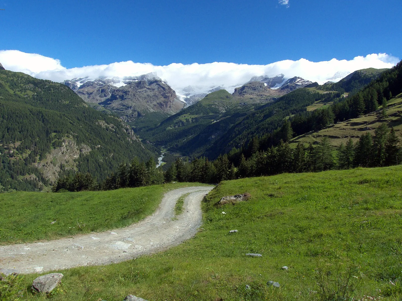
The short route from Crest to Lac Chercherioz climbs a side valley above the central Aosta Valley in the commune of Avise, covering just over 3.8 km to reach a high-altitude lake. The walk starts at Crest (1976 m), already at elevation. The 428 m elevation gain is modest relative to the arrival altitude, allowing a steady progression over open terrain. Lac Chercherioz (2354 m) is the objective: an alpine lake set among meadows and rock, with the panoramic openness typical of exposed slopes in the central valley. The E rating marks a route suited to hikers of average fitness.
Aparcamiento
Galería de fotos
Photos are published immediately. JPG/PNG/WebP, max 6 MB.
Fauna que observar
AEditado y verificado por Andrea Rama
Fuente de datos: Catasto Sentieri Regione Autonoma VdA · Open data — DGR 899/2014
Última verificación:
Val d'Ayas
Senderos relacionados
Mismo valle o rutas similares — más excursiones por descubrir.

Val d'Ayas
Amponey - Becca Trecare
A demanding EE ascent from Amponey to Becca Trecare at 3032m — nearly 1500m of gain on varied terrain with sweeping summit views.

Val d'Ayas
Amponey - Alpe Mascognaz
1.8 km · +309 m · E — from Amponey to Alpe Mascognaz (Central Valley).

Val d'Ayas
Amponey - Bec de Nannaz
In the Val d'Ayas, Ayas: an E-rated climb toward a high-altitude objective through pastures and rock with views of Monte Rosa.

Val d'Ayas
Amponey - Mont Facebelle
In the Val d'Ayas, Ayas: an E/EE-rated climb toward a high-altitude objective in the alpine landscape.