Barmasc - Col Pillonnet
Advertencias
- Some sections of the path are faint: follow yellow markings carefully.
- Residual snow possible until late May/early June.
3.7 km
+799 m
−0 m
3 h
Nivel físico
Mapa y ruta
Traza GPX — verifica sobre el terreno antes de caminar
Descripción
Puntos clave
Salida
Barmasc · 1898 m
Llegada
Col Pillonnet · 2698 m
Sendero
S6
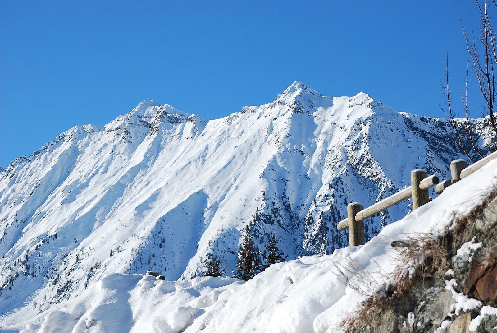
The trail from Barmasc to Col Pillonnet climbs one of the passes linking the Val d'Ayas with the Valtournenche, reaching 2698 m in just 3.7 km with 799 m of elevation gain. The walk begins at Barmasc (1898 m). From the car park, trail 2A climbs the slope directly, soon crossing the Ru Courtod stream, then continues toward the Alpe Corneuil area, gaining height steadily. The final section leads to Col Pillonnet: an open saddle on the Chamois side offering views across both valleys. The E rating reflects a technically straightforward route with steep sections requiring care. Recommended from late May to October.
Aparcamiento
Galería de fotos
Photos are published immediately. JPG/PNG/WebP, max 6 MB.
Flora del sendero
AEditado y verificado por Andrea Rama
Fuente de datos: Catasto Sentieri Regione Autonoma VdA · Open data — DGR 899/2014
Última verificación:
Val d'Ayas
Senderos relacionados
Mismo valle o rutas similares — más excursiones por descubrir.

Val d'Ayas
Amponey - Becca Trecare
A demanding EE ascent from Amponey to Becca Trecare at 3032m — nearly 1500m of gain on varied terrain with sweeping summit views.

Val d'Ayas
Amponey - Alpe Mascognaz
1.8 km · +309 m · E — from Amponey to Alpe Mascognaz (Central Valley).

Val d'Ayas
Amponey - Bec de Nannaz
In the Val d'Ayas, Ayas: an E-rated climb toward a high-altitude objective through pastures and rock with views of Monte Rosa.

Val d'Ayas
Amponey - Mont Facebelle
In the Val d'Ayas, Ayas: an E/EE-rated climb toward a high-altitude objective in the alpine landscape.