Strada per Estoul - Punta Regina - Col de Garda
4.7 km
+513 m
−0 m
2.5 h
Nivel físico
Mapa y ruta
Traza GPX — verifica sobre el terreno antes de caminar
Descripción
Puntos clave
Salida
Estoul · 1884 m
Llegada
Col de Garda · 2289 m
Sendero
S22
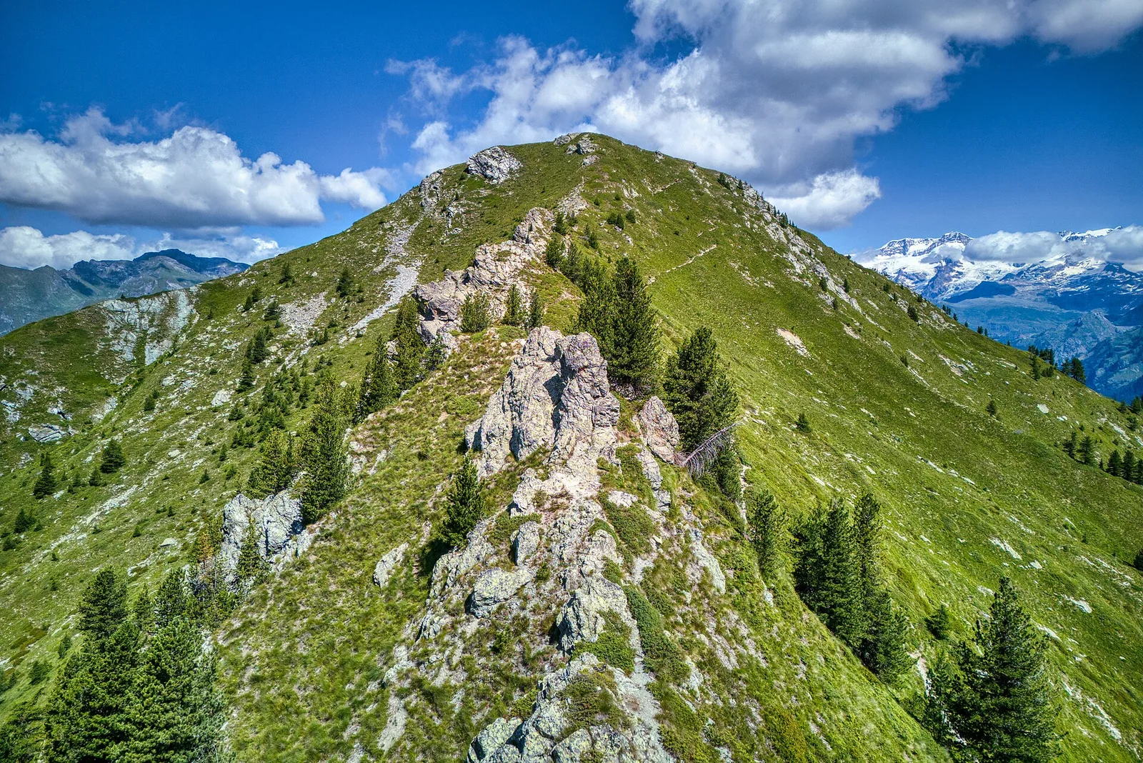
Starting from Estoul (1884 m), a charming hamlet of Brusson nestled among larch trees, the trail climbs steadily north-east across open pastures that host grazing flocks in summer. Rounding the southern flanks of Punta Regina, the vegetation thins and broad views open toward the ridgeline separating Val d'Ayas from the Gressoney valley. The path is grassy and well-marked, with occasional rocky sections near the higher reaches. The Col de Garda (2289 m) rewards hikers with a sweeping panorama over the Monte Rosa massif to the east and the Brusson valley floor to the west. A manageable ascent suitable for moderately fit walkers from June through September.
Aparcamiento
Galería de fotos
Photos are published immediately. JPG/PNG/WebP, max 6 MB.
Flora del sendero
Fauna que observar
AEditado y verificado por Andrea Rama
Fuente de datos: Catasto Sentieri Regione Autonoma VdA · Open data — DGR 899/2014
Última verificación:
Valle del Lys
Senderos relacionados
Mismo valle o rutas similares — más excursiones por descubrir.

Valle del Lys
Anello dei Gemelli della Mologna
8.9 km · +996 m · EEA — from Niel to Niel (Great St Bernard Valley).

Valle del Lys
Balmeto - Leck Albezò
1.2 km · +287 m · E — from Balmeto to Leck Albezò (Champorcher Valley).

Valle del Lys
Bino - Passo di Valnera
4.5 km · +1280 m · E — from Bino to Alpe Jatza (Champorcher Valley).

Valle del Lys
Cascate di Niel
0.6 km · +80 m · E — from Start 7B to Cascate di Niel (Great St Bernard Valley).