Tour Monte Rosa — Stage 9: Breuil-Cervinia → Saint-Jacques
Advertencias
- Snowfields possible on the passes until early July
- Book overnight stops in peak season
15.6 km
+1004 m
−1393 m
8.5 h
Nivel físico
Mapa y ruta
Traza GPX — verifica sobre el terreno antes de caminar
Descripción
Puntos clave
Salida
Breuil-Cervinia · 2001 m
Llegada
Saint-Jacques · 1690 m
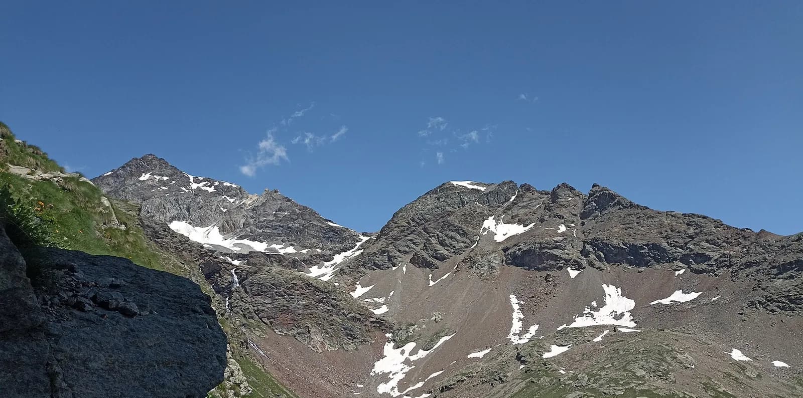
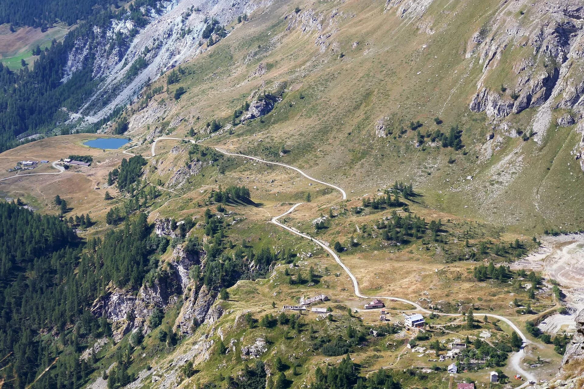
From Breuil-Cervinia climb to the upper Cime Bianche pass (2,982 m), a grand viewpoint over the Matterhorn and the Monte Rosa glaciers, then descend the wild Cime Bianche valley to Saint-Jacques (1,689 m), the last village of the Ayas valley.
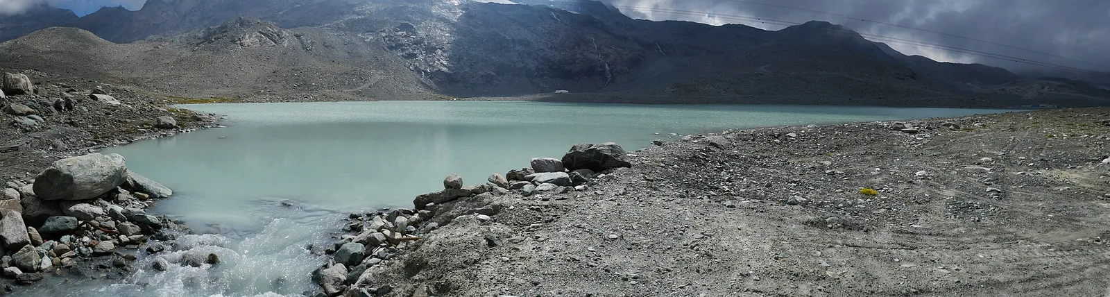
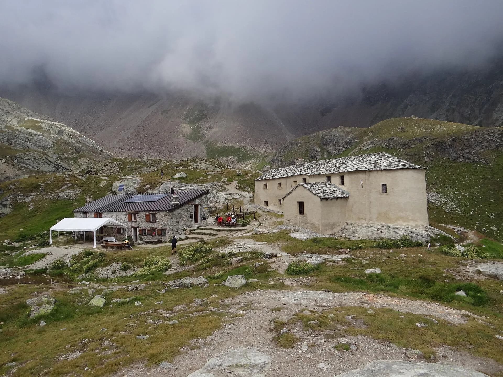
You leave the Breuil basin climbing gently to Plan Maison and on into the Cime Bianche valley, surprisingly lonely despite the nearby lifts: glacial tarns, high grasslands and the Matterhorn taking its leave behind you. The upper Cime Bianche pass is a double balcony: back to the Gran Becca, forward to the Monte Rosa glaciers above the Verra basin. The long descent passes the Gran Lago and the Vascoccia plateaus before dropping to Saint-Jacques, the old Walser roadhead of the Ayas valley, with fountains, a gîte and buses to Champoluc.
Puntos clave
Colle Superiore delle Cime Bianche
2982 m · 6.3 km from start
Ciencias de la Tierra
Geología y paisaje
Monte Rosa is the core of the Penninic nappe of the same name: gneisses and granites of subducted, exhumed European continental crust. Around it the tour crosses the Zermatt-Saas ophiolite zone — green serpentinites, metabasalts and metagabbros, the floor of a vanished Jurassic ocean — outcropping at the Olen, Theodul and Cime Bianche passes. The 2,600-metre Macugnaga east face is the highest wall in the Alps and exposes the nappe in full section.
Historia y cultura
The Cime Bianche valley has long been contested between plans for a Cervinia-Monterosa Ski lift link and those defending it as the last untouched valley of the Aosta Rosa.
Fuentes de agua
Water at the stage's support points (Breuil-Cervinia, Saint-Jacques). On the high ground and at the passes springs are not guaranteed: fill bottles in the valley and at the huts.
Cómo llegar
Aosta Valley side served by VITA buses and connections from Aosta; many valley heads have summer shuttles. Check seasonal timetables at arriva.it / vita-vda.com.
Aparcamiento
Galería de fotos
Photos are published immediately. JPG/PNG/WebP, max 6 MB.
Etapas contiguas
AEditado y verificado por Andrea Rama
Fuente de datos: Tour del Monte Rosa — itinerario internazionale segnalato (TMR) · Traccia calcolata su rete sentieri OpenStreetMap (ODbL); verificare sul terreno
Última verificación:
Valtournenche — Val d’Ayas
Senderos relacionados
Mismo valle o rutas similares — más excursiones por descubrir.
Valtournenche — Valpelline
Tour of the Matterhorn — Stage 1: Breuil-Cervinia → Rifugio Prarayer
The Valcournera pass, a stern gateway to the Valpelline.
Valtournenche — Val Saint-Barthélemy
High Route 1 — Stage 10: Rifugio Jean Barmasse → Rifugio Oratorio di Cuney
The wild heart of the Alta Via: 17 km across Fenêtre de Tsan, Col Terray and on to Rifugio Oratorio di Cuney, with Matterhorn and Grand Combin dominating a horizon of 2700-metre passes.
Valtournenche
High Route 1 — Stage 8: Rifugio Grand Tournalin → Valtournenche
The great descent: from Rifugio Grand Tournalin losing over a thousand metres to the valley floor of Valtournenche, passing through the scenic plateau of Cheneil with Matterhorn views.
Valtournenche
High Route 1 — Stage 9: Valtournenche → Rifugio Jean Barmasse
The shortest stage on the entire AV1: 4.7 km of sustained climbing from Valtournenche to Rifugio Jean Barmasse on the shores of Lago di Cignana, in preparation for the hardest day ahead.