Tour Monte Rosa — Stage 10: Saint-Jacques → Gressoney-Saint-Jean
Advertencias
- Snowfields possible on the passes until early July
- Book overnight stops in peak season
17.5 km
+1297 m
−1692 m
10.5 h
Nivel físico
Mapa y ruta
Traza GPX — verifica sobre el terreno antes de caminar
Descripción
Puntos clave
Salida
Saint-Jacques · 1690 m
Llegada
Gressoney-Saint-Jean · 1399 m
From Saint-Jacques descend along the Evançon to Champoluc, then climb the Cunéaz valley to the Pinter pass (2,777 m), with the four-thousanders of Monte Rosa back on the horizon. The descent through the Loo valley, among Walser pastures, returns to Gressoney-Saint-Jean, closing the loop.
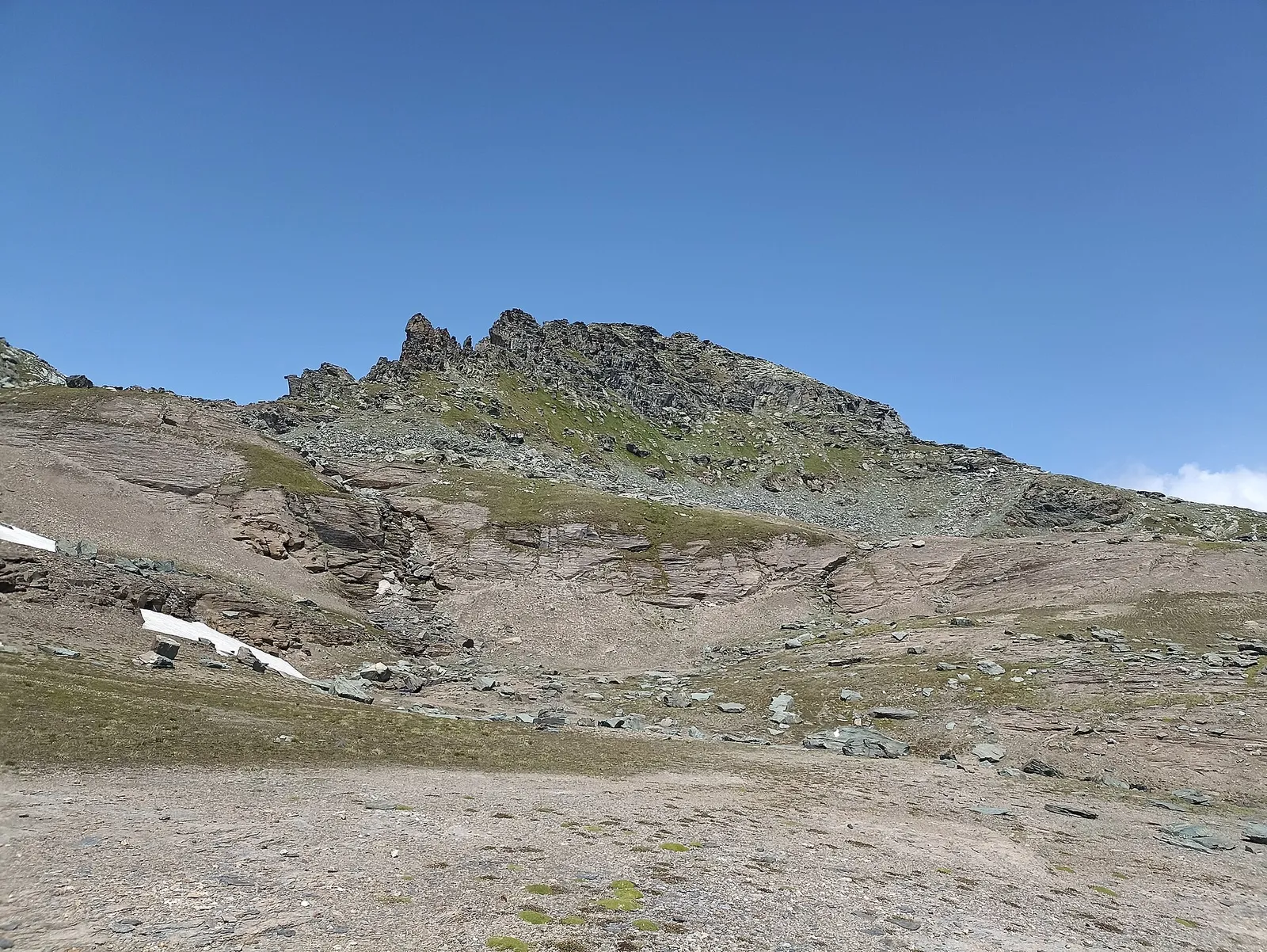
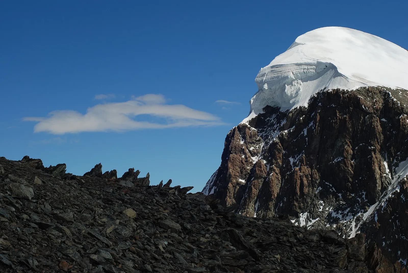
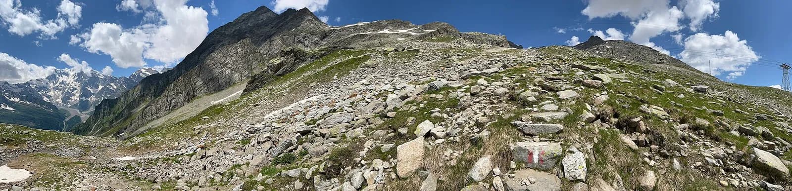
The loop’s last pass is also one of its finest: from the Champoluc valley floor you ascend the Cunéaz valley, dotted with perfectly preserved Walser hamlets, to the tarns below the Pinter pass. From the col, a 360-degree summary of the whole trek: Monte Rosa from Castor to the Lyskamm, the distant Matterhorn, and the Gressoney plains below. The descent through the Loo valley is a beautiful farewell, among stone-roofed chalets and impossibly steep pastures, down to Gressoney-Saint-Jean, where the loop closes facing Monte Rosa. The Crest cable car usefully cuts the first 600 metres.
Puntos clave
Colle Pinter
2777 m · 8 km from start
Ciencias de la Tierra
Geología y paisaje
Monte Rosa is the core of the Penninic nappe of the same name: gneisses and granites of subducted, exhumed European continental crust. Around it the tour crosses the Zermatt-Saas ophiolite zone — green serpentinites, metabasalts and metagabbros, the floor of a vanished Jurassic ocean — outcropping at the Olen, Theodul and Cime Bianche passes. The 2,600-metre Macugnaga east face is the highest wall in the Alps and exposes the nappe in full section.
Historia y cultura
The Walser hamlets of Cunéaz and Loo, today reachable only on foot, were inhabited year-round until the early 1900s: their stadel barns and stone fountains tell of a vertical economy that lasted six centuries.
Fuentes de agua
Water at the stage's support points (Saint-Jacques, Gressoney-Saint-Jean). On the high ground and at the passes springs are not guaranteed: fill bottles in the valley and at the huts.
Cómo llegar
Aosta Valley side served by VITA buses and connections from Aosta; many valley heads have summer shuttles. Check seasonal timetables at arriva.it / vita-vda.com.
Aparcamiento
Galería de fotos
Photos are published immediately. JPG/PNG/WebP, max 6 MB.
Etapas contiguas
AEditado y verificado por Andrea Rama
Fuente de datos: Tour del Monte Rosa — itinerario internazionale segnalato (TMR) · Traccia calcolata su rete sentieri OpenStreetMap (ODbL); verificare sul terreno
Última verificación:
Val d’Ayas — Valle del Lys
Senderos relacionados
Mismo valle o rutas similares — más excursiones por descubrir.
Valle del Lys
Tour Monte Rosa — Stage 1: Gressoney-Saint-Jean → Lago Gabiet
From the Walser capital to Lake Gabiet.
Valle del Lys — Valsesia (Piemonte)
Tour Monte Rosa — Stage 2: Lago Gabiet → Alagna Valsesia
The Col d’Olen and the descent into Valsesia, beyond the Aosta Valley.
Valsesia — Valle Anzasca (Piemonte)
Tour Monte Rosa — Stage 3: Alagna Valsesia → Macugnaga
The Colle del Turlo, a long, solemn crossing on a military mule track.
Valle Anzasca — Saastal (Vallese)
Tour Monte Rosa — Stage 4: Macugnaga → Saas-Almagell
The Monte Moro pass and the golden Madonna facing the east face.