Tour Monte Rosa — Stage 1: Gressoney-Saint-Jean → Lago Gabiet
Advertencias
- Book overnight stops in peak season
 1 / 2
1 / 211.7 km
+1366 m
−564 m
7.5 h
Nivel físico
Mapa y ruta
Traza GPX — verifica sobre el terreno antes de caminar
Descripción
Puntos clave
Salida
Gressoney-Saint-Jean · 1399 m
Llegada
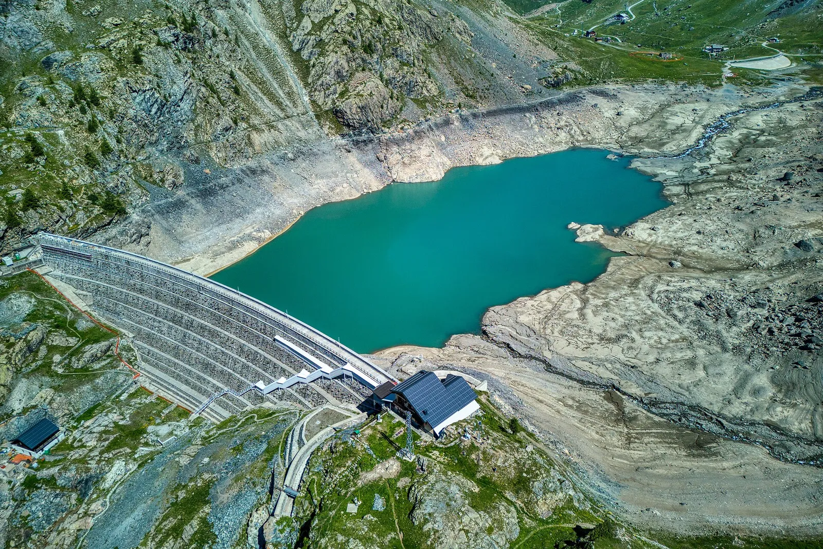
Lago Gabiet · 2364 m
From Gressoney-Saint-Jean follow the Lys valley through Walser villages to Gressoney-La-Trinité, then climb steadily to the lake and Rifugio Gabiet (2,375 m), below the icefalls of the Lys glacier.
You set off from the Walser capital among the dark timber houses of Obre Platz and head up the Lys valley floor past Savoy Castle, beloved of Queen Margherita, and the hamlets of Tschemenoal and Orsia. From Gressoney-La-Trinité the climb gets serious: trail 6 mounts the Salza glacial step through larch woods and boulder fields to the Gabiet lake basin, closed by its dam. The hut looks one way into the Olen valley, the other at the Lys icefalls: at sunset the Lyskamm wall glows pink. Water and refreshment points all along the stage.
Ciencias de la Tierra
Geología y paisaje
Aosta Valley flank of Monte Rosa: gneiss and micaschists, Lys glaciers and Holocene moraines. Walser culture in Gressoney.
Historia y cultura
Gressoney is the southernmost of the Walser colonies founded by Alemannic settlers from Valais in the 13th century: the Töitschu language, timber houses on stone bases and German place names survive to this day.
Fuentes de agua
Water at the stage's support points (Gressoney-Saint-Jean, Rifugio Gabiet, Lago Gabiet). On the high ground and at the passes springs are not guaranteed: fill bottles in the valley and at the huts.
Cómo llegar
VITA buses and connections from Aosta; check seasonal timetables at vita.it.
Aparcamiento
Refugios y vivacs
Galería de fotos
Photos are published immediately. JPG/PNG/WebP, max 6 MB.
Flora del sendero
Etapas contiguas
AEditado y verificado por Andrea Rama
Fuente de datos: Tour del Monte Rosa — itinerario internazionale segnalato (TMR) · Traccia calcolata su rete sentieri OpenStreetMap (ODbL); verificare sul terreno
Última verificación:
Valle del Lys
Senderos relacionados
Mismo valle o rutas similares — más excursiones por descubrir.

Valle del Lys
Anello dei Gemelli della Mologna
8.9 km · +996 m · EEA — from Niel to Niel (Great St Bernard Valley).

Valle del Lys
Balmeto - Leck Albezò
1.2 km · +287 m · E — from Balmeto to Leck Albezò (Champorcher Valley).

Valle del Lys
Bino - Passo di Valnera
4.5 km · +1280 m · E — from Bino to Alpe Jatza (Champorcher Valley).

Valle del Lys
Cascate di Niel
0.6 km · +80 m · E — from Start 7B to Cascate di Niel (Great St Bernard Valley).