Valle Anzasca — Saastal (Vallese)
Tour Monte Rosa — Stage 4: Macugnaga → Saas-Almagell
Advertencias
- Snowfields possible on the passes until early July
- Check the weather: long high-altitude stages with few escape routes
- Book overnight stops in peak season
20.1 km
+1608 m
−1424 m
11.5 h
Nivel físico
Mapa y ruta
Traza GPX — verifica sobre el terreno antes de caminar
Descripción
Puntos clave
Salida
Macugnaga · 1309 m
Llegada
Saas-Almagell · 1673 m
From Macugnaga climb over boulder fields and old Walser paths to the Monte Moro pass (2,853 m), where the golden Madonna faces Monte Rosa’s east face, the most Himalayan wall in the Alps. Descend into Switzerland along the Mattmark lake to Saas-Almagell (1,673 m).
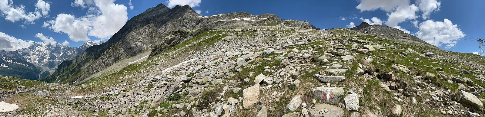
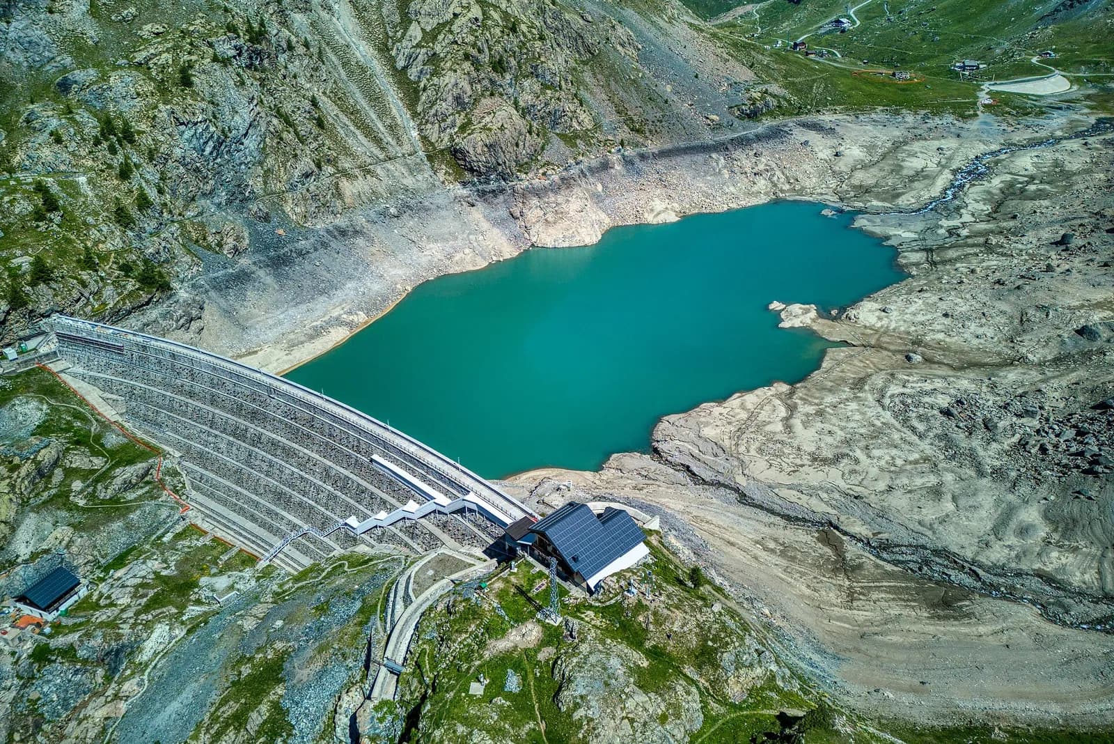
From Staffa, beneath Monte Rosa’s east face — a 2,600-metre wall without equal in the Alps — you climb through pastures and then paint-marked granite blocks to the Monte Moro pass. The gilded Madonna of 1966 and the old customs ruins tell of centuries of Walser trade between Ossola and Valais. To save 1,500 metres of ascent, take the cable car to the Smeraldo lake, twenty minutes below the pass. The Swiss descent skirts the long Mattmark reservoir — whose dam recalls the 1965 tragedy — down to the meadows of Saas-Almagell.
Puntos clave
Passo di Monte Moro
2853 m · 6.8 km from start
Ciencias de la Tierra
Geología y paisaje
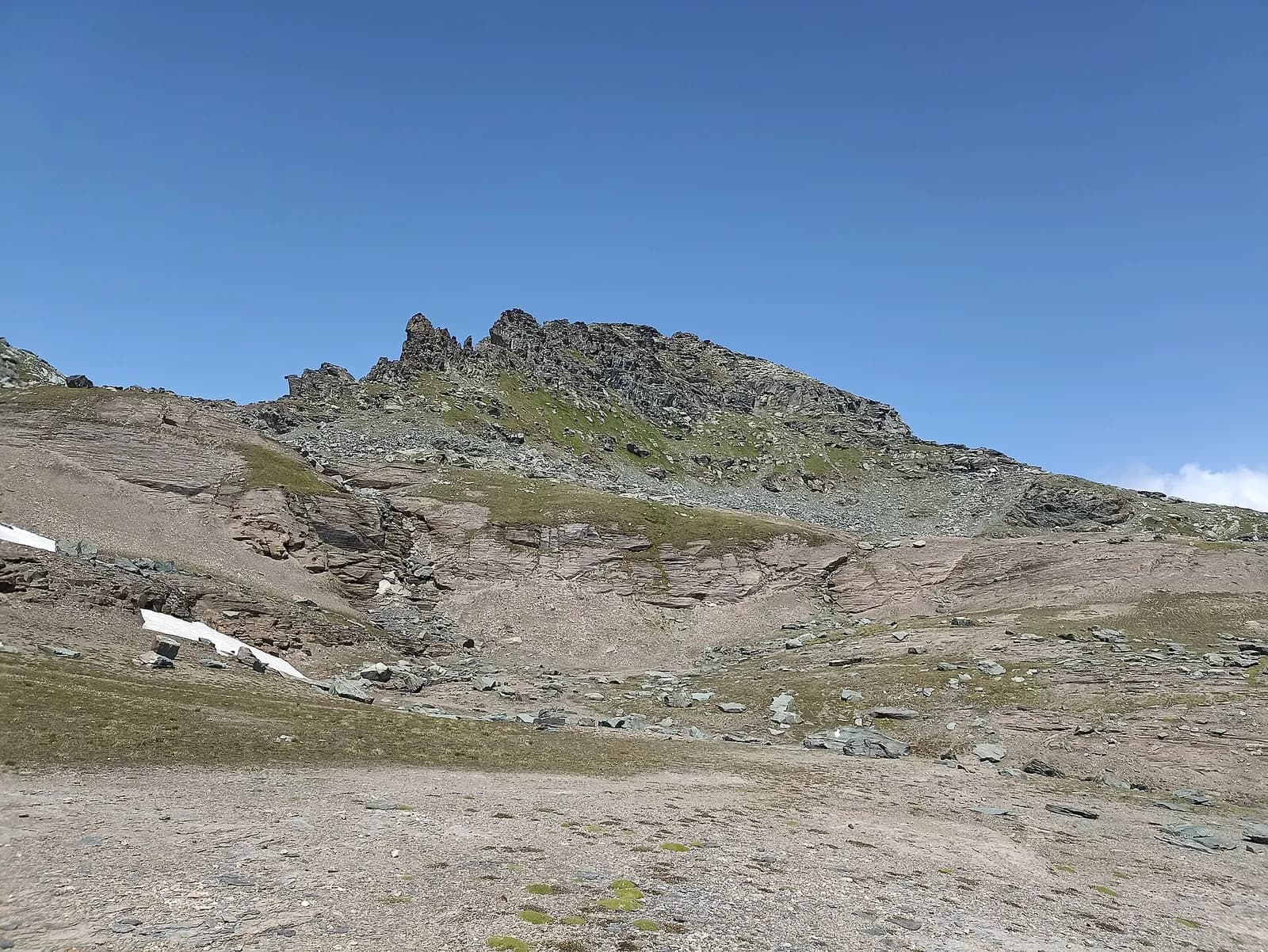
Monte Rosa is the core of the Penninic nappe of the same name: gneisses and granites of subducted, exhumed European continental crust. Around it the tour crosses the Zermatt-Saas ophiolite zone — green serpentinites, metabasalts and metagabbros, the floor of a vanished Jurassic ocean — outcropping at the Olen, Theodul and Cime Bianche passes. The 2,600-metre Macugnaga east face is the highest wall in the Alps and exposes the nappe in full section.
Historia y cultura
The Monte Moro was the Walsers’ front door: through here the founders of Macugnaga descended in the 13th century. The gilded summit Madonna (1966) and the Mattmark dam — whose construction cost 88 lives in 1965 — bracket eight centuries of the pass’s history.
Fuentes de agua
Water at the stage's support points (Macugnaga, Saas-Almagell). On the high ground and at the passes springs are not guaranteed: fill bottles in the valley and at the huts.
Cómo llegar
Cross-border stage: on the foreign sides local public transport applies (PostAuto in Switzerland, line buses in France/Piedmont). Check seasonal timetables; in peak season several access links run by reservation only.
Aparcamiento
Galería de fotos
Photos are published immediately. JPG/PNG/WebP, max 6 MB.
Etapas contiguas
AEditado y verificado por Andrea Rama
Fuente de datos: Tour del Monte Rosa — itinerario internazionale segnalato (TMR) · Traccia calcolata su rete sentieri OpenStreetMap (ODbL); verificare sul terreno
Última verificación:
Valle Anzasca — Saastal (Vallese)
Senderos relacionados
Mismo valle o rutas similares — más excursiones por descubrir.
Valle del Lys
Tour Monte Rosa — Stage 1: Gressoney-Saint-Jean → Lago Gabiet
From the Walser capital to Lake Gabiet.
Val d’Ayas — Valle del Lys
Tour Monte Rosa — Stage 10: Saint-Jacques → Gressoney-Saint-Jean
The Pinter pass closes the Aosta Valley loop of the Rosa.
Valle del Lys — Valsesia (Piemonte)
Tour Monte Rosa — Stage 2: Lago Gabiet → Alagna Valsesia
The Col d’Olen and the descent into Valsesia, beyond the Aosta Valley.
Mattertal (Vallese)
Tour Monte Rosa — Stage 6: Grächen → Europahütte
The first half of the Europaweg, suspended above the Mattertal.