Blanchard - Rifugio Guide di Ayas
Avisos
- High altitude (3,394 m): risk of altitude sickness. Ascend gradually and stay hydrated.
- High-mountain terrain: appropriate equipment required (mountain boots, layered clothing).
- Snowfields and icy ground possible early in the season.
8.8 km
+1668 m
−0 m
6.5 h
Nível físico
Mapa e percurso
Traço GPX — verifique no terreno antes de caminhar
Descrição
Pontos-chave
Partida
Blanchard · 1731 m
Chegada
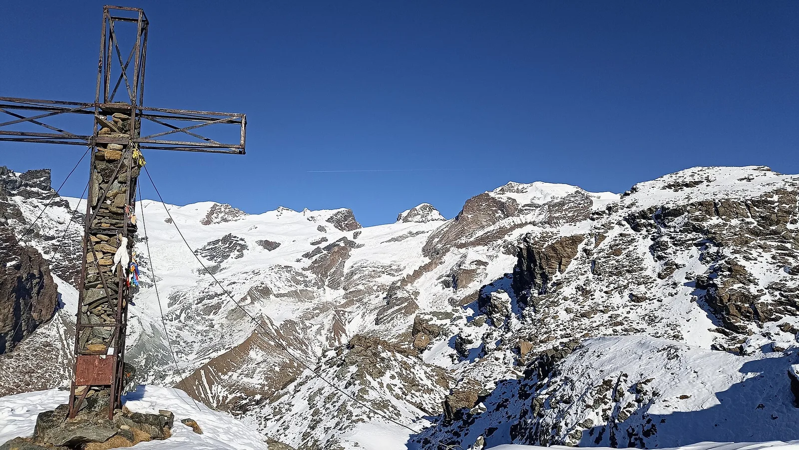
Rifugio Guide di Ayas · 3394 m
Trilho
S28
One of the most demanding routes in the registry: from Blanchard at 1,731 m the trail climbs to the Rifugio Guide di Ayas at 3,394 m, gaining 1,668 m over 8.8 km, rated EE (CAI scale). The refuge sits in the high Ayas Valley at the threshold of a glacial high-alpine environment. The recommended season — June through September — is broad on paper, but high-altitude conditions require careful assessment. Suitable for experienced hikers with adequate fitness and appropriate high-mountain equipment.
Estacionamento
Galeria de fotos
Photos are published immediately. JPG/PNG/WebP, max 6 MB.
Flora do trilho
Fauna para observar
AEditado e verificado por Andrea Rama
Fonte dos dados: Catasto Sentieri Regione Autonoma VdA · Open data — DGR 899/2014
Última verificação:
Val d'Ayas
Trilhos relacionados
Mesmo vale ou percursos semelhantes — mais caminhadas para descobrir.

Val d'Ayas
Amponey - Becca Trecare
A demanding EE ascent from Amponey to Becca Trecare at 3032m — nearly 1500m of gain on varied terrain with sweeping summit views.

Val d'Ayas
Amponey - Alpe Mascognaz
1.8 km · +309 m · E — from Amponey to Alpe Mascognaz (Central Valley).

Val d'Ayas
Amponey - Bec de Nannaz
In the Val d'Ayas, Ayas: an E-rated climb toward a high-altitude objective through pastures and rock with views of Monte Rosa.

Val d'Ayas
Amponey - Mont Facebelle
In the Val d'Ayas, Ayas: an E/EE-rated climb toward a high-altitude objective in the alpine landscape.