Blanchard - Lago Blu
4.2 km
+575 m
−0 m
2.5 h
Nível físico
Mapa e percurso
Traço GPX — verifique no terreno antes de caminhar
Descrição
Pontos-chave
Partida
Blanchard · 1731 m
Chegada
Lago blu · 2297 m
Trilho
S63
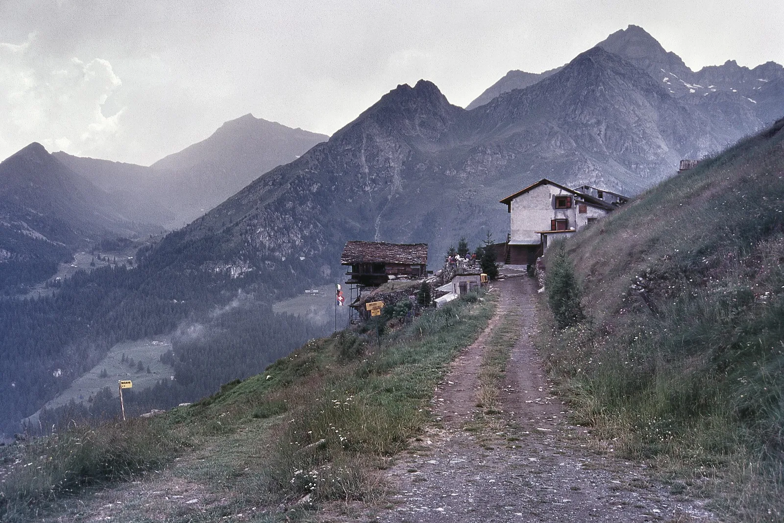
One of the Ayas Valley's best-loved goals: from the hamlet of Blanchard above Champoluc, waymark no. 7 climbs steadily through larch woods and alpine pastures to the Lago Blu (about 2,300 m). The little basin is named for the deep colour of its water, which on calm days mirrors the snows and glaciers of the Monte Rosa massif. A half-day hike for reasonably fit walkers — and, on the lower stretches, for families; high up you meet grazing herds and summer flowers. Always check the season and conditions: the climb stays shaded in the early morning.
Estacionamento
Galeria de fotos
Photos are published immediately. JPG/PNG/WebP, max 6 MB.
Flora do trilho
Fauna para observar
AEditado e verificado por Andrea Rama
Fonte dos dados: Catasto Sentieri Regione Autonoma VdA · Open data — DGR 899/2014
Última verificação:
Val d'Ayas
Trilhos relacionados
Mesmo vale ou percursos semelhantes — mais caminhadas para descobrir.

Val d'Ayas
Amponey - Becca Trecare
A demanding EE ascent from Amponey to Becca Trecare at 3032m — nearly 1500m of gain on varied terrain with sweeping summit views.

Val d'Ayas
Amponey - Alpe Mascognaz
1.8 km · +309 m · E — from Amponey to Alpe Mascognaz (Central Valley).

Val d'Ayas
Amponey - Bec de Nannaz
In the Val d'Ayas, Ayas: an E-rated climb toward a high-altitude objective through pastures and rock with views of Monte Rosa.

Val d'Ayas
Amponey - Mont Facebelle
In the Val d'Ayas, Ayas: an E/EE-rated climb toward a high-altitude objective in the alpine landscape.