Place Moulin - Rifugio Prarayer
 1 / 2
1 / 24.6 km
+0 m
−34 m
1 h
Nível físico
Mapa e percurso
Traço GPX — verifique no terreno antes de caminhar
Descrição
Pontos-chave
Partida
Place Moulin · 2011 m
Chegada
Rifugio Prarayer · 2002 m
Trilho
S12
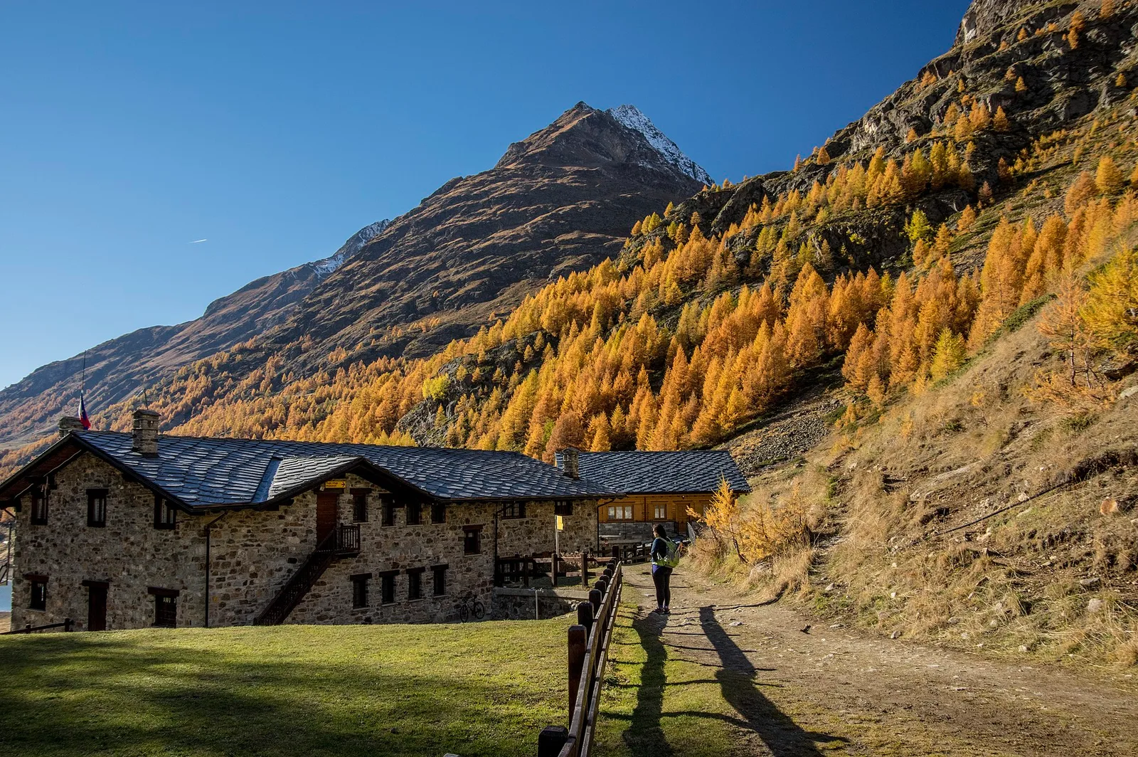
In upper Valpelline, the Place-Moulin dam holds back a great turquoise lake below the Grand Combin and Mont Gelé. From the dam car park, waymark no. 9-10 follows the shore almost level to Rifugio Prarayer (2,005 m) at the head of the reservoir: an easy 4.6 km, perfect for families, children and anyone who wants a great mountain setting without effort. Along the way, glimpses open onto the Grafeneire walls and, from the hut, onto the valley's head glaciers. Tougher trails leave from here toward the Nacamuli and Aosta refuges and the passes into Switzerland.
Estacionamento
Refúgios e abrigos
Galeria de fotos
Photos are published immediately. JPG/PNG/WebP, max 6 MB.
Flora do trilho
Fauna para observar
AEditado e verificado por Andrea Rama
Fonte dos dados: Catasto Sentieri Regione Autonoma VdA · Open data — DGR 899/2014
Última verificação:
Valpelline
Trilhos relacionados
Mesmo vale ou percursos semelhantes — mais caminhadas para descobrir.

Valpelline
Bionaz (Plan Praz) - Place Moulin
Upper Valpelline, Bionaz: an E-rated route toward a glacial objective over open terrain.

Valpelline
Chamin - Bivacco della Sassa
From Chamin (1,732 m) to the Bivacco della Sassa (2,964 m) in the quiet Valpelline: 7.1 km and 1,246 m of ascent.

Valpelline
Champillon - Rifugio Letey - Col Champillon
3.1 km · +643 m · E — from Champillon to Col Champillon (Valtournenche).

Valpelline
Chanté - Mont Saron
From Allein toward Valpelline across the panoramic ridge between the two valleys: an E-rated route over open pastures with views of the Gran San Bernardo.