Place Moulin - Col di Livournea
13.6 km
+929 m
−0 m
5.5 h
Nível físico
Mapa e percurso
Traço GPX — verifique no terreno antes de caminhar
Descrição
Pontos-chave
Partida
Place Moulin · 1978 m
Chegada
Colle Livournea · 2850 m
Trilho
S19
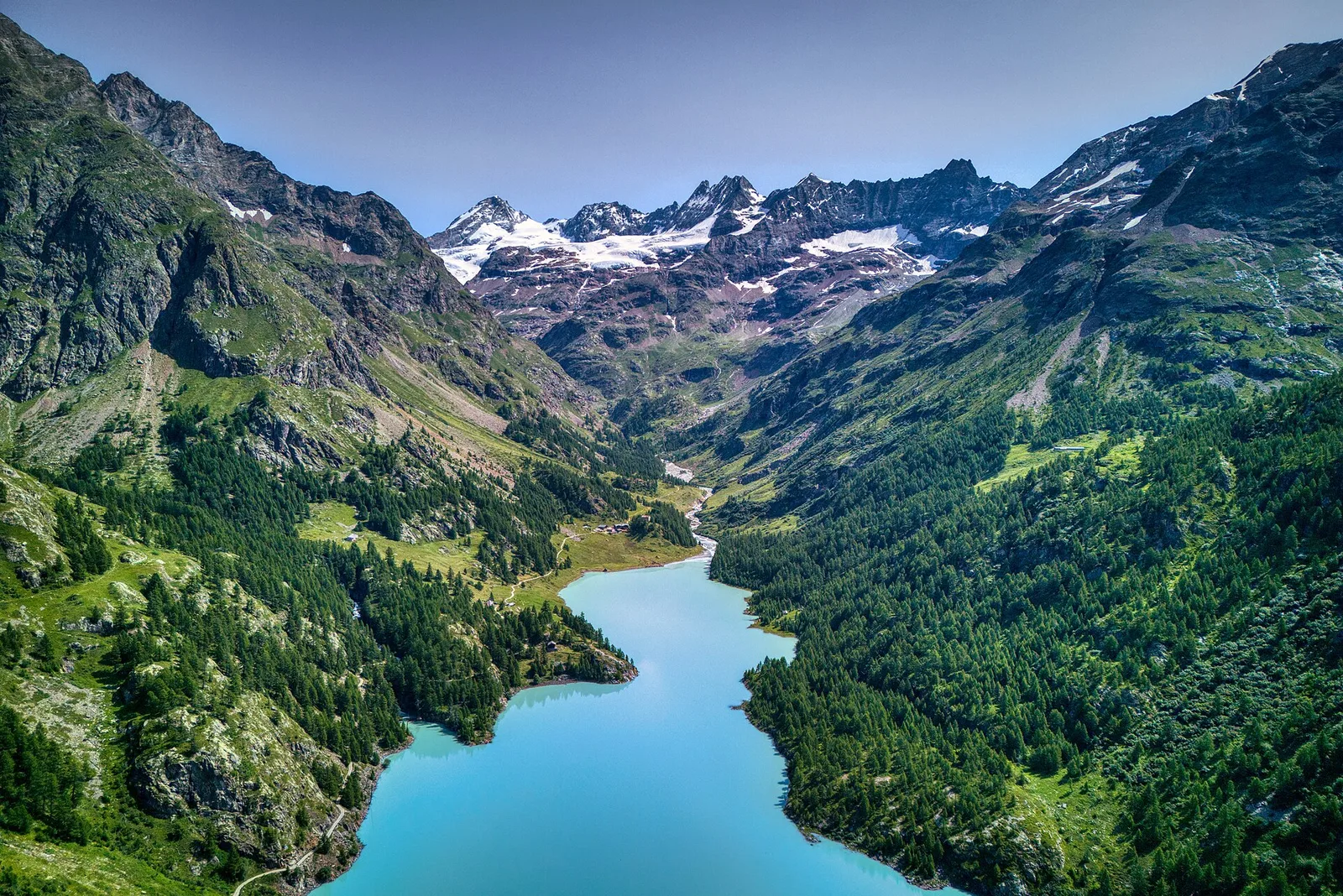
A long, atmospheric route running from the Place Moulin dam, at 1,978 metres at the head of Valpelline, to the Col di Livournea, a high pass at 2,850 metres. The first kilometres skirt the large reservoir, then the path turns into the side valley and climbs at a steady gradient towards the col, among pastures, moraines and stony stretches. It runs 13.6 km with 929 metres of ascent: the difficulty is that of hiking, but the length and altitude call for good fitness and an early start. The col is a historic crossing point between valley heads, looking out over a stark landscape of rock and snowfields. Thirteen cadastre signposts guide you at the junctions. Best from summer to early autumn.
Estacionamento
Galeria de fotos
Photos are published immediately. JPG/PNG/WebP, max 6 MB.
Flora do trilho
AEditado e verificado por Andrea Rama
Fonte dos dados: Catasto Sentieri Regione Autonoma VdA · Open data — DGR 899/2014
Última verificação:
Valpelline
Trilhos relacionados
Mesmo vale ou percursos semelhantes — mais caminhadas para descobrir.

Valpelline
Bionaz (Plan Praz) - Place Moulin
Upper Valpelline, Bionaz: an E-rated route toward a glacial objective over open terrain.

Valpelline
Chamin - Bivacco della Sassa
From Chamin (1,732 m) to the Bivacco della Sassa (2,964 m) in the quiet Valpelline: 7.1 km and 1,246 m of ascent.

Valpelline
Champillon - Rifugio Letey - Col Champillon
3.1 km · +643 m · E — from Champillon to Col Champillon (Valtournenche).

Valpelline
Chanté - Mont Saron
From Allein toward Valpelline across the panoramic ridge between the two valleys: an E-rated route over open pastures with views of the Gran San Bernardo.