High Route 2 — Stage 5: Planaval → Rifugio Chalet de l'Épée
Avisos
- Check weather and residual snow early season
- Book huts in peak season
 1 / 2
1 / 212 km
+915 m
−51 m
4.5 h
Nível físico
~1323 kcal estimadas
Mapa e percurso
Traço GPX oficial — Região Vale de Aosta / lovevda.it
Descrição
Pontos-chave
Partida
Planaval · 1545 m
Chegada
Rifugio Chalet de l'Épée · 2366 m
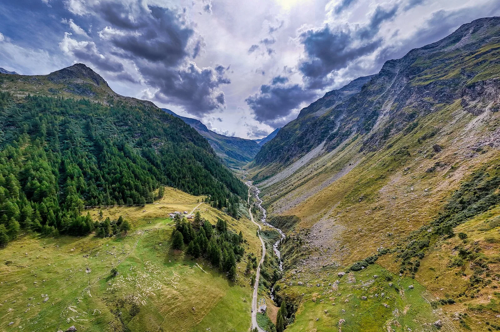
Follow Valgrisenche valley floor via La Frassy and Gerbelle before the final climb to Chalet de l'Épée hut.
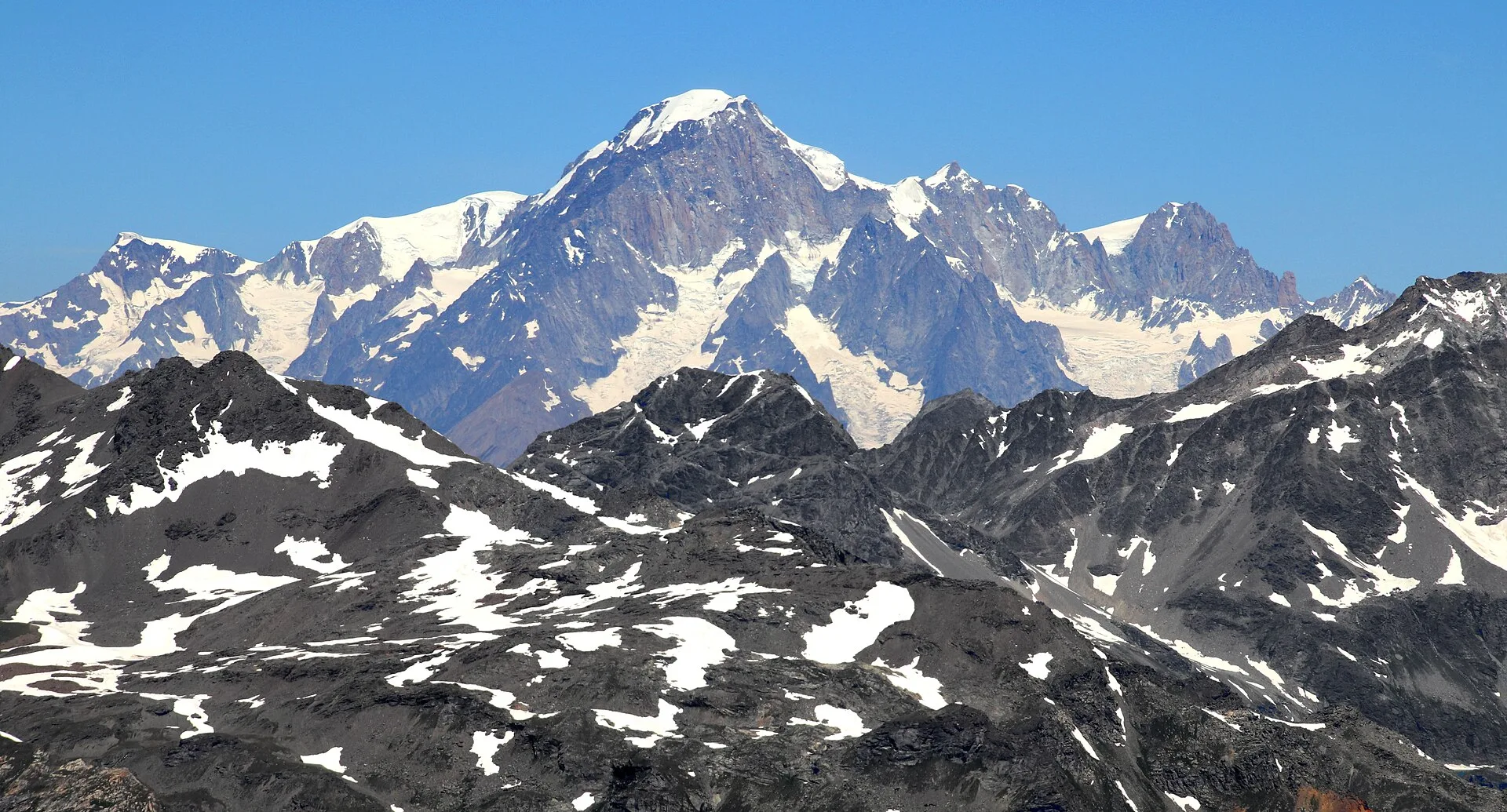
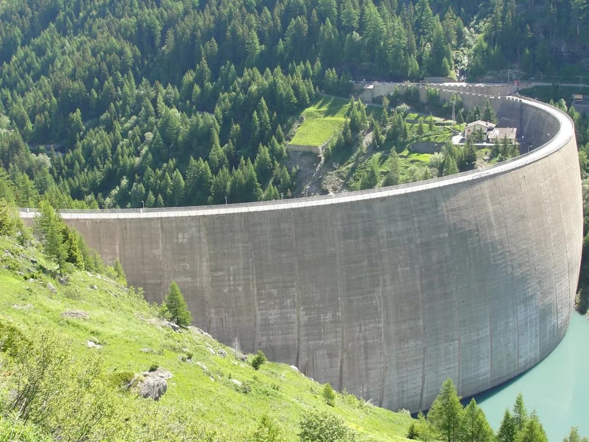
A mid-mountain stage along the east flank of the Valgrisenche: you touch the main village, worth a stop at the drap wool-weaving workshop, then skirt the great Beauregard reservoir — the dam that drowned the hamlet of Fornet in the 1950s — before the wooded climb to the Chalet de l’Épée balcony (2,370 m), face to face with the Grande Sassière.
Pontos-chave
La Frassy
1673 m · 6 km from start
Ciências da Terra
Geologia e paisagem
Side valley with hydroelectric basin: gneiss and crystalline schist outcrops, glacial cirques and lacustrine deposits in the valley floor.
História e cultura
Valgrisenche drap, rough wool woven on 18th-century looms, is one of the last traditional weaves in the Alps: the Les Tisserands cooperative has kept it alive since 1969.
Pontos de água
Fountains in Planaval and Valgrisenche; Chalet de l'Épée hut.
Como chegar
VITA buses and connections from Aosta; check seasonal timetables at vita.it.
Estacionamento
Parcheggi comunali nei paesi di valle; verificare limitazioni in alta stagione.
Refúgios e abrigos
Galeria de fotos
Photos are published immediately. JPG/PNG/WebP, max 6 MB.
Flora do trilho
Etapas adjacentes
AEditado e verificado por Andrea Rama
Fonte dos dados: Catasto Sentieri Regione Autonoma VdA — Alta Via n.2 · Open data — DGR 899/2014
Última verificação:
Valgrisenche
Trilhos relacionados
Mesmo vale ou percursos semelhantes — mais caminhadas para descobrir.
Valgrisenche
Tour du Rutor — Stage 3: Planaval → Valgrisenche
A short breather along the Dora di Valgrisenche.

Valgrisenche — Haute-Tarentaise (Francia)
Tour du Rutor — Stage 4: Valgrisenche → Sainte-Foy-Tarentaise
The Col du Mont, a historic smugglers’ pass into the Tarentaise.

Valgrisenche
Balconata dal Belvedere al lago di San Grato
4.9 km · +705 m · E — from Bois de Grillet to Lago di San Grato (Valtournenche).
Valgrisenche
Bivio strada per Grand Alpe - Col du Mont
5 km · +706 m · E — from Bivio strada per Grand Alpe to Col du Mont (Valtournenche).