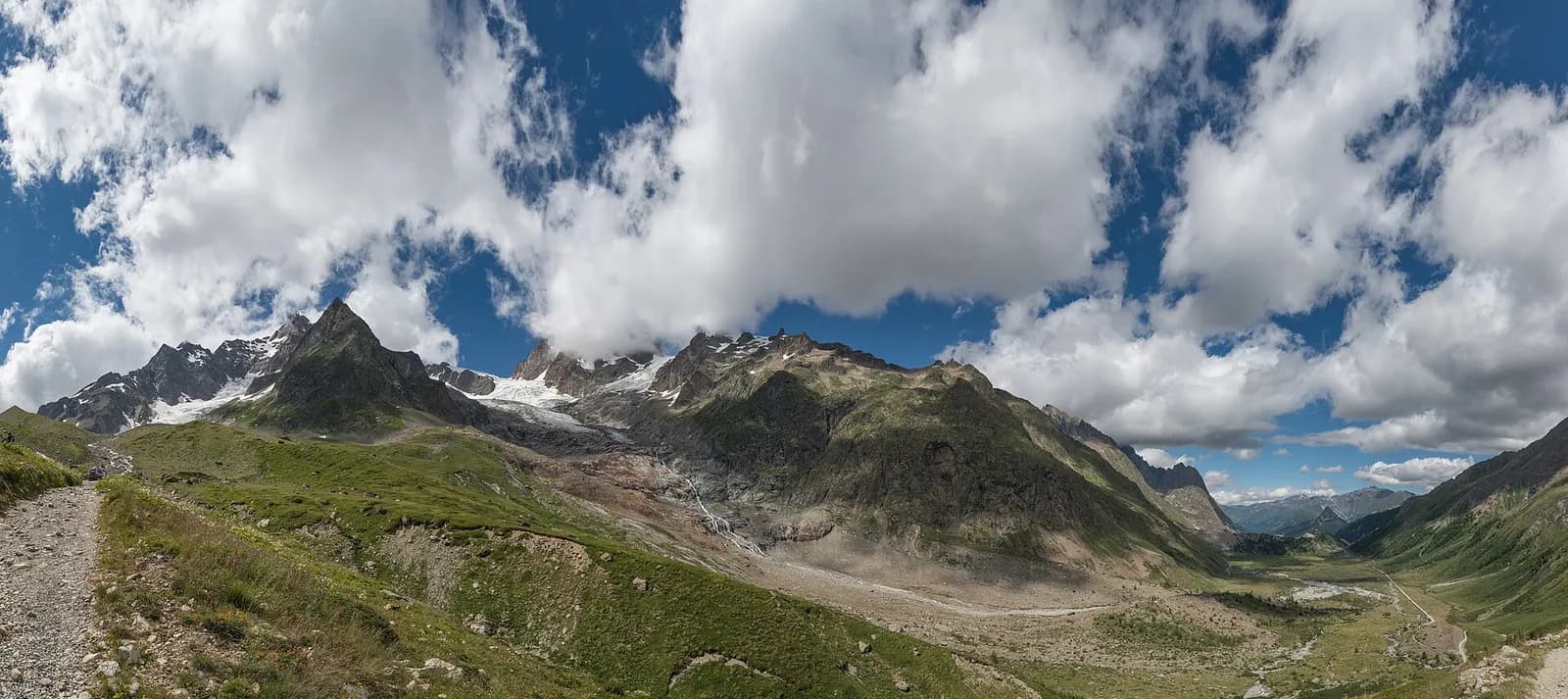
Valle di Chamonix — Aiguilles Rouges
Tour du Mont Blanc — Stage 9: La Flégère → Les Houches
Avisos
- Check the weather: long high-altitude stages with few escape routes
- Book overnight stops in peak season
14.6 km
+334 m
−1492 m
7 h
Nível físico
Mapa e percurso
Traço GPX — verifique no terreno antes de caminhar
Descrição
Pontos-chave
Partida
La Flégère · 1883 m
Chegada
Les Houches · 1006 m
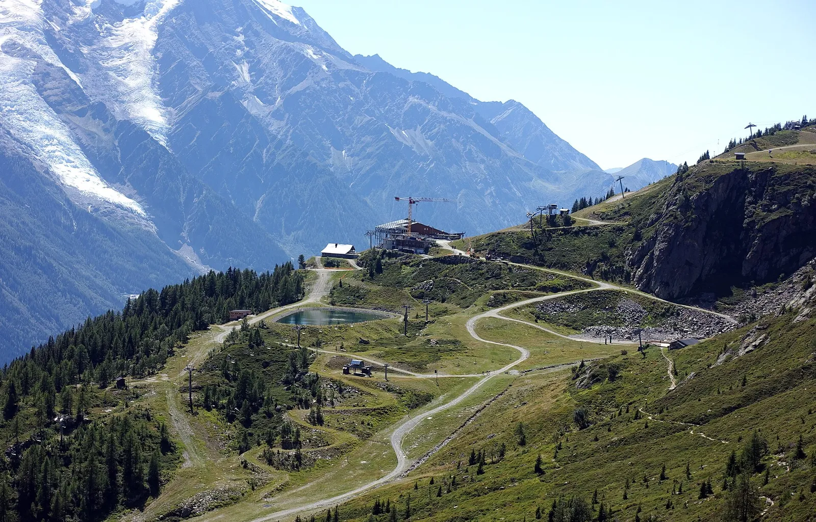
From La Flégère the Grand Balcon Sud continues to Planpraz and climbs to the Col du Brévent and the Brévent summit (2,525 m), the classic viewpoint over the whole north face of Mont Blanc. A long descent past the Bellachat hut leads to Les Houches (1,007 m).
The last great French balcony is also the highest: from Planpraz you climb through reddish scree to the Col du Brévent and on to the summit, where the cable-car station shares space with one of the most photographed panoramas in the Alps — the whole of Mont Blanc, from the Goûter to the Jorasses, with the Bossons glacier plunging valleywards. The descent is long and knee-testing, past the Bellachat refuge and down through forest to Les Houches. A sun-exposed stage with almost no water: full bottles and an early start.
Ciências da Terra
Geologia e paisagem
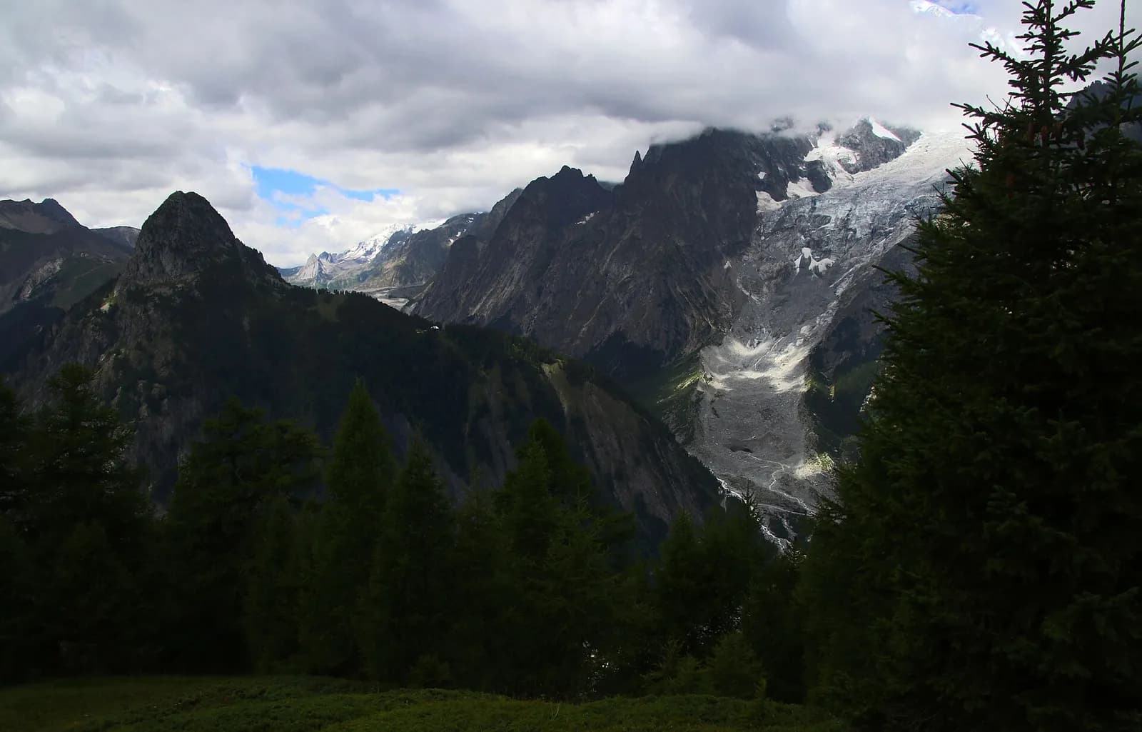
The Mont Blanc massif is a Hercynian granite batholith (~300 million years old) uplifted by the Alpine orogeny: the pale Mont Blanc granite — the “protogine” — forms the Peuterey and Géant spires. At its feet the tour walks on older crystalline basement rocks (gneiss and micaschist) and, in Val Veny, on the Mesozoic limestones of the Pyramides Calcaires, a sliver of sedimentary cover pinched between the granites. The Miage and Brenva moraines are textbook examples.
História e cultura
From the Brévent in 1786 Horace-Bénédict de Saussure scanned the route for the first ascent of Mont Blanc through his telescope: the summit opposite was reached by Balmat and Paccard on 8 August that year.
Pontos de água
Water at the stage's support points (La Flégère, Les Houches). On the high ground and at the passes springs are not guaranteed: fill bottles in the valley and at the huts.
Como chegar
Cross-border stage: on the foreign sides local public transport applies (PostAuto in Switzerland, line buses in France/Piedmont). Check seasonal timetables; in peak season several access links run by reservation only.
Estacionamento
Galeria de fotos
Photos are published immediately. JPG/PNG/WebP, max 6 MB.
Etapas adjacentes
AEditado e verificado por Andrea Rama
Fonte dos dados: Tour du Mont Blanc — itinerario internazionale segnalato · Traccia calcolata su rete sentieri OpenStreetMap (ODbL); verificare sul terreno
Última verificação:
Valle di Chamonix — Aiguilles Rouges
Trilhos relacionados
Mesmo vale ou percursos semelhantes — mais caminhadas para descobrir.
Val Ferret
Tour du Mont Blanc — Stage 1: Courmayeur → Rifugio Giorgio Bertone
A steady climb from Courmayeur to the Rifugio Bertone balcony.
Val Montjoie — Vallée des Glaciers
Tour du Mont Blanc — Stage 11: Les Contamines-Montjoie → Les Chapieux
The great Bonhomme crossing, the wild heart of the French TMB.
Vallée des Glaciers — Val Veny
Tour du Mont Blanc — Stage 12: Les Chapieux → Rifugio Elisabetta Soldini
The Col de la Seigne: back into Italy, into the great Mont Blanc amphitheatre.
Val Veny
Tour du Mont Blanc — Stage 13: Rifugio Elisabetta Soldini → Courmayeur
Lac Combal, the Mont Favre balcony and closing the loop in Courmayeur.