Trail guide
The best mountain-bike trails in Aosta Valley
Five Aosta Valley routes on dirt roads, mule tracks and ancient rû channels, perfect for mountain bike and e-bike — from Place Moulin lake to the Great St Bernard pass.
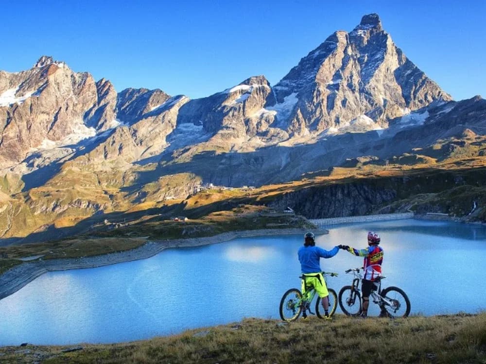
The Aosta Valley is not only a land of hiking: the very network of farm tracks, forest roads, ancient irrigation rû and mule tracks that serves the high-altitude pastures sketches out one of the most varied training grounds in the western Alps for the mountain bike. Steady climbs on compact surfaces, panoramic traverses on the hillside, long false flats along the historic channels: unlike technical single-tracks, these routes reward legs and lungs more than acrobatics, and with the arrival of e-bikes they have become accessible to a much wider audience.
This guide brings together five routes from the Sentieri VdA catalogue that develop largely on dirt and rideable surfaces, chosen because they differ from one another in setting, altitude and effort — and because none of them appears in our other guides. All are catalogued as hiking itineraries: this means they must be ridden by MTB with respect, always giving way to those on foot and checking the trail page for elevation gain, recommended season and surface.
The Aosta Valley's farm tracks and trails are shared routes: some sections may be subject to local regulation or seasonal bans. Always check the signage on site and proceed at a moderate speed near alpine pastures and herds.
1. Bionaz–Place Moulin, the fjord of the upper Valpelline
The Bionaz (Plan Praz)–Place Moulin route climbs the upper Valpelline up to the great artificial reservoir of Place Moulin, a turquoise stretch of water almost three kilometres long, closed off by the walls of the Grand Combin massif. At 11 km and +698 m of elevation gain (difficulty E), it's the classic "alpine fjord" itinerary: a mostly drivable surface, steady gradients, a panorama that opens up progressively onto the glacier.
It's an ideal route for a first outing of the season or for an e-bike excursion with the family: the Place Moulin dam, one of the highest gravity dams in Europe, is a destination in itself. Set off in the morning to avoid the afternoon valley wind, and bring an extra layer: even in July, at the far end of the reservoir, the glacial air makes the altitude felt.
2. The ru de Menouve, false flat of distinction
Few itineraries tell the story of Aosta Valley hydraulic engineering like the Road to Daillon–Alpe Ponteille along the ru de Menouve: 8.8 km with just +379 m of elevation gain (E), a walk — and a ride — that is almost flat and follows the course of a historic irrigation channel on the edge of the Menouve valley. The rû are medieval and modern works that carry the glaciers' water to the pastures and vineyards: pedalling along their bank means moving level along the hillside, with the panorama always open.
It's the perfect itinerary for those seeking distance and altitude without big efforts: a regular surface, panoramic exposure, very little elevation gain. It can also be tackled in the shoulder seasons, when the higher altitudes are still snow-covered.
3. Druges–Plan Rué, above the Great St Bernard valley
The Druges–Plan Rué climb, 7.2 km and +710 m (E), rises from the villages of the Saint-Oyen basin towards the alpine pastures that dominate the historic Great St Bernard valley. It's a "clean" climbing route, on an alpine-road surface, that repays the effort with a view over the head of the valley and over the ancient transit corridor towards Switzerland.
For bikers it's a good endurance training ground: a continuous gradient, no technical sections, a flowing descent on the same track. Recommended in high summer, when the alpine pastures are active and the late-day light illuminates the meadows.
4. Towards the Great St Bernard pass on the military road
The State Road 27–Great St Bernard Pass itinerary — 6.7 km and +754 m, E — largely follows the course of an ancient military road towards one of the most history-laden passes of the Alps, crossed by Roman legions, pilgrims of the Via Francigena and by Napoleon's army in 1800. The solid surface and the steady gradient make it a climb suited to the fit muscle-powered MTB and, above all, to the e-bike.
Arriving in the saddle at the pass, at over 2400 metres, with the hospice and the small lake in the background, is an experience that combines sport and historical memory. Check the season: the pass is free of snow only in the heart of summer.
5. Lacs de Dziule, the dirt road of the Vertosan
For those wanting altitude and a severe setting, the Or de Fra–Lacs de Dziule route climbs the Vertosan Valley, in Valdigne, up to two glacial stretches of water at 2553 metres: 6.9 km, +702 m, difficulty E, largely on an alpine-pasture dirt road. It's the most "alpine" itinerary of the selection, immersed in a landscape of rocks and high grasslands where the forest is now behind you.
The reward is twofold: the ride on the dirt road and the arrival at little-frequented high-altitude lakes. The recommended season is autumn, when the air is clear and the colours of the grassland turn bronze. Always bring water and a windproof jacket: at that altitude the weather changes quickly.
Riding with respect
The fortune of Aosta Valley cycle-touring depends on coexistence with hikers, shepherds and wildlife. Three rules apply everywhere: give way to those on foot, controlled speed near alpine pastures and animals, no trace left on the ground. Always check each itinerary's page for elevation gain, season and surface conditions before setting out — and choose the right day, because at altitude the difference between a splendid climb and a risky one is made by the weather.