High Route 1 — Stage 17: Rifugio Bonatti → Courmayeur
12.1 km
+300 m
−1101 m
3.5 h
Fitness level
~2500 kcal estimated
Elevation profile
Map & route
Download GPXOfficial GPX track — Aosta Valley Region / lovevda.it
Description
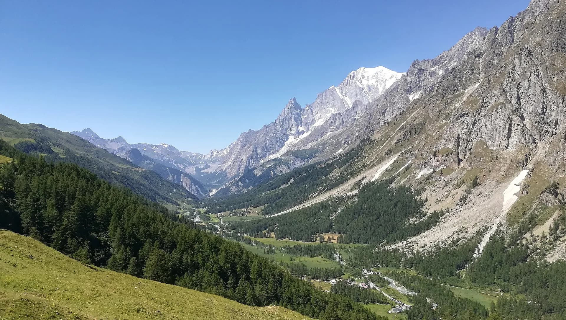
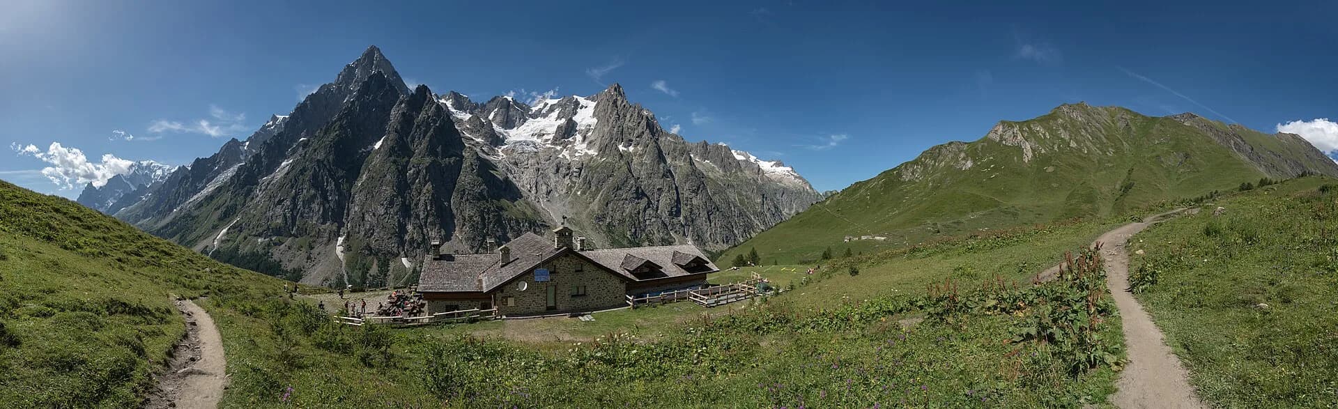
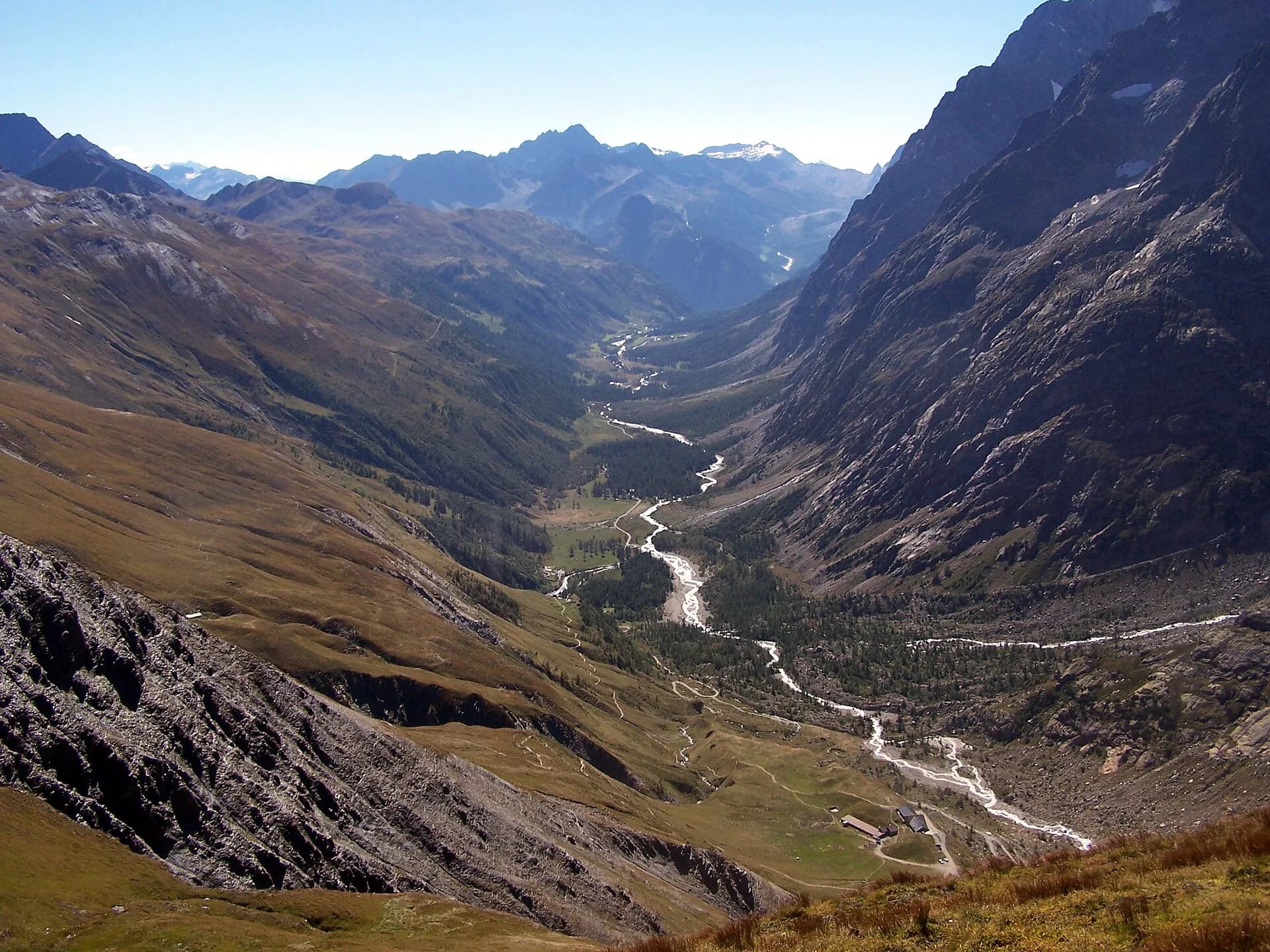
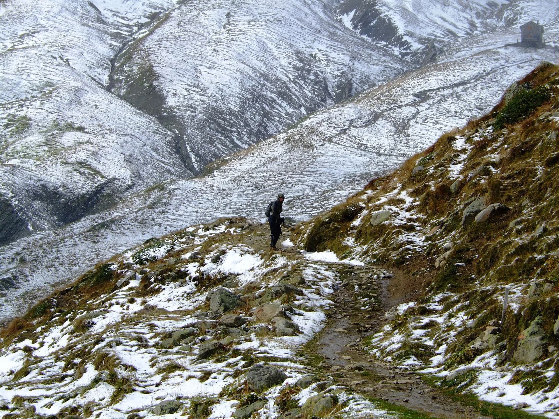
Stage seventeen, the final leg of Alta Via 1, is a long and celebratory descent to Courmayeur along the Val Ferret balcony trail, with Mont Blanc as a constant companion throughout. From Rifugio Bonatti the path crosses the valley head toward Rifugio Bertone (2048 m) along a trail following the forest edge with unbroken views onto Grandes Jorasses, Miage Glacier and the Mont Blanc crest. The final descent from Bertone to Courmayeur drops steeply through forest, emerging into town among the gardens of the historic centre. Courmayeur (1224 m) is one of Italy's alpine capitals, home to one of the country's oldest sections of the Club Alpino Italiano, an alpine museum dedicated to the history of early ascents and a vibrant main street lined with outdoor shops and restaurants serving fonduta. Completing this final stage after 17 stages and over 190 km of walking is a genuinely moving experience: many hikers mark the arrival with a toast on terraces overlooking the eternal white of the massif that accompanied every step of the journey.
Key points
Rifugio Walter Bonatti
2025 m · 0 km from start
Stage start, last AV1 night
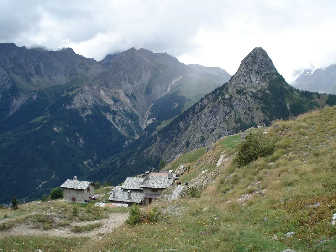
Rifugio Bertone
2048 m · 6.5 km from start
Intermediate hut with panoramic terrace
Courmayeur
1224 m · 12.1 km from start
AV1 finish, alpine capital
Earth sciences
Geology & landscape
The descent along Val Ferret crosses gneiss and calcschists of the Mont Blanc massif with deformed granite and mica phyllite outcrops. The balcony trail follows a Würmian moraine front of the Miage glacier with proglacial deposits and abandoned terraces. Below 1800 m, alluvial deposits of the Ferret stream appear with pebbles of gneiss, granite and limestone. Forested slopes display paleosols on decomposed moraines with acid soils suited to larch and rhododendron. The Miage glacier, visible from the trail, is among the most monitored in the Alps for glaciological retreat. Marble and calcschist outcrops indicate the massif sedimentary cover.
History & culture
Courmayeur is an alpine capital with a historic CAI section and alpine museum. Completing the AV1 after 17 stages and over 190 km is celebrated on the centre terraces.
Water sources
Water at Bonatti and Bertone huts. Fountains in Courmayeur centre.
Getting there
VITA and Savda buses to Courmayeur from Aosta. Summer Val Ferret connections.
Parking
Parcheggi a Courmayeur centro e La Palud (funivia Monte Bianco).
Warnings
- Steep descent in the final forest section
- High tourist traffic in Courmayeur in August
Nearby peaks
Start & end
Start
Rifugio Walter Bonatti
2023 m
Finish
Courmayeur
1200 m
Refuges & bivouacs
Photo gallery
Flora along the trail
Wildlife to spot
Themes and features
Adjacent stages
ACurated and verified by Andrea
Data source: Catasto Sentieri Regione VdA + AllTrails (12.1 km verificati) · Open data — DGR 899/2014
Last verified:
Val Ferret
Related trails
Same valley or similar routes — more hikes to explore.
Val Ferret
Tour du Mont Blanc — Stage 1: Courmayeur → Rifugio Bertone
First Italian TMB stage: climb to Rifugio Bertone above Courmayeur.
Val Ferret
Tour du Mont Blanc — Stage 2: Rifugio Bertone → Rifugio Bonatti
High traverse of Val Ferret to the famous Rifugio Bonatti.
Val Ferret
Tour du Mont Blanc — Stage 3: Rifugio Bonatti → Rifugio Elena
From Bonatti to Elena along the Val Ferret balcony.
Val Ferret
Tour du Mont Blanc — Stage 4: Rifugio Elena → Col de la Seigne
Final Italian stage: climb to Col de la Seigne (FR border).