High Route 1 — Stage 16: Rifugio Frassati → Rifugio Bonatti via Col Malatrà
10 km
+430 m
−900 m
4 h
Fitness level
~3100 kcal estimated
Elevation profile
Map & route
Download GPXOfficial GPX track — Aosta Valley Region / lovevda.it
Description
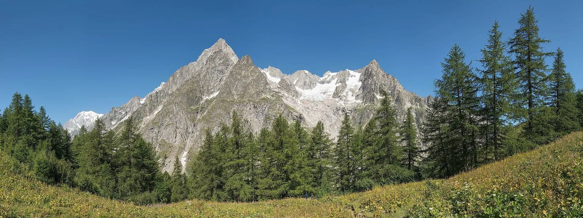
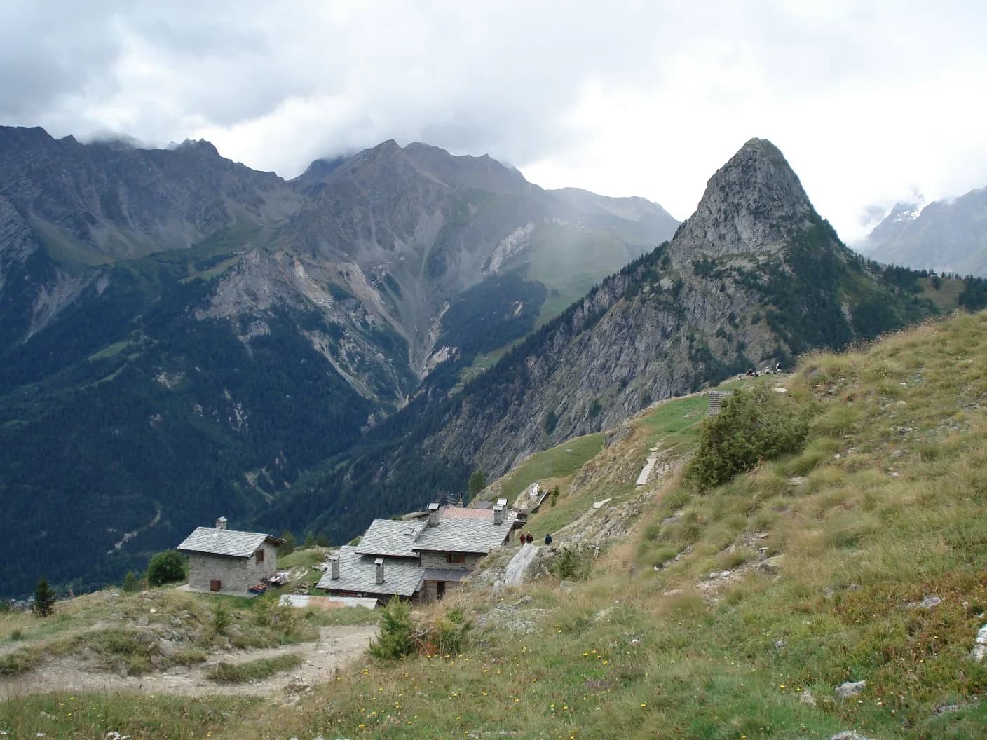
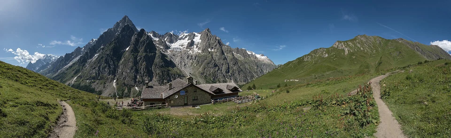
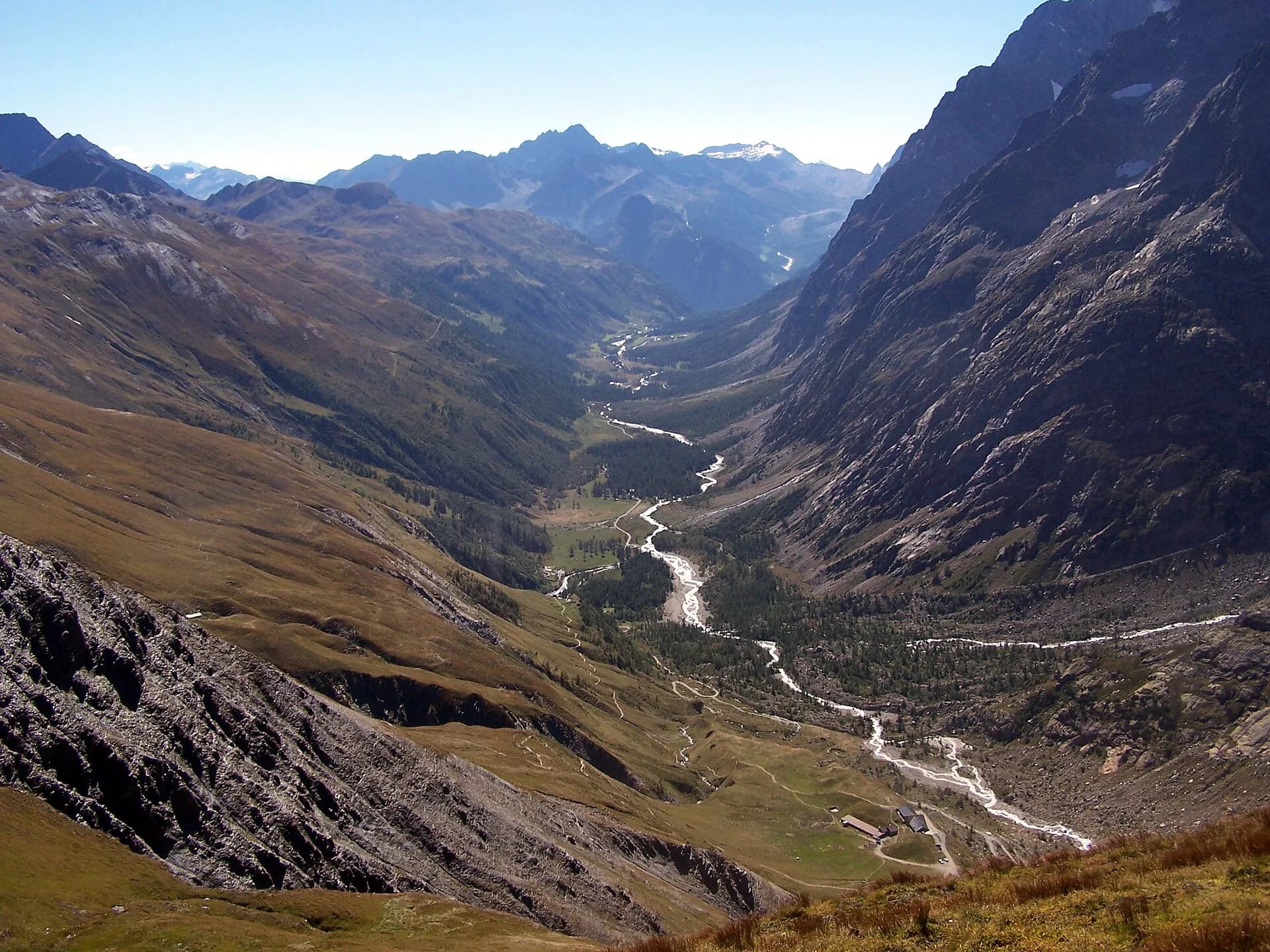
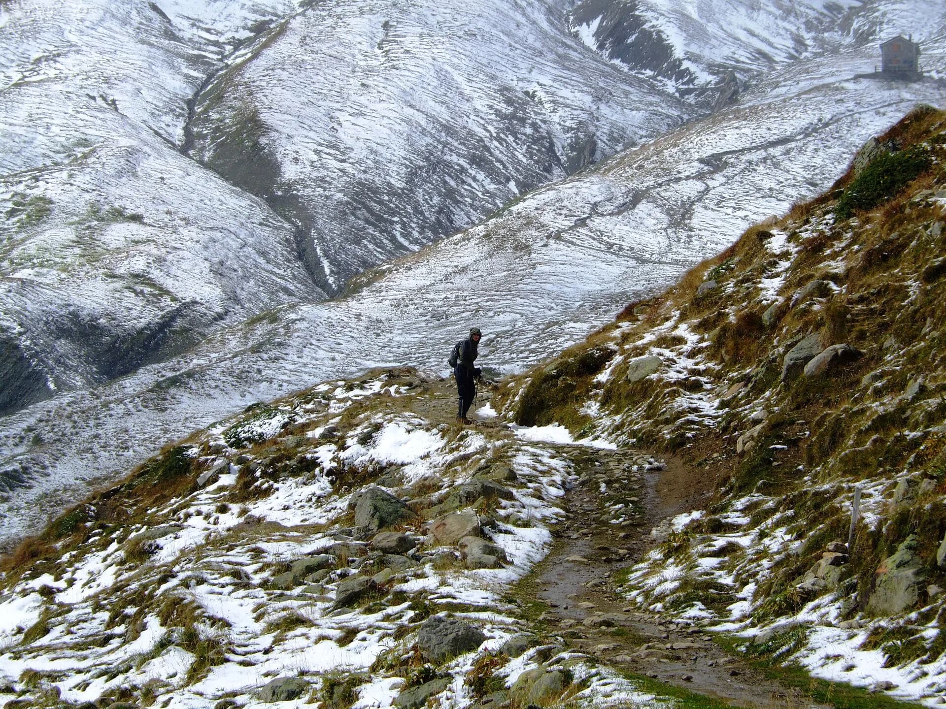
Stage sixteen is the most alpine stretch of the entire Alta Via 1: it climbs to Col Malatrà at 2925 metres — the highest point of the whole route — and descends into Val Ferret to Rifugio Walter Bonatti. From Rifugio Frassati the path rises through the Merdeux basin on progressively rockier and more open terrain, with sections of compact scree demanding careful footwork. The cross at Col Malatrà is a long-awaited landmark: at this altitude the panorama is absolute, with Mont Blanc rising in full majesty to the northwest, Grand Combin to the east and the Gran Paradiso summits on the distant horizon. The descent toward Val Ferret is long and occasionally slippery — dew-wet grass early in the morning — so staying on the marked trail is essential. Rifugio Walter Bonatti (2025 m) is the most celebrated overnight stop on the entire Alta Via 1, made famous through its proximity to the Tour du Mont Blanc, offering an unrivalled view of Mont Blanc. Reservations weeks in advance are indispensable during peak season.
Key points
Rifugio Pier Giorgio Frassati
2540 m · 0 km from start
Stage start, leave at dawn
Col Malatrà
2925 m · 5.5 km from start
Highest point on entire AV1, panoramic cross
Earth sciences
Geology & landscape
Col Malatrà is the geological rooftop of the AV1, on augen gneiss and micaschists of the Austroalpine basement with quartz bands and migmatites. The ascent crosses Penninic calcschists and chloritic phyllites with deformed granite outcrops. The descent into Val Ferret traverses Würmian glacial deposits of the Miage glacier with lateral moraines and proglacial sediments. Erratic blocks of gneiss and granite testify to glacial transport. Malatrà valley slopes show active landslides and periglacial scree deposits. Below 2200 m, dolomitic limestone and schist outcrops of the lower Penninic stack appear with ophiolites in side valleys.
History & culture
Rifugio Walter Bonatti is dedicated to the great Italian explorer. Val Ferret is a historic valley of the Tour du Mont Blanc and early alpine ascents.
Water sources
Water at Rifugio Frassati. Carry supplies for the pass climb. Water at Rifugio Bonatti.
Getting there
Foot access only. Emergency descent via Val Ferret or Petit Saint-Bernard.
Parking
Non applicabile: tappa point-to-point tra rifugi.
Warnings
- AV1 highest point: check weather and snow
- Long descent on dew-wet grass in the morning
- Book Bonatti weeks in advance
Nearby peaks
Start & end
Start
Rifugio Pier Giorgio Frassati
2506 m
Finish
Rifugio Walter Bonatti
2023 m
Refuges & bivouacs
Photo gallery
Flora along the trail
Wildlife to spot
Themes and features
Adjacent stages
ACurated and verified by Andrea
Data source: Catasto Sentieri Regione VdA + thealps.com — km stimati, D+/D− da GPS traces · Open data — DGR 899/2014
Last verified:
Val Ferret
Related trails
Same valley or similar routes — more hikes to explore.
Val Ferret
Tour du Mont Blanc — Stage 1: Courmayeur → Rifugio Bertone
First Italian TMB stage: climb to Rifugio Bertone above Courmayeur.
Val Ferret
Tour du Mont Blanc — Stage 2: Rifugio Bertone → Rifugio Bonatti
High traverse of Val Ferret to the famous Rifugio Bonatti.
Val Ferret
Tour du Mont Blanc — Stage 3: Rifugio Bonatti → Rifugio Elena
From Bonatti to Elena along the Val Ferret balcony.
Val Ferret
Tour du Mont Blanc — Stage 4: Rifugio Elena → Col de la Seigne
Final Italian stage: climb to Col de la Seigne (FR border).