High Route 1 — Stage 9: Valtournenche → Rifugio Jean Barmasse
4.7 km
+682 m
−25 m
2.5 h
Fitness level
~1800 kcal estimated
Elevation profile
Map & route
Download GPXOfficial GPX track — Aosta Valley Region / lovevda.it
Description
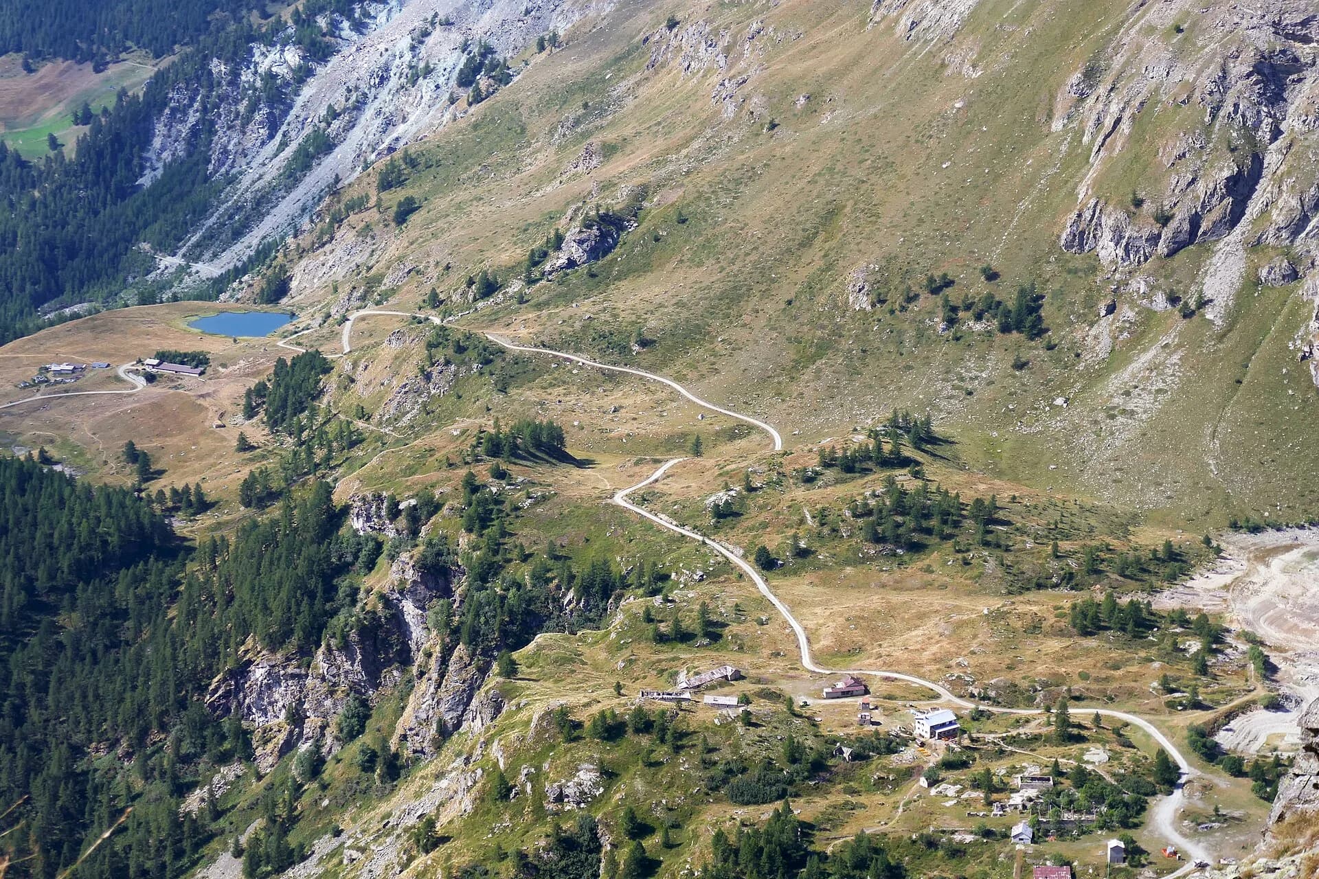
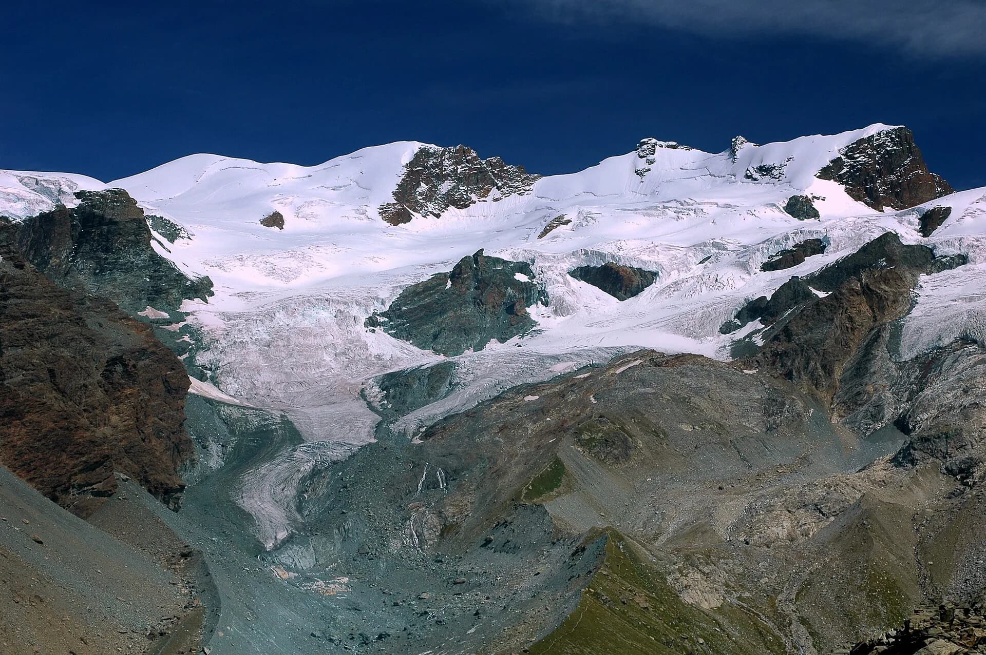
Stage nine is the shortest of the entire Alta Via 1 but no less demanding in gradient: in fewer than five kilometres the trail climbs over 650 metres, rising from the centre of Valtournenche to Rifugio Jean Barmasse on the shore of Lago di Cignana. The stage begins by crossing the Marmore torrent and climbing toward the hamlet of Valmartin, where the path enters a conifer forest and begins a sustained, well-marked ascent. The hydroelectric infrastructure of the dam signals proximity to the artificial lake, a turquoise mirror reflecting the Valtournenche ridgelines. Rifugio Jean Barmasse (2157 m), positioned on the edge of the reservoir, serves as the launchpad for the most demanding stage of the entire Alta Via the following morning. The brevity of this stage is deliberate in the original AV1 design: it allows for genuine rest and energy accumulation before the long traverse toward Rifugio Cuney. Many walkers consider combining stage nine with stage ten, but this is strongly discouraged unless fitness levels are exceptional and an early departure is guaranteed.
Key points
Valtournenche
1520 m · 0 km from start
Stage start from village centre
Lago di Cignana
2140 m · 4 km from start
Turquoise artificial basin below the dam
Rifugio Jean Barmasse
2157 m · 4.7 km from start
Stage finish, base camp for stage 10
Earth sciences
Geology & landscape
The short climb ascends the western Valtournenche slope on Penninic calcschists and micaschists with serpentinite and metabasalt (ophiolite) outcrops. Lake Cignana occupies a natural basin shaped on Würmian moraines of the Valtournenche glacier, then artificially dammed for hydroelectric production. Rocks around the lake show glacial striations and meltwater potholes. Above the dam, augen gneiss of the Austroalpine basement outcrops with quartz and feldspar bands. Colluvial deposits and historic landslides indicate slope instability below Valmartin. Conifer forests grow on decomposed glacial deposits with acid humus-rich soils.
History & culture
The Cignana dam is part of the Valdostan hydroelectric network. Barmasse hut is a strategic AV1 stop before the hardest traverse toward Cuney.
Water sources
Resupply in Valtournenche. Potable water at Rifugio Barmasse.
Getting there
VITA bus to Valtournenche. Trail access from the central square.
Parking
Parcheggio a Valtournenche centro, vicino al punto di partenza sentiero.
Warnings
- Sustained gradient in few kilometres
- Do not combine with stage 10 without excellent fitness
Nearby peaks
Start & end
Start
Valtournenche
1528 m
Finish
Rifugio Jean Barmasse
2164 m
Refuges & bivouacs
Photo gallery
Flora along the trail
Wildlife to spot
Themes and features
Adjacent stages
ACurated and verified by Andrea
Data source: Catasto Sentieri Regione VdA + AllTrails (4.7 km, 2h25 verificati) + thealps.com · Open data — DGR 899/2014
Last verified:
Valtournenche
Related trails
Same valley or similar routes — more hikes to explore.
Valtournenche
Matterhorn Tour — Stage 1: Breuil-Cervinia → Rifugio Duca degli Abruzzi
Climb from Cervinia to Rifugio Duca degli Abruzzi below the east face.
Valtournenche
Matterhorn Tour — Stage 2: Rifugio Duca degli Abruzzi → Rifugio Oriondé
Traverse toward Rifugio Oriondé and Plateau Rosa.
Valtournenche
Matterhorn Tour — Stage 3: Rifugio Oriondé → Colle del Teodulo
Climb to Colle del Teodulo, pass toward the Swiss side of the tour.
Valtournenche
Monte Rosa Tour — Stage 3: Valtournenche → Breuil-Cervinia
Connection in the Matterhorn valley toward Breuil-Cervinia.