Runaz - Milliery - Baulin
Advertencias
- Over 1130 m of ascent: good stamina required; factor in return time.
6.9 km
+1130 m
−0 m
4.5 h
Nivel físico
Mapa y ruta
Traza GPX — verifica sobre el terreno antes de caminar
Descripción
Puntos clave
Salida
Runaz · 839 m
Llegada
Baulin · 1865 m
Sendero
S26
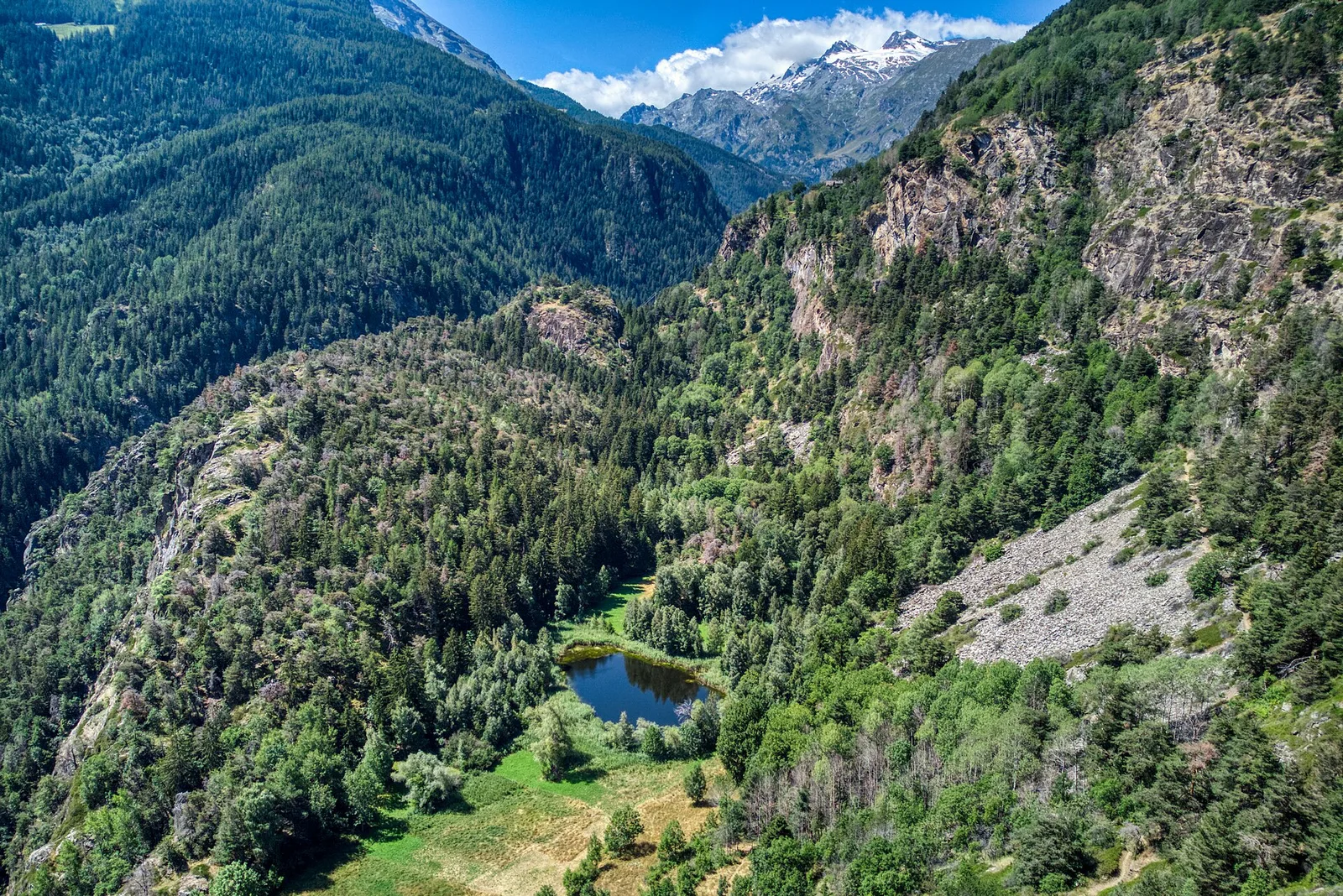
One of the most demanding trails in the Valdigne purely in terms of elevation gain, this 6.9-kilometre route climbs from Runaz at 839 metres to the high-altitude pasture of Baulin at 1865 metres, gaining over 1130 metres. The path passes through Milliery, a traditional Aosta Valley hamlet with notable rural architecture — stone barns, wine presses, and ancient storage buildings of ethnographic interest. Beyond the village, the trail enters wilder terrain, moving through mixed woodland before reaching open mountain pastures. The reward is sweeping views of Mont Blanc and the peaks of the Valdigne. Baulin remains an active summer alp where livestock and shepherds continue a centuries-old pastoral tradition.
Aparcamiento
Galería de fotos
Photos are published immediately. JPG/PNG/WebP, max 6 MB.
Flora del sendero
Fauna que observar
AEditado y verificado por Andrea Rama
Fuente de datos: Catasto Sentieri Regione Autonoma VdA · Open data — DGR 899/2014
Última verificación:
Valle centrale
Senderos relacionados
Mismo valle o rutas similares — más excursiones por descubrir.

Valle centrale
Anello del Verrand
2.6 km · +233 m · E — from Château Verrand to Château Verrand (Rhêmes Valley).

Valle centrale
Area giochi Croux - Parleyaz
4.1 km · +476 m · E — from Area giochi Croux to Parleyaz (Central Valley).

Valle centrale
Arlier - Cloutraz (Pontey)
From Arlier (603m) to Cloutraz (1067m) on the Châtillon hillside: 3.5 km E through vineyards, woodland and views over the Dora Baltea.

Valle centrale
Arpilles - Champromenty
2.1 km · +333 m · E — from Arpilles to Champromenty (Lys Valley).