Saint-Jacques - Col de Nannaz
6.6 km
+1082 m
−0 m
4.5 h
Nivel físico
Mapa y ruta
Traza GPX — verifica sobre el terreno antes de caminar
Descripción
Puntos clave
Salida
Saint-Jacques · 1700 m
Llegada
Col de Nannaz · 2770 m
Sendero
S20
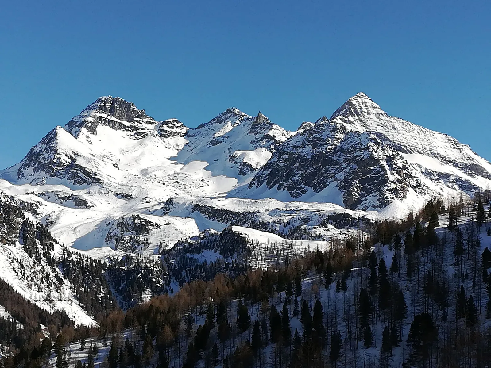
From Saint-Jacques, the highest village of Val d'Ayas at 1,700 metres, the path climbs the hillside to Col de Nannaz, at 2,770 metres, a pass on the ridge dividing Ayas from the adjoining valleys. It runs 6.6 km with more than a thousand metres of ascent: a hike, but a demanding one, crossing woods, alps and high pastures before the grassy and stony slopes below the col. Along the climb and from the pass the view opens onto the head of the valley and, behind, onto the Aosta Valley face of Monte Rosa. A classic outing for those seeking height and panorama in a day, for fit walkers and with an eye on the afternoon weather. Best in summer.
Aparcamiento
Galería de fotos
Photos are published immediately. JPG/PNG/WebP, max 6 MB.
Flora del sendero
Fauna que observar
AEditado y verificado por Andrea Rama
Fuente de datos: Catasto Sentieri Regione Autonoma VdA · Open data — DGR 899/2014
Última verificación:
Val d'Ayas
Senderos relacionados
Mismo valle o rutas similares — más excursiones por descubrir.

Val d'Ayas
Amponey - Becca Trecare
A demanding EE ascent from Amponey to Becca Trecare at 3032m — nearly 1500m of gain on varied terrain with sweeping summit views.

Val d'Ayas
Amponey - Alpe Mascognaz
1.8 km · +309 m · E — from Amponey to Alpe Mascognaz (Central Valley).

Val d'Ayas
Amponey - Bec de Nannaz
In the Val d'Ayas, Ayas: an E-rated climb toward a high-altitude objective through pastures and rock with views of Monte Rosa.

Val d'Ayas
Amponey - Mont Facebelle
In the Val d'Ayas, Ayas: an E/EE-rated climb toward a high-altitude objective in the alpine landscape.