Blanchard - Passo Superiore Bettolina - Rifugio Sella
Advertencias
- EE route for hikers with solid high-mountain experience only.
- Mandatory equipment: microspikes/crampons, ice axe if snow, layered clothing.
- Rapid weather changes above 3000 m: do not attempt with unstable forecasts.
- Residual snow and morning ice possible even in midsummer.
9.4 km
+1869 m
−0 m
7 h
Nivel físico
Mapa y ruta
Traza GPX — verifica sobre el terreno antes de caminar
Descripción
Puntos clave
Salida
Blanchard · 1731 m
Llegada
Rifugio Quintino Sella · 3593 m
Sendero
S30
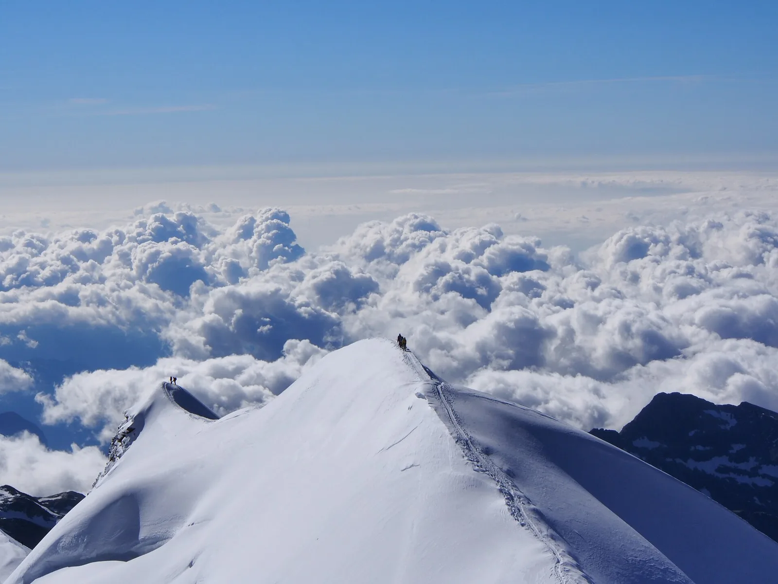
One of the most demanding trails in the entire Aosta Valley network, this 9.4-kilometre route ascends nearly 1869 metres from Blanchard (1731 m) to the Rifugio Quintino Sella at 3593 metres, in the high glacial environment of the Monte Rosa massif. Classified EE, the route demands excellent physical fitness, appropriate mountaineering equipment, and solid high-altitude navigation skills. The lower section passes through woodland and alpine pastures before the terrain becomes rocky and barren, with residual snowfields and scree. The Quintino Sella hut is a historic base for ascents of Castore and other Monte Rosa summits. Rapid weather changes at this altitude are common and must be taken seriously.
Aparcamiento
Galería de fotos
Photos are published immediately. JPG/PNG/WebP, max 6 MB.
Flora del sendero
Fauna que observar
AEditado y verificado por Andrea Rama
Fuente de datos: Catasto Sentieri Regione Autonoma VdA · Open data — DGR 899/2014
Última verificación:
Val d'Ayas
Senderos relacionados
Mismo valle o rutas similares — más excursiones por descubrir.

Val d'Ayas
Amponey - Becca Trecare
A demanding EE ascent from Amponey to Becca Trecare at 3032m — nearly 1500m of gain on varied terrain with sweeping summit views.

Val d'Ayas
Amponey - Alpe Mascognaz
1.8 km · +309 m · E — from Amponey to Alpe Mascognaz (Central Valley).

Val d'Ayas
Amponey - Bec de Nannaz
In the Val d'Ayas, Ayas: an E-rated climb toward a high-altitude objective through pastures and rock with views of Monte Rosa.

Val d'Ayas
Amponey - Mont Facebelle
In the Val d'Ayas, Ayas: an E/EE-rated climb toward a high-altitude objective in the alpine landscape.