Bivacco Gontier - Col du Tradzo
Advertencias
- High-altitude route: start early, plan time and water, and turn back before early afternoon.
- Residual snow may linger in gullies and on north-facing slopes into early summer: assess current conditions.
- In fog the path across pastures and boulder fields can be hard to follow: rely on waymarks and a map.
2 km
+556 m
−0 m
2 h
Nivel físico
Mapa y ruta
Traza GPX — verifica sobre el terreno antes de caminar
Descripción
Puntos clave
Salida
Bivacco Gontier · 2302 m
Llegada
Col du Tradzo · 2875 m
Sendero
S20
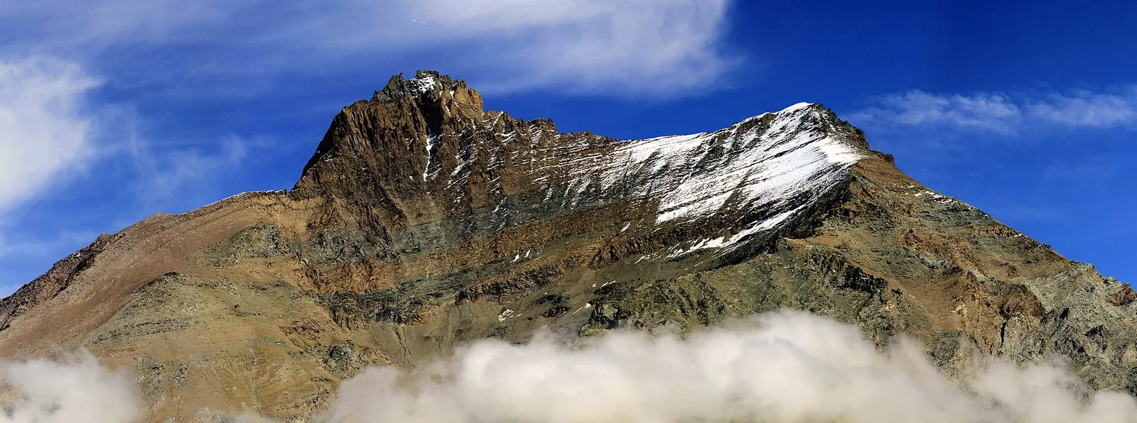
From the Gontier bivouac, at 2,302 metres on the Cogne valley slope, the path climbs to Col du Tradzo, a pass at 2,875 metres on the edge of the Gran Paradiso National Park. Two kilometres for more than five hundred metres of ascent: a hike, but a steep one, on high pastures, moraines and scree before the col. The setting is the stark, silent high mountain of Gran Paradiso, realm of ibex and chamois, with wide views over the massif's peaks. The col is a crossing point between side valleys in a little-frequented sector. Tackle it with good fitness, an eye on the afternoon weather and care for early-season snowfields. Best in summer.
Aparcamiento
Galería de fotos
Photos are published immediately. JPG/PNG/WebP, max 6 MB.
Flora del sendero
AEditado y verificado por Andrea Rama
Fuente de datos: Catasto Sentieri Regione Autonoma VdA · Open data — DGR 899/2014
Última verificación:
Val di Cogne
Senderos relacionados
Mismo valle o rutas similares — más excursiones por descubrir.

Val di Cogne
Alpe Bardoney (incrocio sentieri 12-13G)- Col de l'Arolla
5.3 km · +684 m · EE — from Alpe Bardoney (incrocio sentieri 12-13G) to Col de l'Arolla (Lys Valley).

Val di Cogne
Antiche miniere di ferro di Colonna
3.8 km · +852 m · E — from Moline to Miniere di Colonna (Lys Valley).

Val di Cogne
Arpisson - Col Chasèche
2.3 km · +498 m · E — from Arpisson to Col Chasèche (Lys Valley).

Val di Cogne
Arrivo impianto risalita Chamolé- Tête Noire
1.4 km · +497 m · E — from Arrivo impianto risalita Chamolé to Tête Noire (Lys Valley).