Place Moulin - Alpe Tsa de Tsan
Advertencias
- High-altitude route: start early, plan time and water, and turn back before early afternoon.
- Residual snow may linger in gullies and on north-facing slopes into early summer: assess current conditions.
- In fog the path across pastures and boulder fields can be hard to follow: rely on waymarks and a map.
10.9 km
+650 m
−0 m
4.5 h
Nivel físico
Mapa y ruta
Traza GPX — verifica sobre el terreno antes de caminar
Descripción
Puntos clave
Salida
Place Moulin · 2011 m
Llegada
Alpe Tsa de Tsan · 2615 m
Sendero
S16
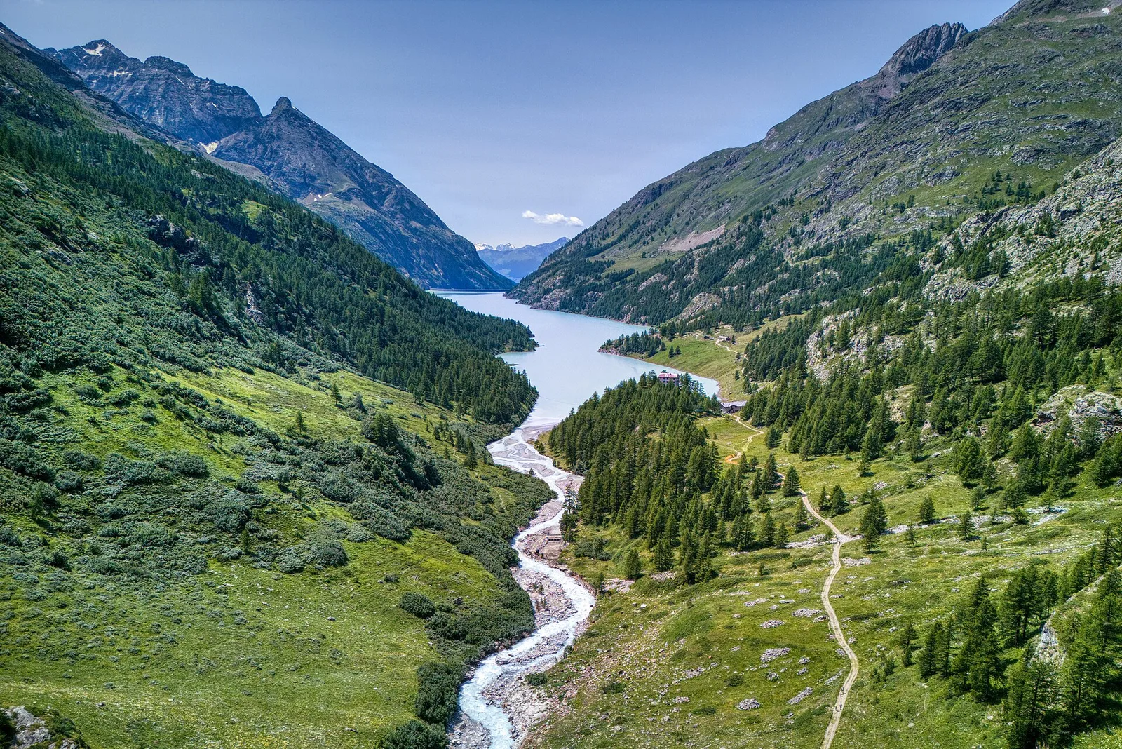
The route from Place Moulin to Alpe Tsa de Tsan unfolds in the upper Valpelline in Bionaz, in a high-mountain landscape dominated by the glacial masses framing the valley head. The walk starts from the Place Moulin dam (2011 m), one of the most imposing engineering works in the region, which impounds a reservoir at the heart of a glacial basin. The route covers 10.9 km with 650 m of ascent. The path follows the reservoir shore, then climbs toward the Alpe Tsa de Tsan plateau (2615 m), close to the glacier of the same name. The environment is that of high glacial mountain: meltwater streams, moraines, smoothed bedrock and vast open scenery. The E rating reflects no technical difficulty, though the altitude calls for attention to weather. Advisable from July to September.
Aparcamiento
Galería de fotos
Photos are published immediately. JPG/PNG/WebP, max 6 MB.
Flora del sendero
Fauna que observar
AEditado y verificado por Andrea Rama
Fuente de datos: Catasto Sentieri Regione Autonoma VdA · Open data — DGR 899/2014
Última verificación:
Valpelline
Senderos relacionados
Mismo valle o rutas similares — más excursiones por descubrir.

Valpelline
Bionaz (Plan Praz) - Place Moulin
Upper Valpelline, Bionaz: an E-rated route toward a glacial objective over open terrain.

Valpelline
Chamin - Bivacco della Sassa
From Chamin (1,732 m) to the Bivacco della Sassa (2,964 m) in the quiet Valpelline: 7.1 km and 1,246 m of ascent.

Valpelline
Champillon - Rifugio Letey - Col Champillon
3.1 km · +643 m · E — from Champillon to Col Champillon (Valtournenche).

Valpelline
Chanté - Mont Saron
From Allein toward Valpelline across the panoramic ridge between the two valleys: an E-rated route over open pastures with views of the Gran San Bernardo.