
EE
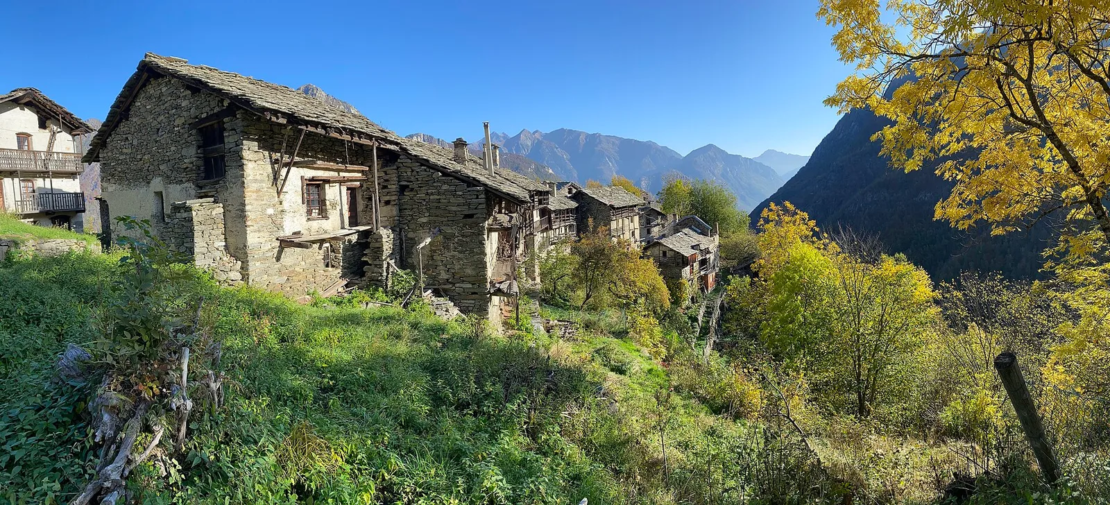
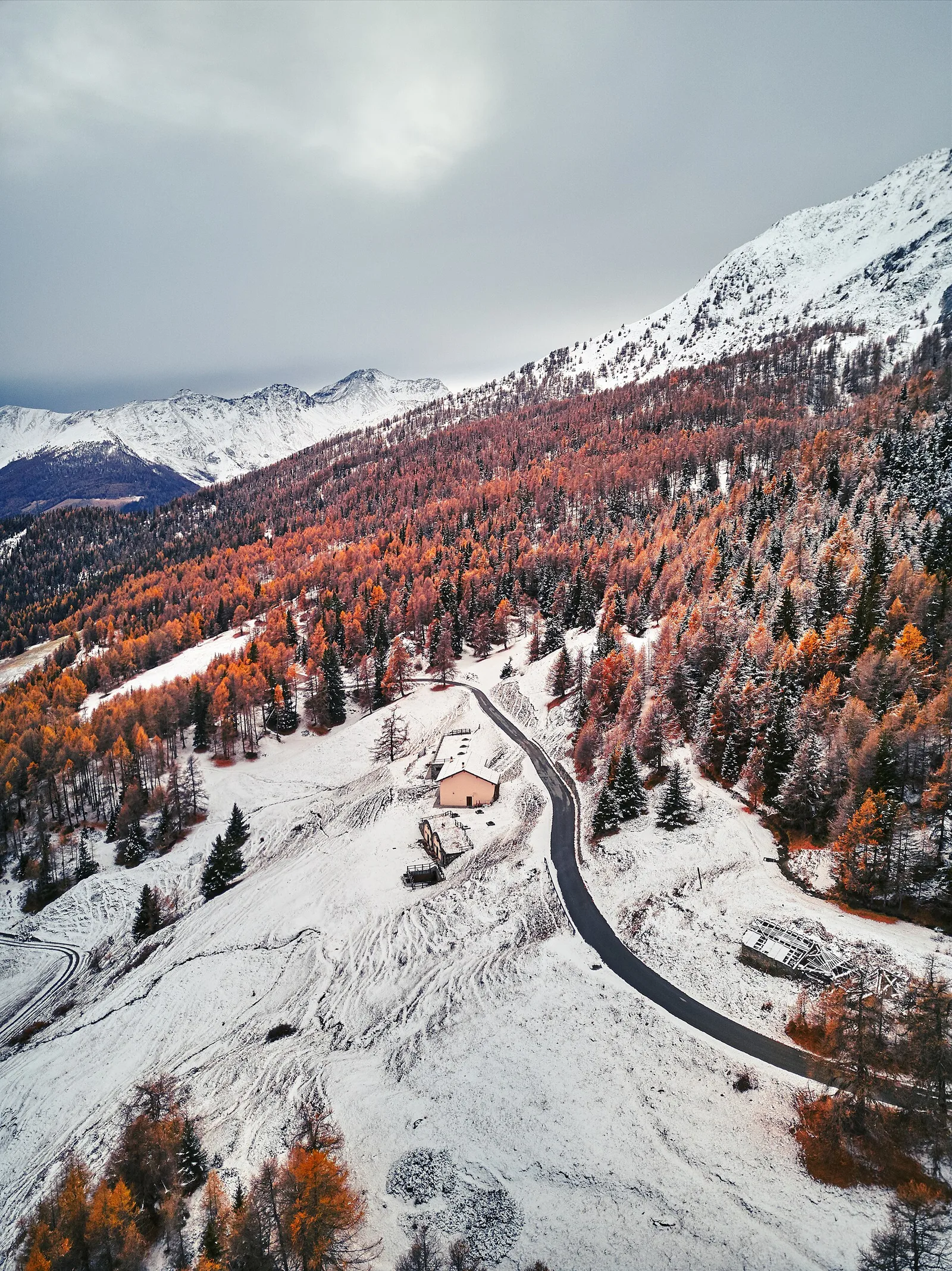
Val d'Ayas
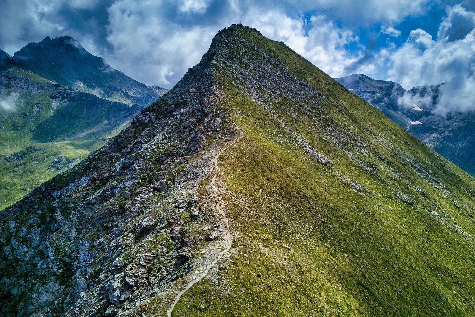
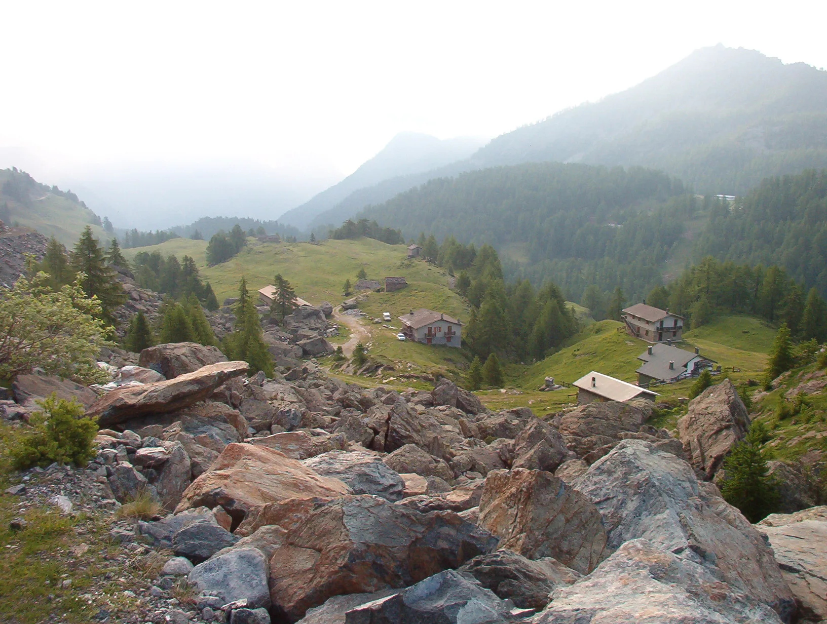
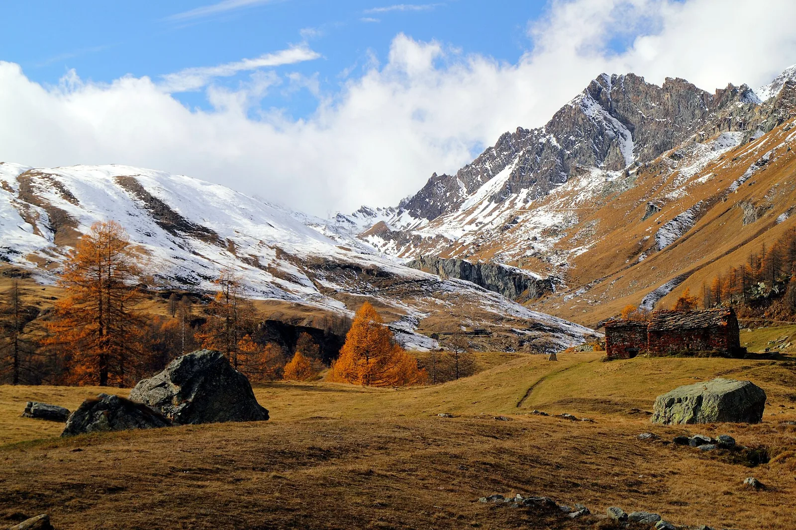
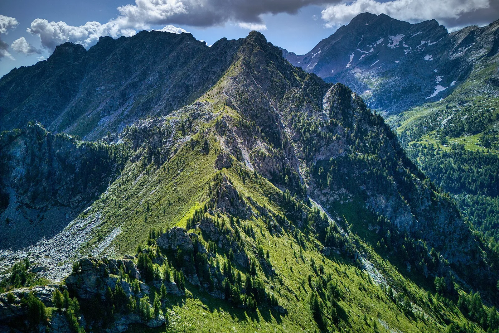
Amponey - Mont Facebelle
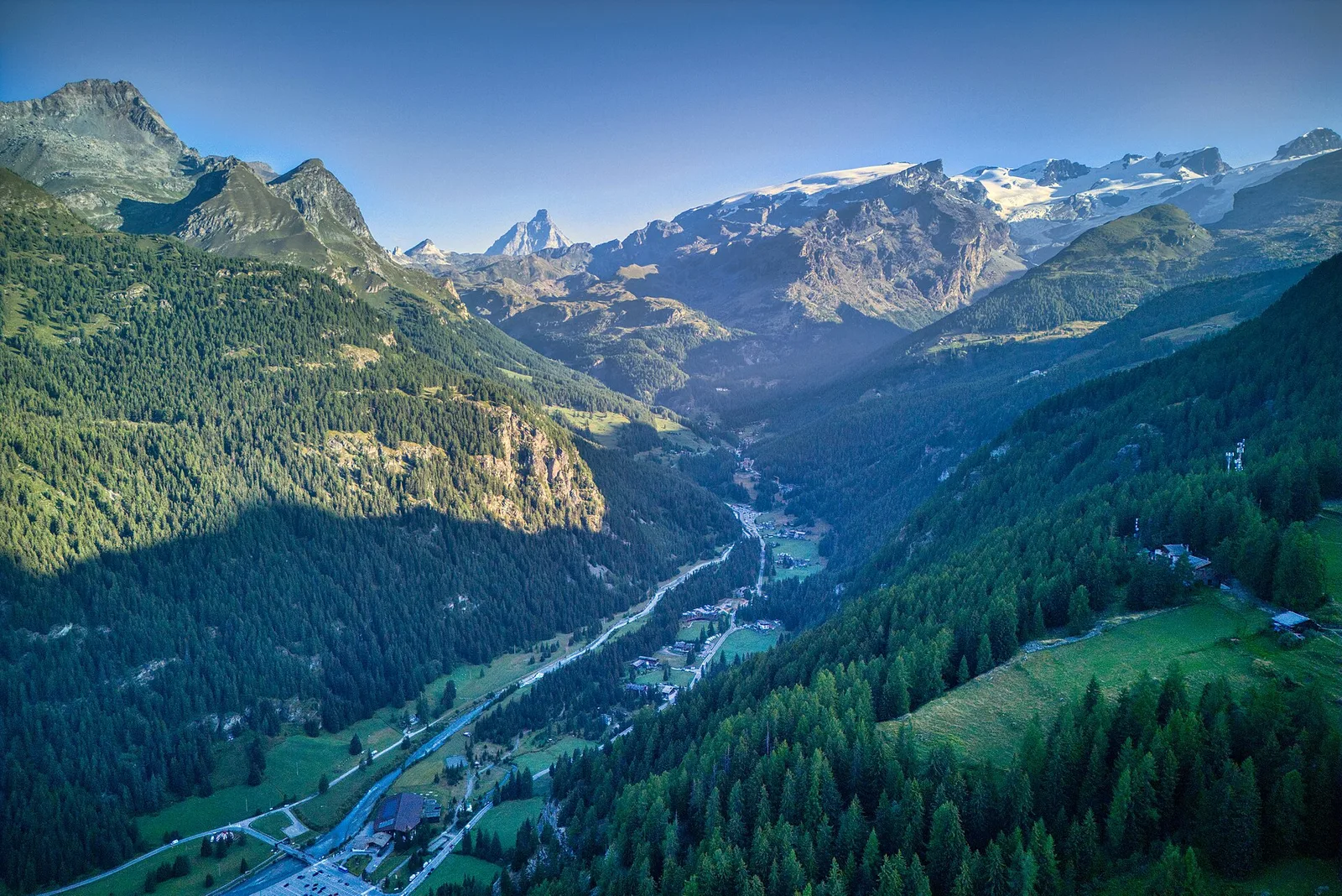
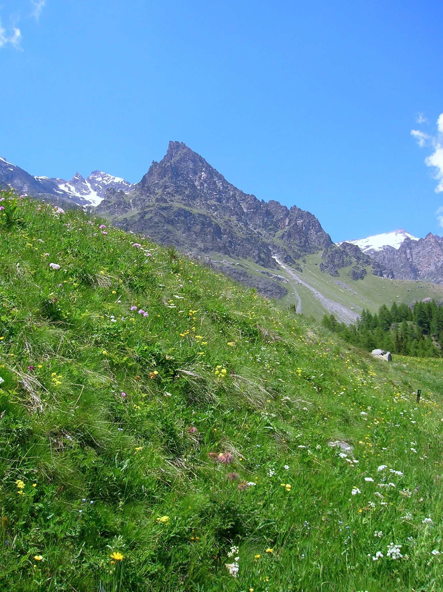
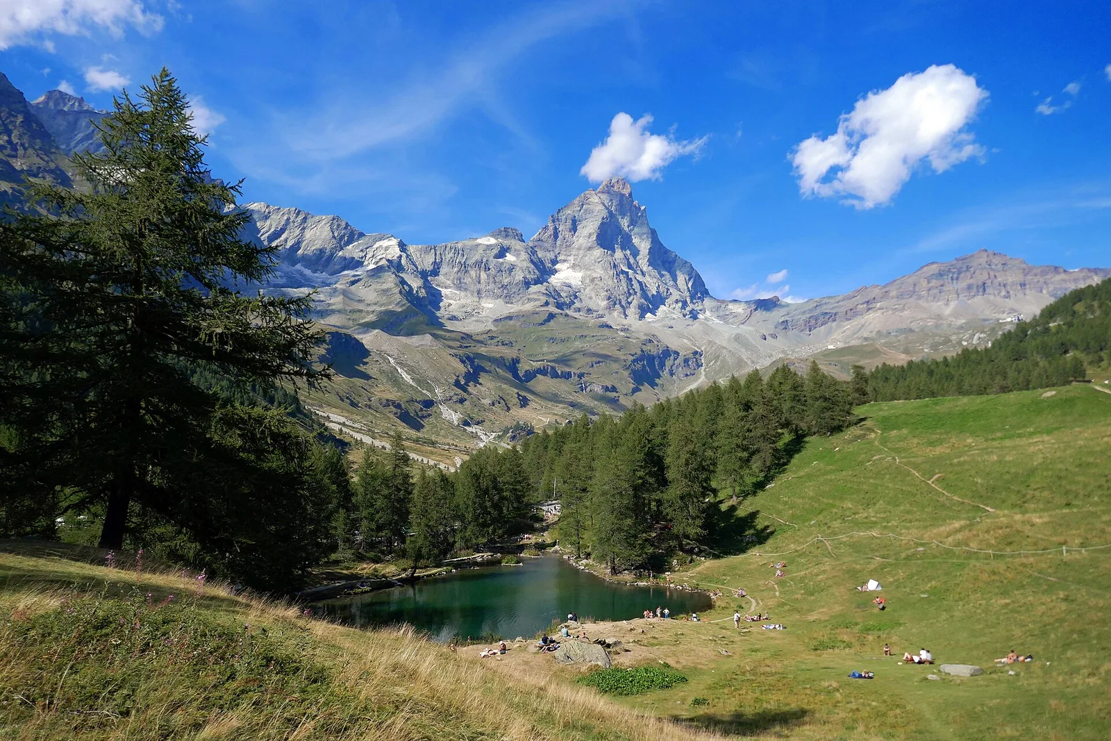
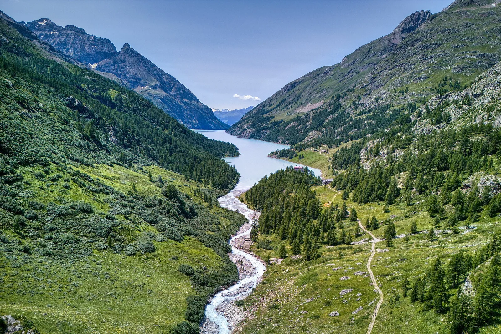
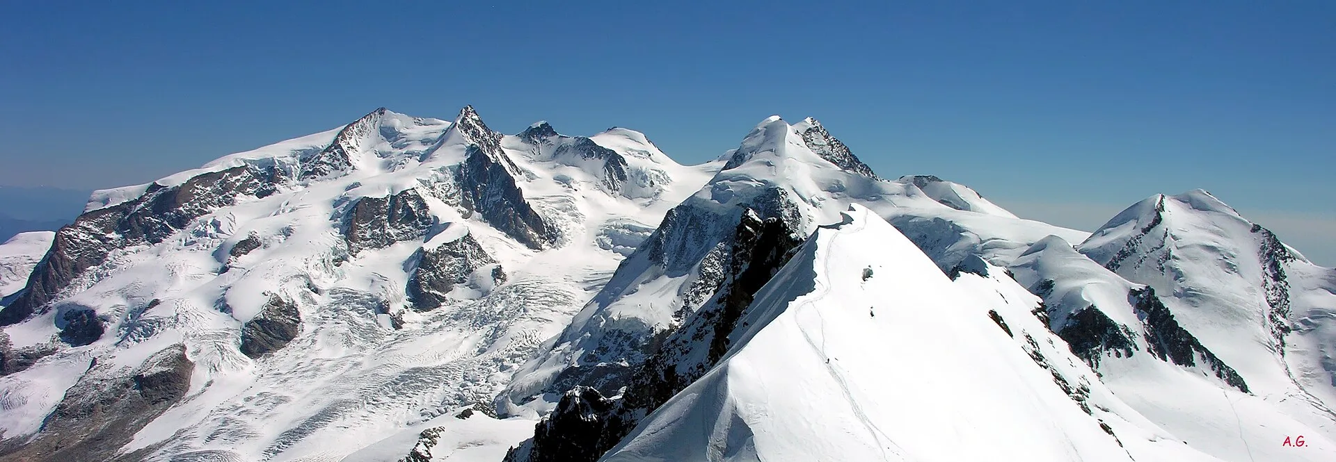
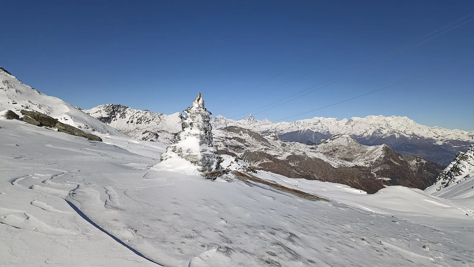
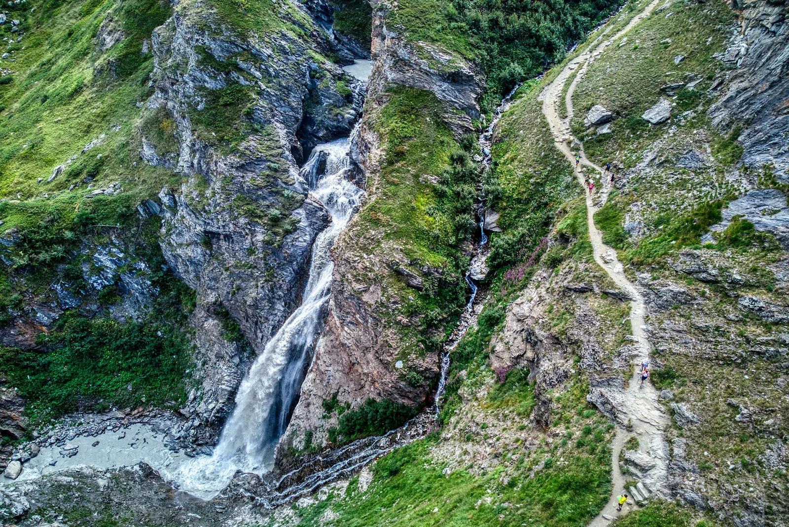
In the Val d'Ayas, Ayas: an E/EE-rated climb toward a high-altitude objective in the alpine landscape.
5.6 km+1077 m4 h
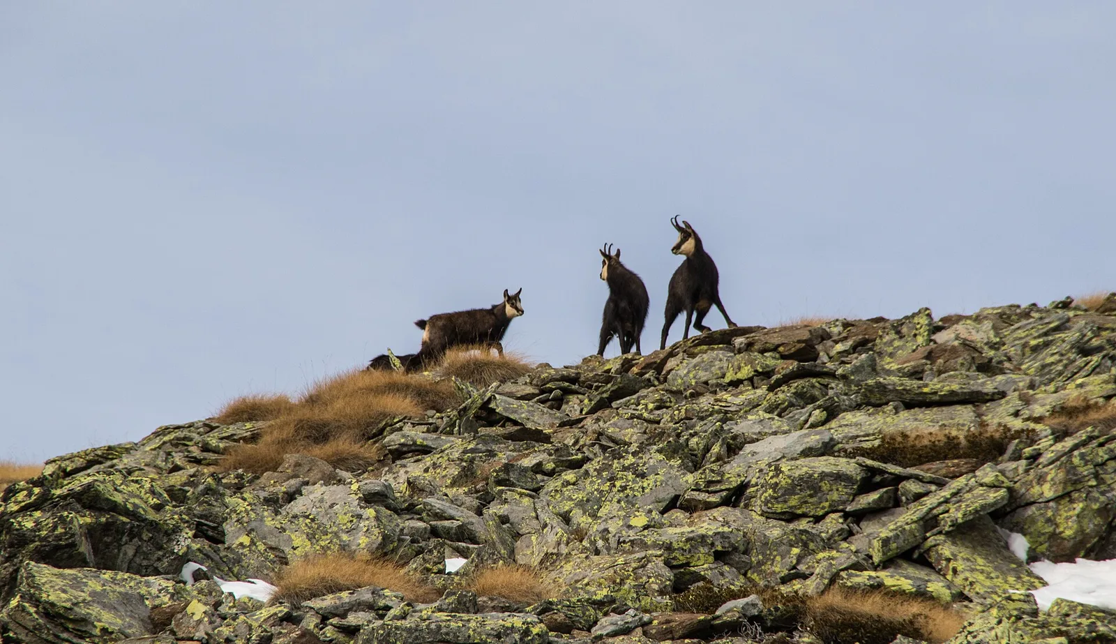
Where to spot
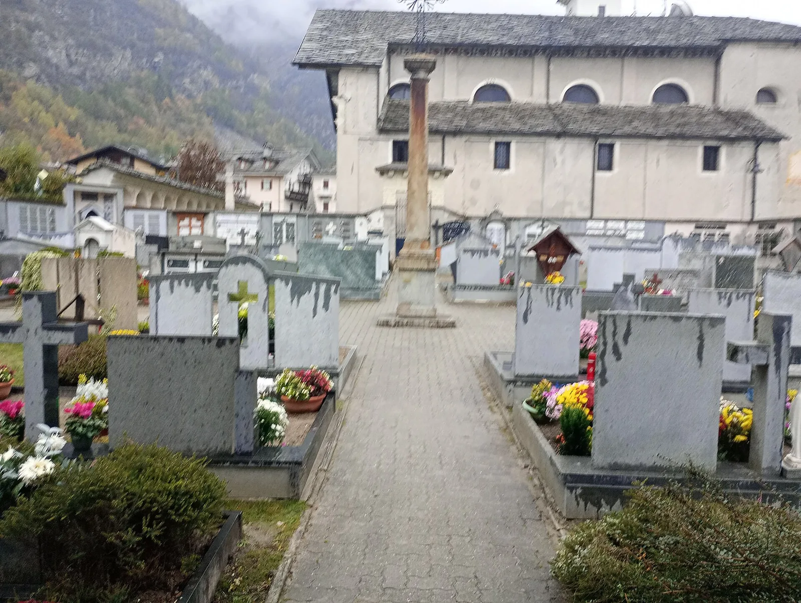
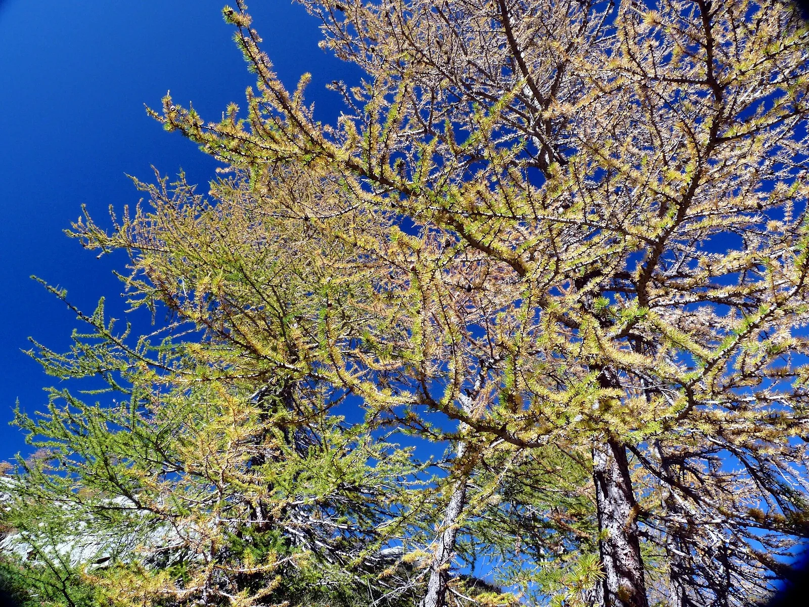
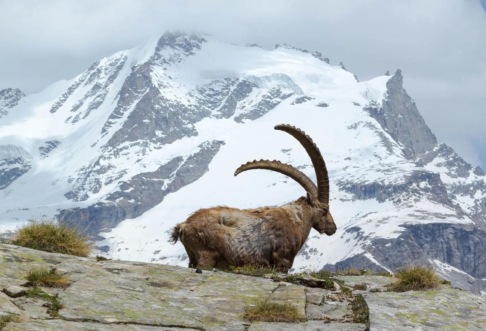
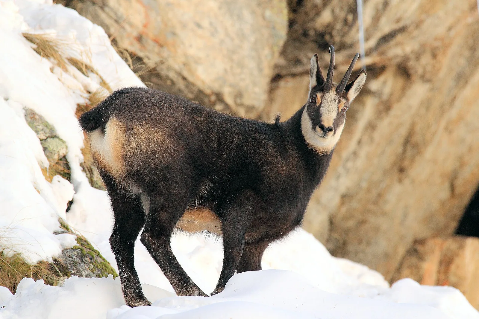
82 trails where Dwarf willow is listed in flora/fauna: difficulty T–EEA, elevation gain 0–3545 m.
82 · 0.7–78.9 km · +0–3545 m
Val d'Ayas
In the Val d'Ayas, Ayas: an E/EE-rated climb toward a high-altitude objective in the alpine landscape.
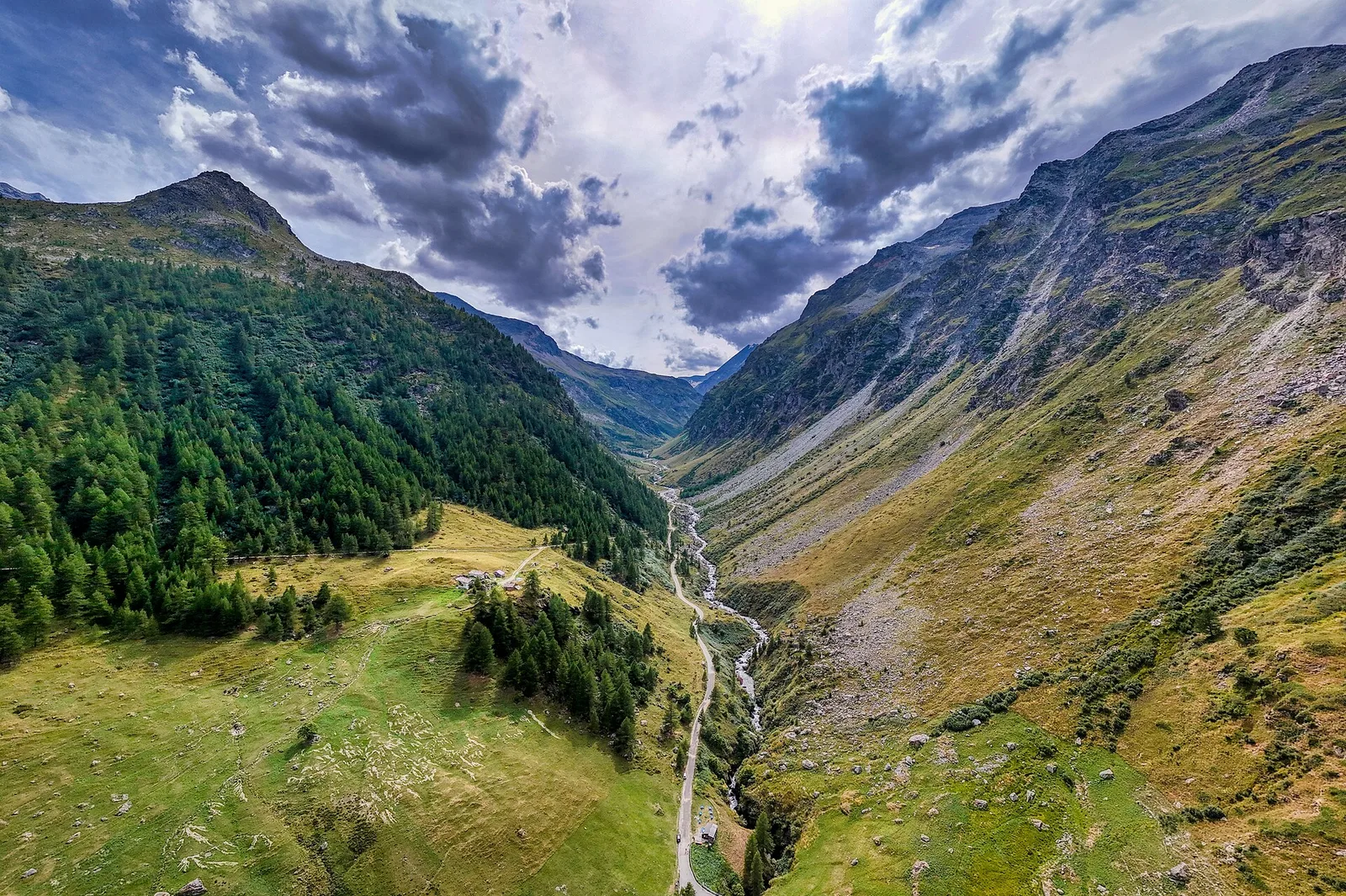
Val Veny
3.4 km · +997 m · EEA — from Area pic-nic Plan Veny to Rifugio Monzino (Great St Bernard Valley).

Valle di Champorcher
13.9 km · +1540 m · E — from Barche to Grand Alpe (Lys Valley).
Valle centrale
A demanding climb from Grand Brissogne to Bivacco Menabreaz on a barely-visited flank of the central Aosta Valley — 1567m of gain and true solitude.
Valle del Gran San Bernardo
6.5 km · +1197 m · E — from Buthier to Pointe Chaligne (Central Valley).

Valle del Gran San Bernardo
6.5 km · +1197 m · E — from Buthier to Punta Chaligne (Central Valley).
Valtournenche
From Chamois (1812 m) — Italy's only road-free municipality — to trail junction 4 at 2600 m. 779 m ascent over high pastures above the central Aosta Valley.
Valtournenche
6.9 km · +960 m · E — from Chamois to Col de Nannaz (Central Valley).

Valle di Champorcher
10.1 km · +1406 m · E — from Champrocher to Col Laris (Valtournenche).

Valpelline
From Allein toward Valpelline across the panoramic ridge between the two valleys: an E-rated route over open pastures with views of the Gran San Bernardo.
Valle di Champorcher
6.7 km · +1139 m · EE — from Chardonney to Col Laris (Valtournenche).
Valle centrale
7.2 km · +1539 m · EE — from Cloutraz to Col Giron (Valdigne).
Valtournenche
33.1 km · +2969 m · EE — from Col Collon to Colle del Teodulo (Valpelline).
Bassa Valle
32.2 km · +3545 m · EE — from Col de Bonze to Col Laris (Valtournenche).
La Thuile
9 km · +1272 m · E — from Capoluogo to Col des Orgères (Lys Valley).
Valle del Lys
78.9 km · +0 m · E — from Colle del Teodulo to Capoluogo (Central Valley).
Valle centrale
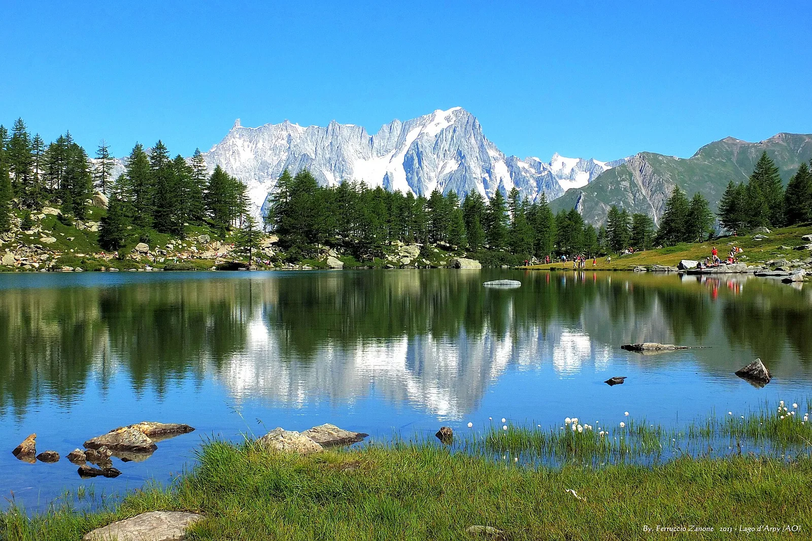
From Costablinaz to Lac d’Arpy (trail 14), Morgex: 6.1 km, +611 m, E. A balcony lake facing Mont Blanc.
Valle del Gran San Bernardo
9.1 km · +1701 m · E — from Cré to Pointe Chaligne (Central Valley).
Val d'Ayas
2.8 km · +323 m · E — from Crest to Belvedere (Central Valley).
Valle centrale
11.4 km · +1892 m · E — from Crétaz to Becca d'Aver (Valsavarenche).
Valle di Champorcher
4.5 km · +487 m · E — from Dondena to Santuario al lago Miserin (Valtournenche).
Valpelline
7.8 km · +1552 m · E — from Planavilla to Col Champillon (Valtournenche).
Valle del Gran San Bernardo
6.5 km · +1468 m · E — from Echevennoz to Pointe Chaligne (Central Valley).
Valpelline
9.9 km · +1466 m · EE — from Etirol to Cima Bianca (Valpelline).

Valtournenche
8.3 km · +1014 m · E — from Etirol to Col de Tsomioy (Valpelline).
La Thuile
13.6 km · +1159 m · E — from Faubourg to Col des Chavannes (Lys Valley).
Valle centrale
9.9 km · +1151 m · EE — from Fonteil to Becca d'Aveille (Rhêmes Valley).
Valle del Gran San Bernardo
8.9 km · +1661 m · E — from Gignod to Pointe Chaligne (Central Valley).
Valpelline
4.8 km · +1037 m · E — from Glacier to Bivacco Regondi (Valpelline).
Val d'Ayas
6.7 km · +1050 m · EE — from Gressoney-la-Trinité to Passo del Rothorn (Salerfòrkò) (Lys Valley).
Valle del Lys
6.7 km · +1641 m · E — from Kuniu to Colle Tschasten nord (Ayas Valley).
La Thuile
2.9 km · +549 m · E — from Lac d'Arpy to Colle Comba Sorda (Col Cormet) (Central Valley).
Val di Cogne
0.7 km · +35 m · E — from Pila arrivo seggiovia to Lac de Chamolé (Lys Valley).
La Thuile
5.7 km · +637 m · E — from Col Saint-Charles to lago di Pietra Rossa (Central Valley).
Valle di Champorcher
6.9 km · +1065 m · E — from Le Crin to Col de Médzove (Lys Valley).
Valle di Champorcher
9.1 km · +1362 m · EE — from Le Crin to Col Fussy (Lys Valley).

Valle di Champorcher
8.6 km · +1305 m · EE — from Le Crin to Col Moutsaillon (Lys Valley).
Valle di Champorcher
3.5 km · +770 m · E — from Le Crin to Grand Bellalanaz (Lys Valley).
Valle del Gran San Bernardo
2.7 km · +581 m · E — from Località Pra d'Arc to Colle di Saint-Rhémy (Central Valley).
Valle del Lys
7.7 km · +1043 m · E — from Loomatto to Passo di Lazoney (Champorcher Valley).
Valle centrale
6.2 km · +1444 m · EE — from Lusey to Col Varotta (Valtournenche).
Valpelline
6.1 km · +1205 m · E — from Capoluogo to Bivacco Regondi (Valpelline).
Valle del Lys
3.5 km · +1000 m · EE — from Ondre Eselbode to Bivacco Gastaldi (Lys Valley).
Valle del Lys
4.7 km · +1081 m · T — from Ondrò Verdebio to Colle Valdobbia (Champorcher Valley).
La Thuile
11.4 km · +1418 m · E — from Parcheggio Area camper to Col de la Lex Blanche (Lys Valley).
Valle di Champorcher
5.8 km · +767 m · E — from Parcheggio Dondena to Col de Moutsaillon (Valtournenche).
Valtournenche
5.7 km · +693 m · E — from Parcheggio Porliod to Innesto AV1 (Valpelline).
Valtournenche
4.9 km · +740 m · E — from Perrère to Bec du Pio Merlo (Central Valley).
Valle di Champorcher
2.6 km · +507 m · EE — from Petit-Rosier to Col d'Arcomy (Valtournenche).
Valtournenche
3.3 km · +618 m · E — from Breuil-Cervinia to Motta de Pleté occidentale (Central Valley).
Val di Cogne
5.3 km · +794 m · E — from Pila, Gorraz to Pointe du Drinc (Lys Valley).
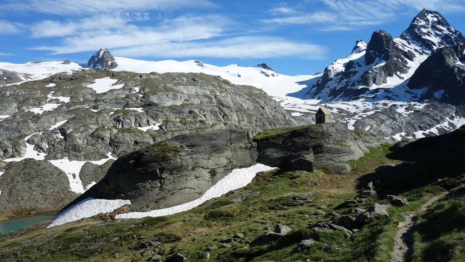
Valpelline
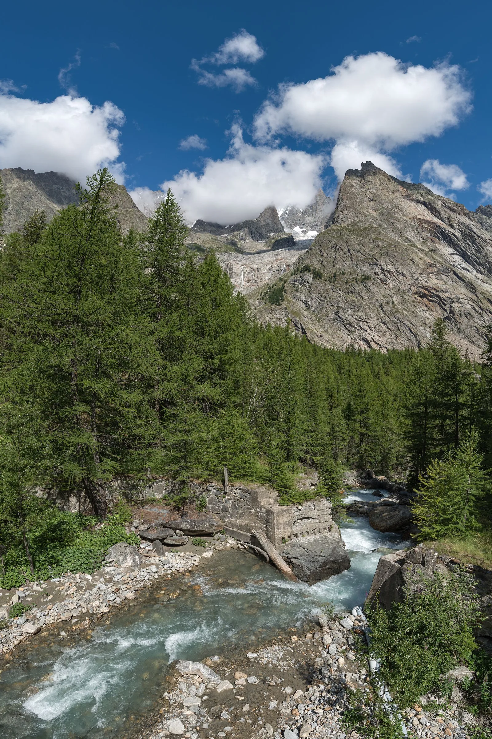
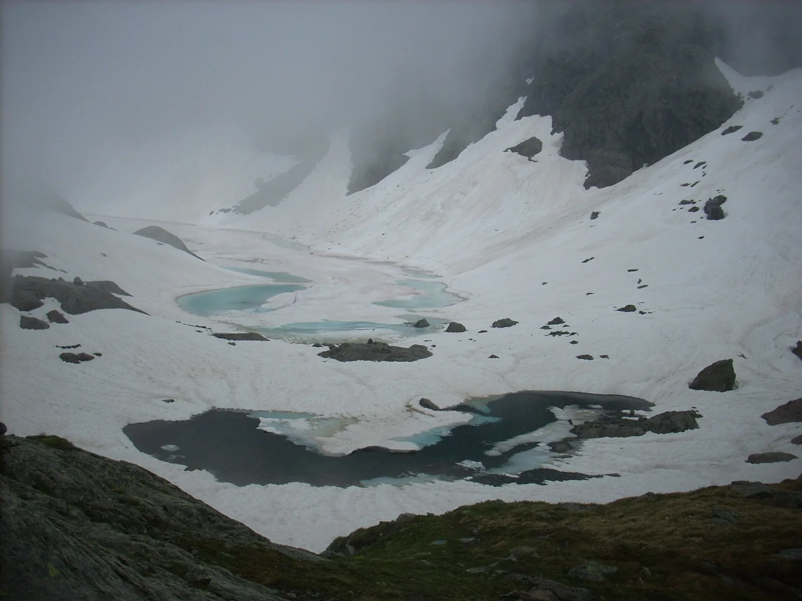
From the Place Moulin dam, the trail climbs the upper Valpelline to the Alpe Tsa de Tsan (2615 m), deep within a glacial landscape among the highest terrain of the Aosta Valley.
Valle del Lys
4.6 km · +1151 m · EE — from Plan Coummarial to Mont Mars (Lys Valley).
Valtournenche
4.8 km · +1032 m · EE — from Plan de la Glae to Mont Pancherot (Central Valley).
Valtournenche
4.2 km · +720 m · E — from Plan de la Glaea to Illiaz - Perron (Central Valley).
Valsavarenche
9 km · +643 m · E — from Pont to Col du Nivolet (Ayas Valley).
Valsavarenche
3.6 km · +327 m · E — from Pont to Meyes desot (Ayas Valley).
Valle centrale
A long climb from the Aosta valley floor, via Chacotteyes and Tsa de Metz, to Pointe Chaligne: 1,940 metres of ascent and a 360° view over the Aosta basin.
Val Veny
6.1 km · +640 m · E — from Pont Combal to Col des Chavannes (Great St Bernard Valley).
Valpelline
6.8 km · +1318 m · E — from Ponte Vernosse to Col Vamea (Lys Valley).

Valpelline
From Pouillaye (1626 m) to Colle di Montagnaye (2907 m): a demanding border crossing between the Valpelline and the Swiss Canton of Valais.
Bassa Valle
9 km · +1546 m · E — from Pramotton to Alpe Bonze (Valtournenche).
Valpelline
7.9 km · +832 m · E — from Praz to Bivacco Reboulaz (Valpelline).
Valle di Champorcher
2.1 km · +331 m · EE — from Remoran to Col Terre Rousse (Valtournenche).
Valle di Champorcher
5.2 km · +468 m · E — from Rifugio Barbustel to Col de Mézove (Central Valley).
Valgrisenche
4 km · +556 m · E — from Rifugio Bezzi to Col de Vaudet (Valtournenche).
Valgrisenche
1.6 km · +341 m · E — from Rifugio Bezzi to Lac Vert (Valtournenche).
Valle del Lys
1.7 km · +418 m · EEA — from Rifugio Coda to Mont Mars (Lys Valley).
Valle di Champorcher
5.3 km · +576 m · E — from Rifugio Dondena to Col Laris (Valtournenche).
Valle del Lys
5.5 km · +259 m · E — from Rifugio Gabiet to Bivacco Gastaldi (Lys Valley).
Valle del Lys
6.5 km · +838 m · E — from Staffal to Orestes Huette (Lys Valley).

Valle di Champorcher
6.4 km · +967 m · E — from Strada Dondena to Parcheggio Dondena (Valtournenche).
Val d'Ayas
In the commune of Brusson, Val d'Ayas: an E-rated route among hamlets and pastures on the sunny slope with panoramic views.
Valle del Lys
In the commune of Brusson, Val d'Ayas: a route among hamlets and alpine pastures on the sunny slope with valley views.
Valgrisenche
6.3 km · +1091 m · E — from Surrier, bivio poderali to Bivacco Ravelli (Valtournenche).
Valle del Lys
15.6 km · +0 m · E — from Rifugio della Barma to Niel (Lys Valley).
Valsavarenche
17.2 km · +1676 m · EE — from Eaux Rousses to Rifugio Sella (Ayas Valley).
Val di Rhêmes
3.7 km · +390 m · E — from Thumel to Rifugio Benevolo (Great St Bernard Valley).
Valgrisenche
5.3 km · +963 m · E — from Valgrisenche to Becca dei Quattro Denti (Valtournenche).
Valpelline
8.9 km · +1318 m · E — from Vernosse to Col Vamea (Lys Valley).
Val d'Ayas
5.3 km · +1303 m · EE — from Veulla to Col Varotta (Central Valley).
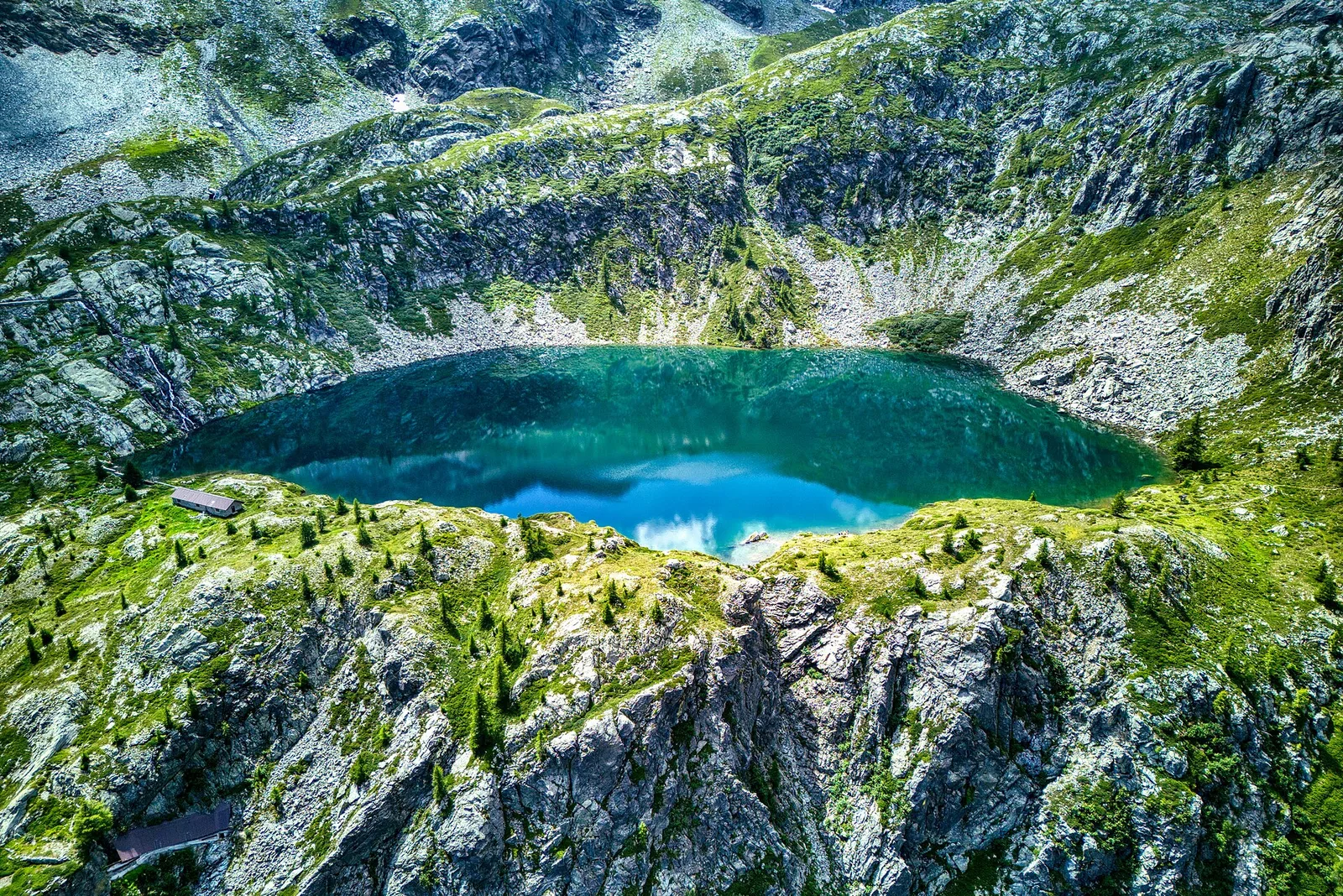
Valle di Champorcher
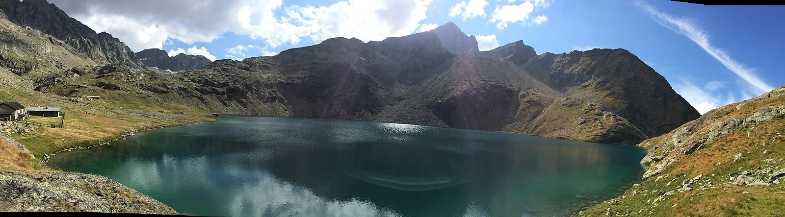
From Veulla (1286 m) to Lac Gelé (2606 m) above Charvensod: 1311 m of sustained ascent to a glacial tarn easily reached from the city of Aosta.