Chamois - Col di Nannaz
6.9 km
+960 m
−0 m
4 h
Nivel físico
Mapa y ruta
Traza GPX — verifica sobre el terreno antes de caminar
Descripción
Puntos clave
Salida
Chamois · 1823 m
Llegada
Col de Nannaz · 2772 m
Sendero
S8
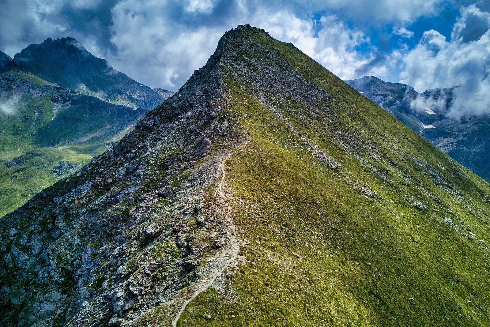
Chamois is one of the very few Italian municipalities with no road access — it is reached only on foot or by cable car from Buisson. This isolation sets the tone for the climb to Col de Nannaz (2772 m), a 6.9 km route with 960 m of ascent graded E. From the village at 1823 m the trail climbs steadily through summer pastures and alp zones before reaching the rocky upper slopes below the col. At 2772 m, the Col de Nannaz offers a sweeping 360-degree panorama over the central Aosta Valley peaks. The car-free context of Chamois gives this outing an unusual sense of genuine remoteness.
Aparcamiento
Galería de fotos
Photos are published immediately. JPG/PNG/WebP, max 6 MB.
Fauna que observar
AEditado y verificado por Andrea Rama
Fuente de datos: Catasto Sentieri Regione Autonoma VdA · Open data — DGR 899/2014
Última verificación:
Valtournenche
Senderos relacionados
Mismo valle o rutas similares — más excursiones por descubrir.

Valtournenche
Anello Area sportiva-Fiernaz-Area sportiva
2.9 km · +28 m · T — from Area sportiva to Area sportiva (Valtournenche).

Valtournenche
Anello dei Villaggi di Antey ( Ruvère, Liesse,Fontaney, Villettaz)
A loop through the sunlit hamlets of Antey and Torgnon: traditional Aosta Valley architecture, vineyards and mid-mountain forest, 5.2 km from Ruvère.

Valtournenche
Anello di Champlève
1.9 km · +140 m · E — from Champlève to Champlève (Central Valley).

Valtournenche
Area Pic Nic Champlong - Becca d'Aver e Cima Longhede
6.4 km · +913 m · E — from Area Pic Nic Champlong to Cima Longhede (Valsavarenche).