Chardonney - Lago Vercoche - Col Laris
6.7 km
+1139 m
−0 m
4.5 h
Nivel físico
Mapa y ruta
Traza GPX — verifica sobre el terreno antes de caminar
Descripción
Puntos clave
Salida
Chardonney · 1450 m
Llegada
Col Laris · 2588 m
Sendero
S46
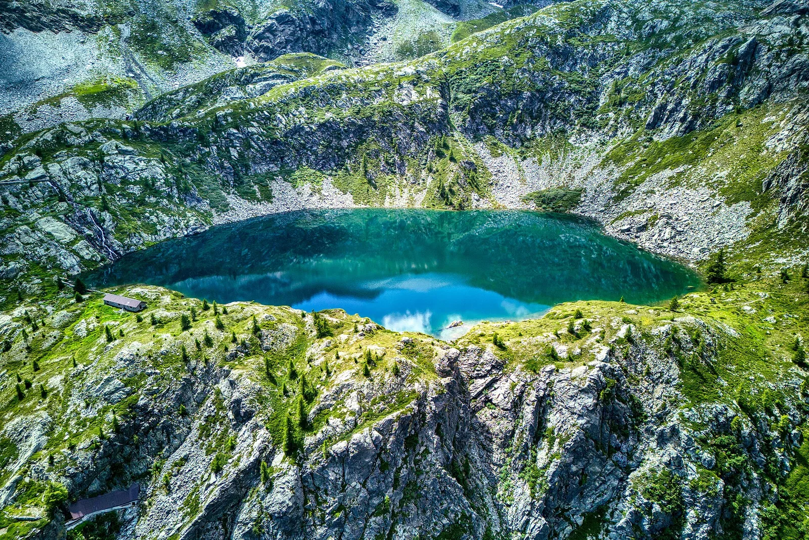
From Chardonney (1450 m), a hamlet of Champorcher, this Expert Hikers (EE) route reaches Lake Vercoche and continues to the Col Laris (2588 m), with over 1100 metres of ascent in about 6.7 kilometres. The climb crosses woods and alpine pastures to the Vercoche basin, a sheet of water set among the high meadows of the Champorcher valley, then gains the pass over scree and ridges. It is a demanding day for its height gain and high terrain: it calls for fitness, a sure foot and a settled day. Champorcher, at the south-eastern end of the Aosta Valley, keeps an intimate, uncrowded setting, dominated above by the buttresses of Mont Glacier.
Aparcamiento
Galería de fotos
Photos are published immediately. JPG/PNG/WebP, max 6 MB.
Flora del sendero
Fauna que observar
AEditado y verificado por Andrea Rama
Fuente de datos: Catasto Sentieri Regione Autonoma VdA · Open data — DGR 899/2014
Última verificación:
Valle di Champorcher
Senderos relacionados
Mismo valle o rutas similares — más excursiones por descubrir.

Valle di Champorcher
Barche - Plan Clavalité - Grand Alpe
13.9 km · +1540 m · E — from Barche to Grand Alpe (Lys Valley).

Valle di Champorcher
Castagnot - Col de Pofouey
3.8 km · +903 m · E — from Castagnot to Colle d'Arcomy (Central Valley).

Valle di Champorcher
Champorcher - Col de la Fricolla
8.8 km · +1350 m · EE — from Champorcher to Col de la Fricolla (Valtournenche).

Valle di Champorcher
Champorcher - Col Laris
10.1 km · +1406 m · E — from Champrocher to Col Laris (Valtournenche).