Costablinaz - Lac d'Arpy
6.1 km
+611 m
−0 m
3 h
Nivel físico
Mapa y ruta
Traza GPX — verifica sobre el terreno antes de caminar
Descripción
Puntos clave
Salida
Costablinaz · 1476 m
Llegada
Lac d'Arpy · 2071 m
Sendero
S20
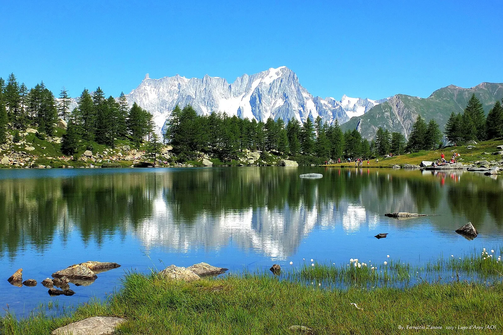
In the municipality of Morgex, above the Colle San Carlo, Lac d'Arpy is one of the Aosta Valley's most famous panoramic lakes. From Costablinaz, waymark no. 14 rises gently through firs and pastures to the lake basin (2,071 m), facing the entire Mont Blanc range: on clear days the face and glaciers mirror in the water, especially at dawn. The route suits families and anyone after a great view with modest ascent; from the lake, extensions lead to the Pietra Rossa lakes and surrounding passes. Best from June to October.
Aparcamiento
Galería de fotos
Photos are published immediately. JPG/PNG/WebP, max 6 MB.
Flora del sendero
Fauna que observar
AEditado y verificado por Andrea Rama
Fuente de datos: Catasto Sentieri Regione Autonoma VdA · Open data — DGR 899/2014
Última verificación:
Valle centrale
Senderos relacionados
Mismo valle o rutas similares — más excursiones por descubrir.

Valle centrale
Anello del Verrand
2.6 km · +233 m · E — from Château Verrand to Château Verrand (Rhêmes Valley).

Valle centrale
Area giochi Croux - Parleyaz
4.1 km · +476 m · E — from Area giochi Croux to Parleyaz (Central Valley).

Valle centrale
Arlier - Cloutraz (Pontey)
From Arlier (603m) to Cloutraz (1067m) on the Châtillon hillside: 3.5 km E through vineyards, woodland and views over the Dora Baltea.

Valle centrale
Arpilles - Champromenty
2.1 km · +333 m · E — from Arpilles to Champromenty (Lys Valley).