Glacier - Bivacco Regondi
4.8 km
+1037 m
−0 m
4 h
Nivel físico
Mapa y ruta
Traza GPX — verifica sobre el terreno antes de caminar
Descripción
Puntos clave
Salida
Glacier · 1571 m
Llegada
Bivacco Regondi · 2594 m
Sendero
S12
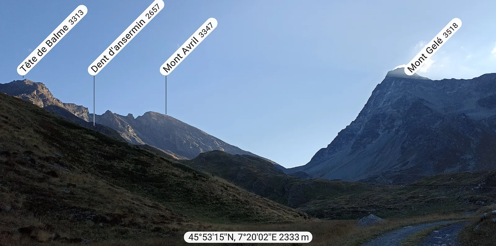
Glacier - Bivacco Regondi is an official trail from the Aosta Valley trail registry (code 46_S12). The route lies in the municipality of Oyace, in the Valpelline. From Glacier (1571 m) to Bivacco Regondi (2594 m): 4.8 km with +1037 m of elevation change, difficulty E (CAI scale). Minimum elevation 1571 m, maximum 2594 m. Recommended season per registry: Giugno-settembre (months 6, 7, 8, 9). Waymarking: 6 segnavia recorded in the registry. GPX track and elevation data from Regione Autonoma Valle d'Aosta (open data DGR 899/2014).
Aparcamiento
Galería de fotos
Photos are published immediately. JPG/PNG/WebP, max 6 MB.
Flora del sendero
Fauna que observar
AEditado y verificado por Andrea Rama
Fuente de datos: Catasto Sentieri Regione Autonoma VdA · Open data — DGR 899/2014
Última verificación:
Valpelline
Senderos relacionados
Mismo valle o rutas similares — más excursiones por descubrir.

Valpelline
Bionaz (Plan Praz) - Place Moulin
Upper Valpelline, Bionaz: an E-rated route toward a glacial objective over open terrain.

Valpelline
Chamin - Bivacco della Sassa
From Chamin (1,732 m) to the Bivacco della Sassa (2,964 m) in the quiet Valpelline: 7.1 km and 1,246 m of ascent.

Valpelline
Champillon - Rifugio Letey - Col Champillon
3.1 km · +643 m · E — from Champillon to Col Champillon (Valtournenche).

Valpelline
Chanté - Mont Saron
From Allein toward Valpelline across the panoramic ridge between the two valleys: an E-rated route over open pastures with views of the Gran San Bernardo.