High Route 1 — Stage 12: Oyace → Ollomont via Col Brison
Avisos
- High elevation gain relative to distance
- Residual snow possible in June on Col Brison
12.4 km
+1145 m
−1155 m
5.5 h
Nível físico
~3600 kcal estimadas
Mapa e percurso
Traço GPX oficial — Região Vale de Aosta / lovevda.it
Descrição
Pontos-chave
Partida
Oyace · 1367 m
Chegada
Ollomont · 1379 m
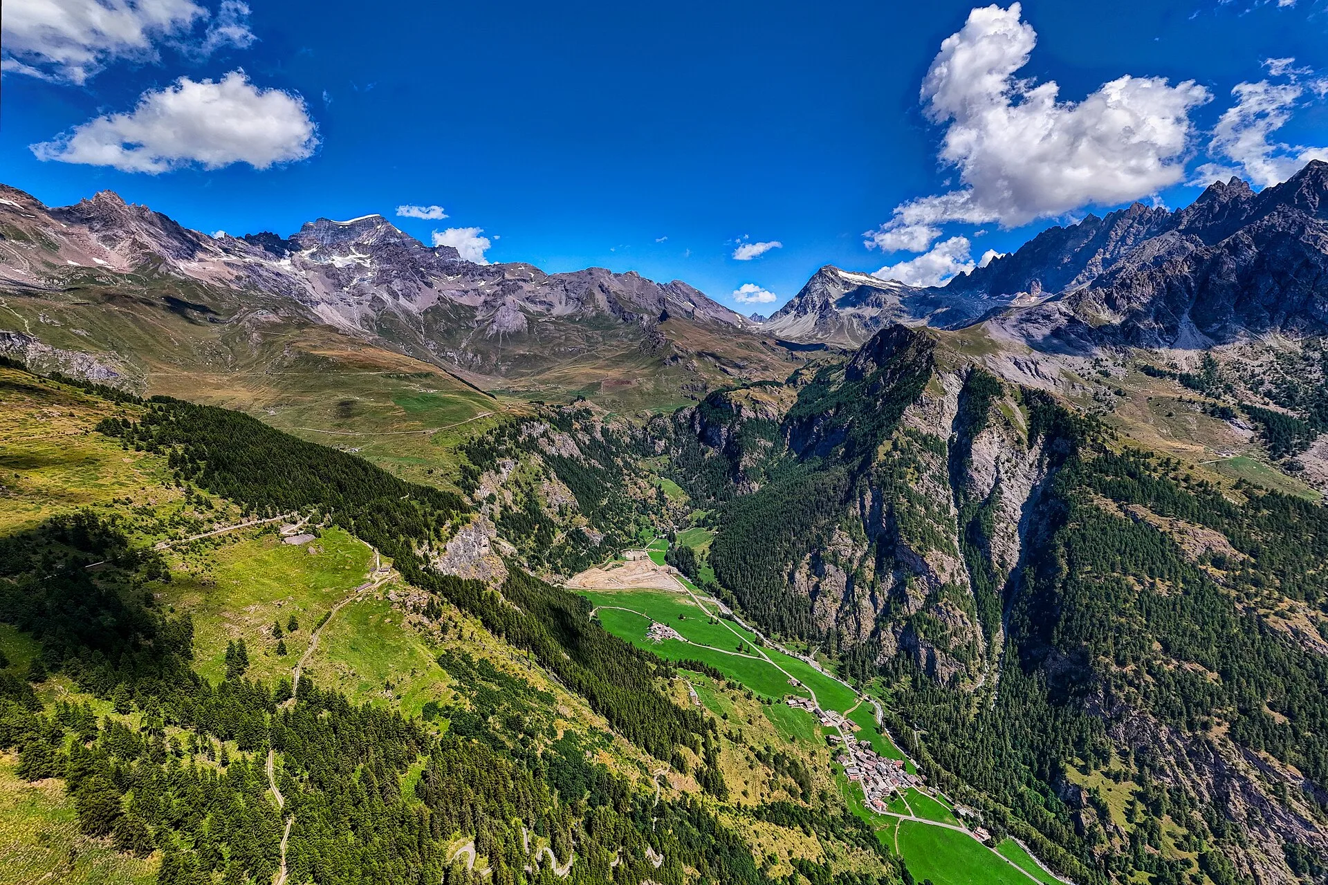
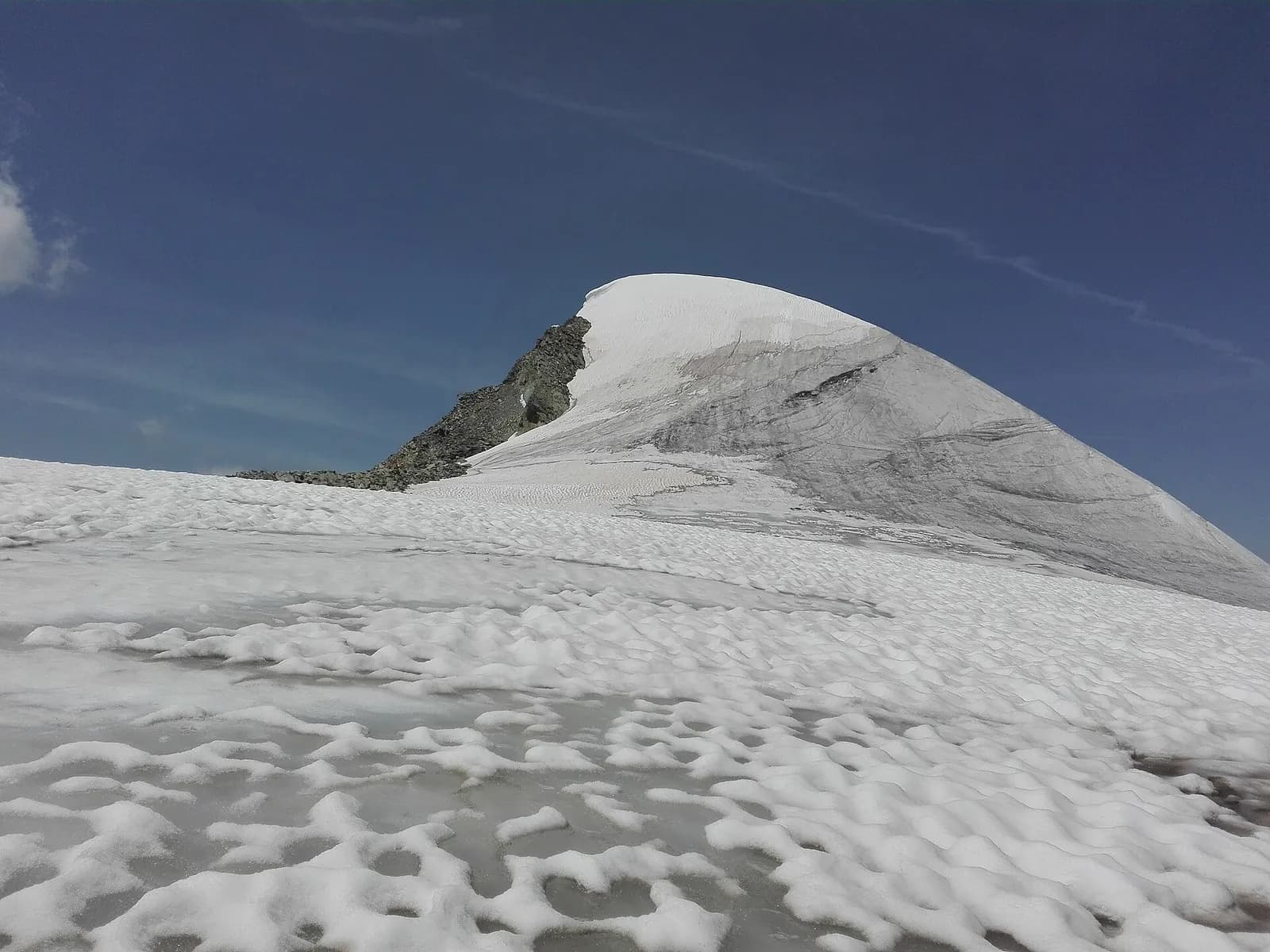
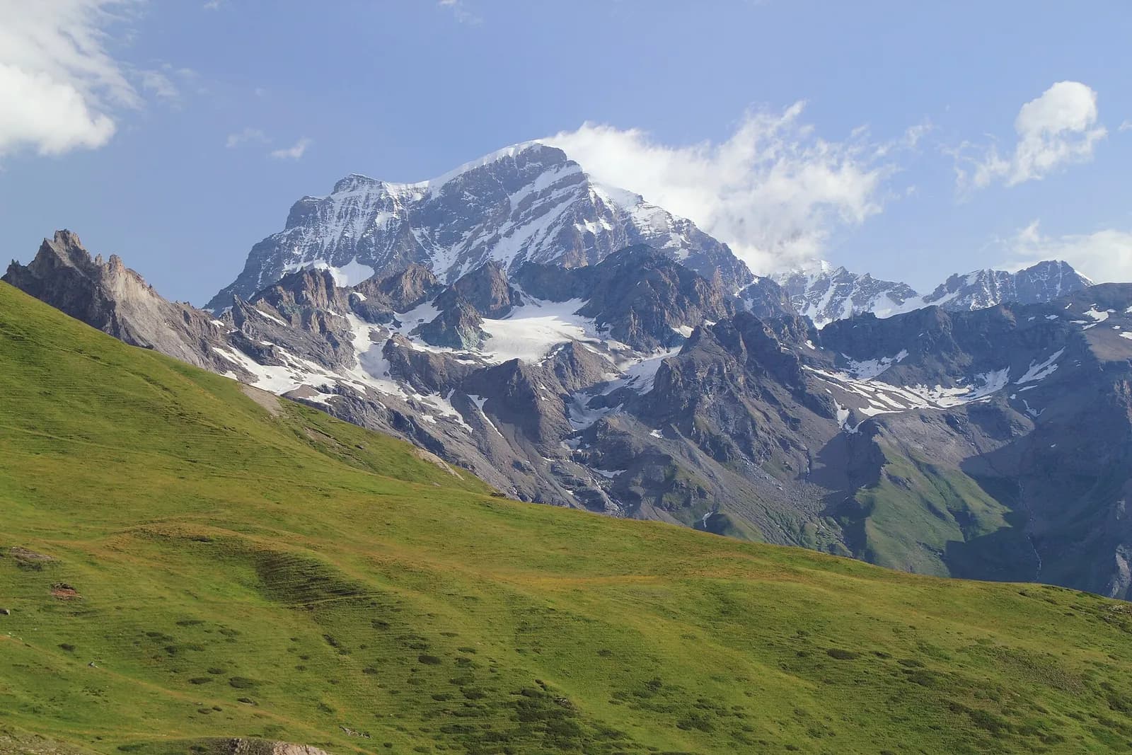
Stage twelve crosses the Valpelline from Oyace to Ollomont, climbing over Col Brison (2520 m) in one of the physically most demanding stages for the ratio of elevation gain to distance. The route leaves Oyace centre, drops briefly to the Buthier torrent and then climbs relentlessly through a conifer forest to the summer farm of Sucheaz (1993 m), where the trees give way to high pastures. The ascent continues toward Col Brison through solid, well-maintained switchbacks, reaching the pass where Mont Vélan (3734 m) and Grand Combin suddenly appear on the skyline with the Swiss side of the Grand Saint-Bernard valley visible on the horizon. The descent to Ollomont is equally significant: over 1100 metres on a clear path crossing the Beria alp before dropping into the valley-floor forest. Ollomont (1393 m) is a small Valpelline village with a Romanesque bell tower and a centuries-old cheesemaking tradition: an ideal stop to taste local dairy produce and resupply before the final three stages to Courmayeur.
Pontos-chave
Oyace
1397 m · 0 km from start
Stage start
Ollomont
1393 m · 12.4 km from start
Stage finish, Romanesque bell tower
Ciências da Terra
Geologia e paisagem
The climb to Col Brison crosses the Austroalpine metamorphic basement with augen gneiss, micaschists and quartzites of the Mont Vélan massif. The pass outcrops on intensely deformed rocks with symmetric folds and migmatite zones. Valpelline slopes display Würmian glacial deposits with lateral moraines and proglacial sediments. Sucheaz summer farm develops on decomposed moraines with fertile pasture soils. The descent toward Ollomont crosses chloritic phyllites and mica schists with deformed granite outcrops. Penninic ophiolites (serpentinites) outcrop in the valley floor toward Bionaz. Periglacial deposits with active scree indicate instability on slopes above 2200 m.
História e cultura
Ollomont preserves a Romanesque bell tower and centuries-old cheesemaking tradition. Valpelline is land of transhumance and alpine cheese production.
Pontos de água
Fountain in Oyace. Springs at Sucheaz in summer. Bar in Ollomont.
Como chegar
VITA bus to Oyace and Ollomont from Aosta via Valpelline.
Cumes próximos
Galeria de fotos
Photos are published immediately. JPG/PNG/WebP, max 6 MB.
Flora do trilho
Fauna para observar
Temas e características
Etapas adjacentes
AEditado e verificado por Andrea Rama
Fonte dos dados: Catasto Sentieri Regione VdA + AllTrails (12.4 km verificati) + thealps.com + vasentiero.org · Open data — DGR 899/2014
Última verificação:
Valpelline
Trilhos relacionados
Mesmo vale ou percursos semelhantes — mais caminhadas para descobrir.
Valpelline — Val d’Hérens
Tour of the Matterhorn — Stage 2: Rifugio Prarayer → Arolla
The Col Collon: an alpine transfer over the glacier, as in the Middle Ages.
Valpelline — Valle del Gran San Bernardo
Tour des Combins — Stage 1: Ollomont → Saint-Rhémy-en-Bosses
From the By basin to the Col Champillon, on the Tour des Combins line.

Valpelline
Bionaz (Plan Praz) - Place Moulin
Upper Valpelline, Bionaz: an E-rated route toward a glacial objective over open terrain.

Valpelline
Chamin - Bivacco della Sassa
From Chamin (1,732 m) to the Bivacco della Sassa (2,964 m) in the quiet Valpelline: 7.1 km and 1,246 m of ascent.