
E
Valle centrale
Anello del Verrand
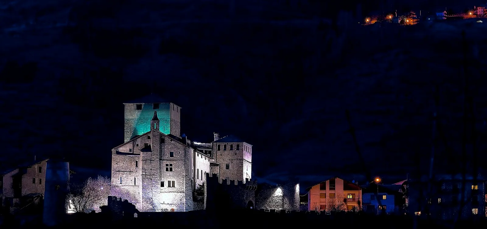
2.6 km · +233 m · E — from Château Verrand to Château Verrand (Rhêmes Valley).
2.6 km+233 m1 h
Where to spot
45 trails where Field gentian is listed in flora/fauna: difficulty E–EEA, elevation gain 0–1766 m.
45 · 1.2–12.7 km · +0–1766 m
Valle centrale
2.6 km · +233 m · E — from Château Verrand to Château Verrand (Rhêmes Valley).

Valtournenche
1.9 km · +140 m · E — from Champlève to Champlève (Central Valley).

Valle centrale
2.1 km · +333 m · E — from Arpilles to Champromenty (Lys Valley).

Bassa Valle
A short woodland climb from Arsines, above Arnad, to Col Fenêtre: a scenic pass of the lower Aosta Valley.
Valle centrale
7.9 km · +1473 m · E — from Bellecombe to Mont Barbeston (Valdigne).
Val d'Ayas
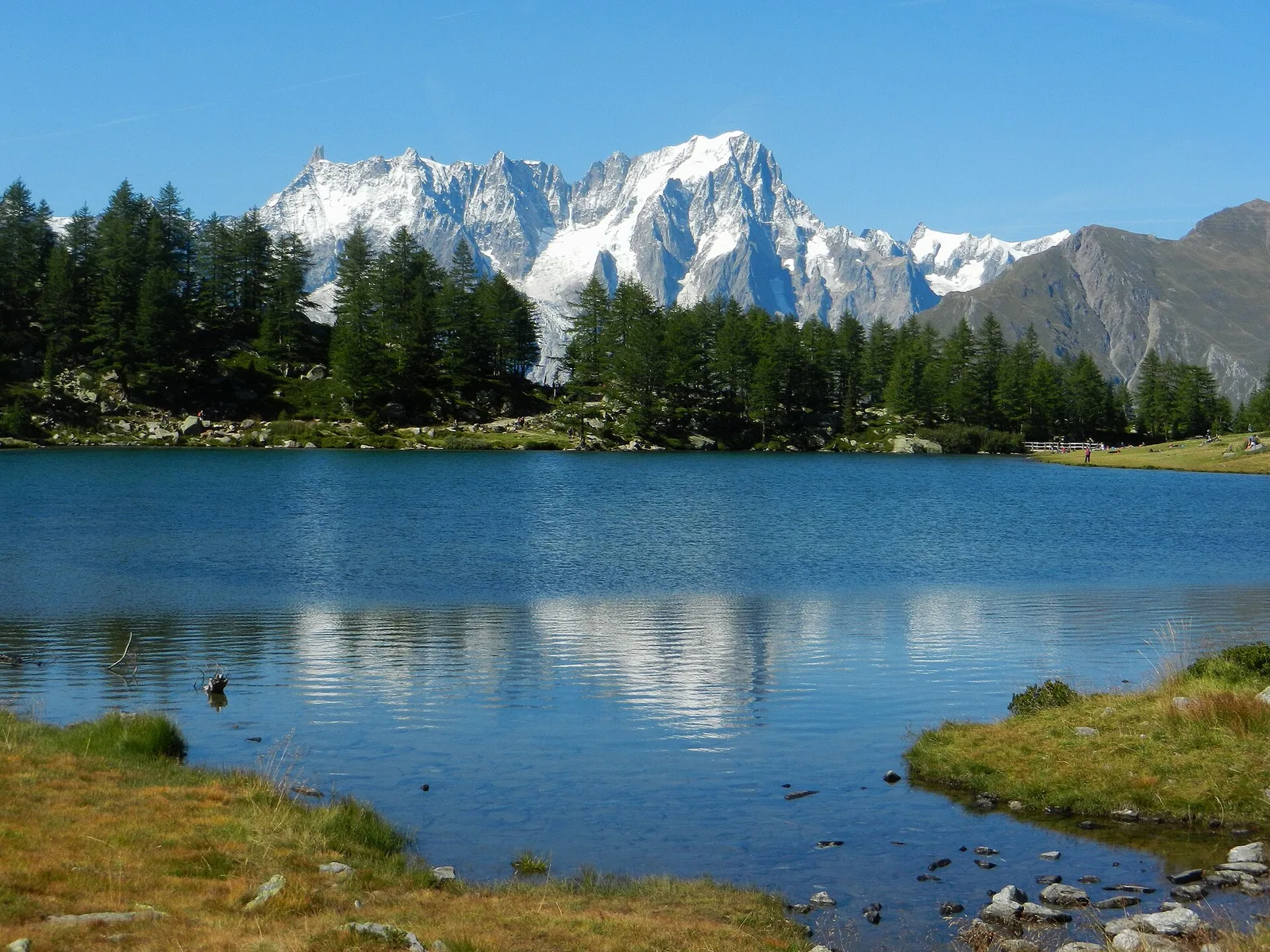
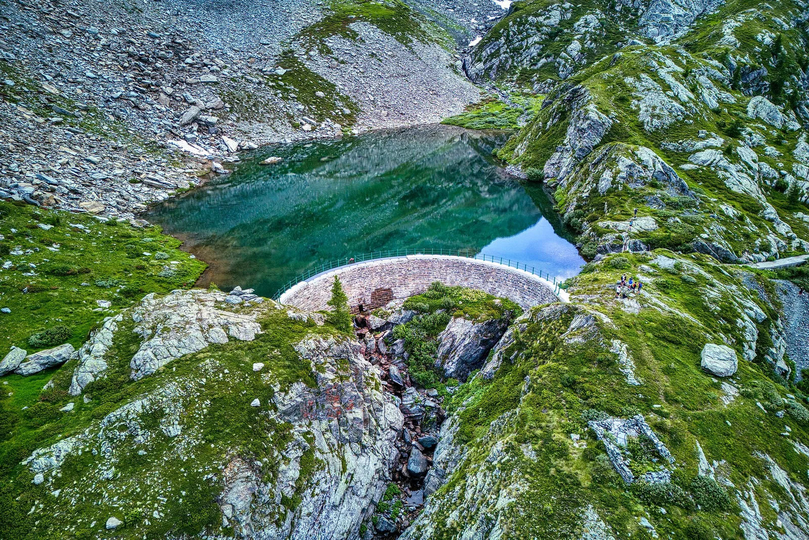
From Blanchard to the Lago Blu of Ayas (trail 7): 4.2 km, +575 m, E. The pool that mirrors Monte Rosa.
Valgrisenche
8 km · +678 m · E — from Borègne to Plontaz (Valtournenche).
Val d'Ayas
In the commune of Brusson, Val d'Ayas: an accessible route among pastures and hamlets with panoramic views.
Valle del Gran San Bernardo
2.8 km · +516 m · E — from Buthier to Alpe e Rifugio Chaligne (Central Valley).
Valtournenche
5.5 km · +811 m · E — from Verrayes (capoluogo) to Col des Bornes (Valsavarenche).
Valtournenche
3.1 km · +220 m · E — from Chamois to Col Pilaz (Central Valley).
Valle centrale
In the Valdigne, La Salle: an E-rated climb toward upper slope zones with views of Mont Blanc.
Valtournenche
6.5 km · +813 m · EEA — from Châté to Becca d'Aver (Valpelline).
Bassa Valle
3.3 km · +921 m · E — from Collaré to Mont de Beuby (Central Valley).

Valle del Gran San Bernardo
From Ville di Allein, an honest climb through pastures and larch woods to the Dortoir Baravex refuge at 1938 m, in the Great St Bernard valley.
Valle del Gran San Bernardo
2 km · +288 m · E — from Etroubles to Prailles (Central Valley).
Valsavarenche
5.2 km · +966 m · E — from Fenille to Colle Becca Plana (Ayas Valley).
Val di Cogne
3.1 km · +95 m · E — from Gimillan to Tsavanis (Lys Valley).
La Thuile
1.9 km · +314 m · E — from Lac d'Arpy to Col de la Croix (Central Valley).
La Thuile
6.6 km · +790 m · E — from Joux to Laghi di Bella Comba (Lys Valley).
Val d'Ayas
In the Val d'Ayas, commune of Ayas: a steady E-rated climb toward a high-altitude objective on well-marked terrain.
Valle centrale
2.2 km · +263 m · E — from Liveroulaz to Chaillod (Central Valley).
Val d'Ayas
3 km · +259 m · E — from Mayn to Curien (Ayas Valley).
Valle di Champorcher
9.5 km · +1766 m · E — from Monteil to Col Pousseuil (Valtournenche).
Val di Rhêmes
4.5 km · +581 m · E — from Oreiller to Casotto PNGP di Sort (Great St Bernard Valley).
Valle di Champorcher
6.9 km · +1248 m · E — from Outre l'Eve to Col Santanel (Valtournenche).
Valle del Lys
1.6 km · +583 m · E — from Pianatz to Berord (Great St Bernard Valley).
Val Veny
1.2 km · +156 m · E — from Plan de Lognan to Jardin du Miage (Lac Vert) (Great St Bernard Valley).
Bassa Valle
2.4 km · +790 m · E — from Saint-Roch to Col de Plan Fenetre (Central Valley).
Valtournenche
3.4 km · +700 m · E — from Plan Prorion to Becca d'Aver (Valpelline).
Valle centrale
5.2 km · +575 m · E — from Planaval to Bonalex (La Thuile).
Valle centrale
3.4 km · +635 m · E — from Plout to Druges (Great St Bernard Valley).
Valtournenche
2 km · +261 m · E — from Praz to Praz Croux (Valpelline).
Valle di Champorcher
4 km · +700 m · E — from Varesa to Santuario di Retempio (Champorcher Valley).
Valle centrale
2.1 km · +740 m · EE — from Servettaz to Druges (Lys Valley).
Valle del Lys
3.4 km · +539 m · E — from Staffal to Rifugio del Lys (Lys Valley).
Valle del Lys
8.6 km · +1145 m · E — from Steina to Passo di Loo (Champorcher Valley).
Valle di Champorcher
3.5 km · +639 m · EE — from Strada Dondena to Col Cima Piana (Valtournenche).
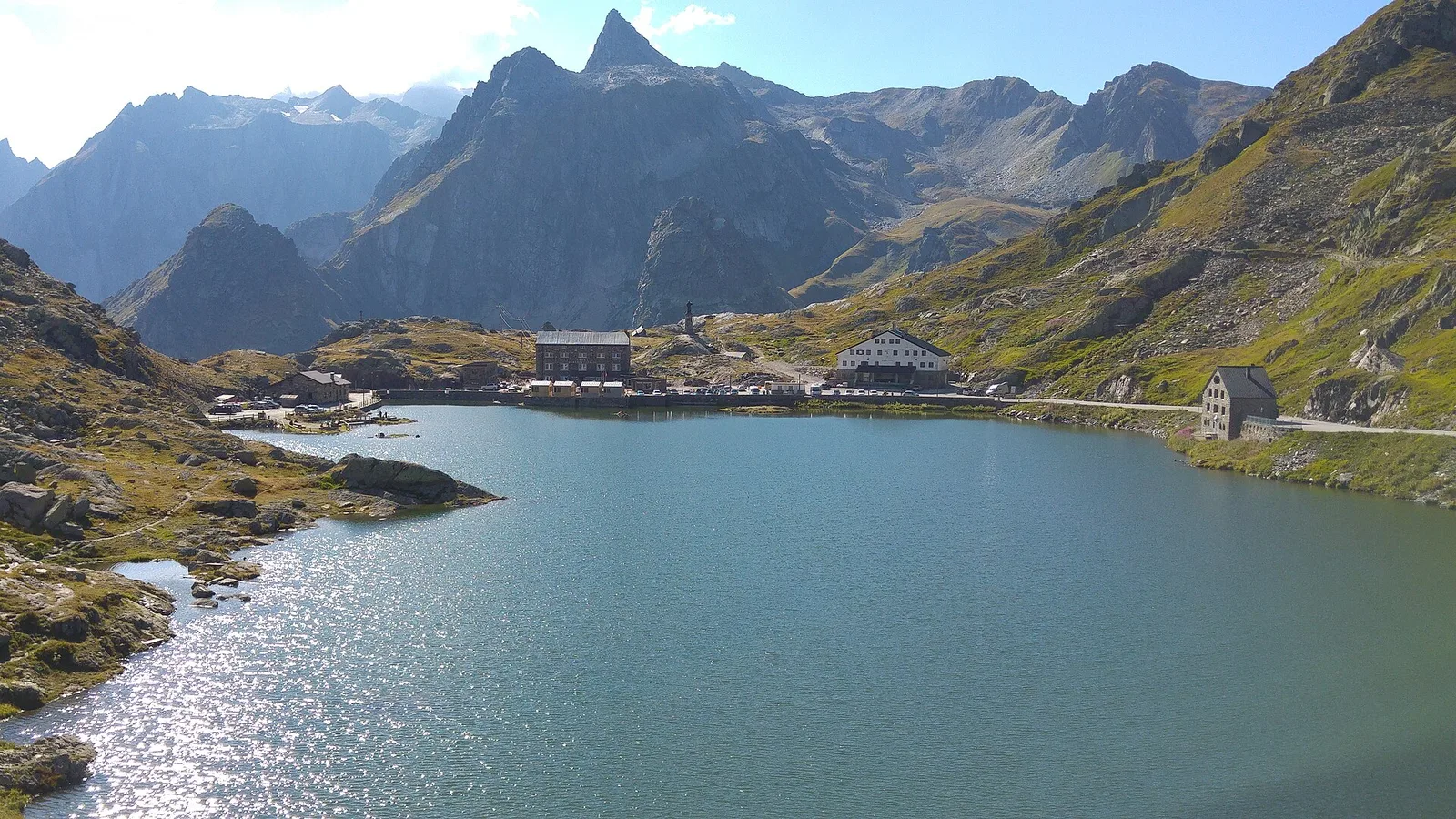
Valle del Gran San Bernardo
6.7 km · +754 m · E — from Strada Statale 27, start str militare to Colle del Gran San Bernardo (Central Valley).
Valle del Lys
12.7 km · +1425 m · E — from Capoluogo to Crest (Champorcher Valley).
Valle centrale
3.9 km · +289 m · E — from Vetan to Alpe Loe (Or) (Central Valley).
Valle di Champorcher
7.2 km · +1020 m · E — from Veulla to Col du Lac Blanc (Central Valley).
Valle centrale
2.9 km · +466 m · E — from Veyves to Parleyaz (Central Valley).
Valle centrale
A steep climb from Vieyes to Col de Becca Plana, at 2,266 metres: from the valley floor to the high pastures in just under five kilometres.
Valle centrale
3.4 km · +722 m · E — from Villair to Rifugio Bertone, tavola di orientamento (Great St Bernard Valley).