High Route 1 — Stage 3: Rifugio Coda → Rifugio Barma
9 km
+320 m
−410 m
4 h
Fitness level
~2400 kcal estimated
Elevation profile
Map & route
Download GPXOfficial GPX track — Aosta Valley Region / lovevda.it
Description
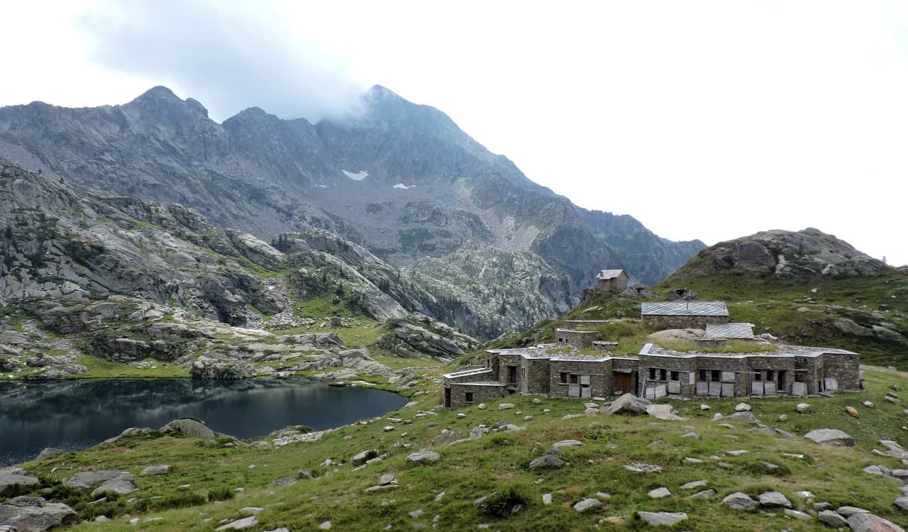
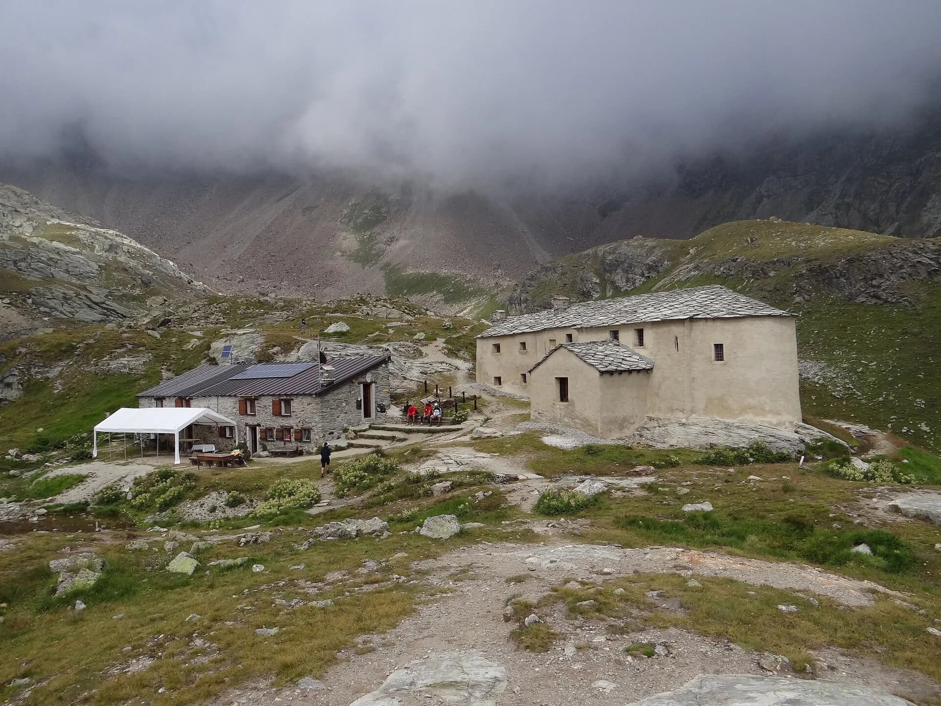
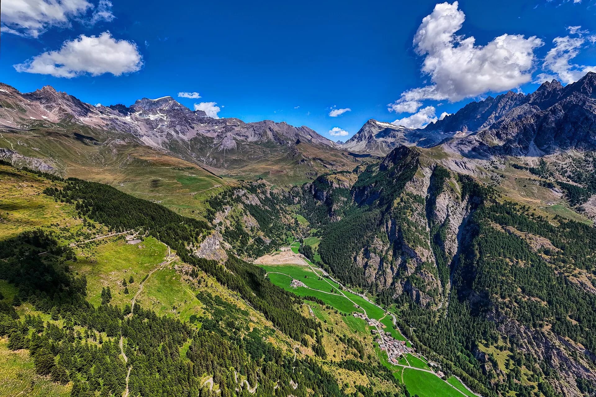
Leaving Rifugio Coda, stage three follows a high-level traverse that holds above two thousand metres for most of its length. The trail tracks east along the edge of the Mont Mars Reserve, crossing alpine wetlands — blanket bogs, sedge meadows and patches of cotton grass — a fragile habitat protected under European biodiversity directives. The path rises and falls with the ridge's undulating profile: nothing technical, but a sustained leg workout that catches walkers off-guard if they expect a simple transfer stage. The day's high point is Col Lasoney, which opens northwest to the full length of the Lys valley and, on clear days, frames Monte Rosa from base to summit. The descent to the Barma Lakes delivers one of the Alta Via's most intimate landscapes: glacially carved basins reflecting the sky, rimmed by smooth granite slabs and end-of-summer bilberry red. Rifugio Barma (2191 m) sits at the lake's edge, a small family-run hut with a kitchen rooted in the cooking traditions of the Gaby valley. It is the ideal place to stop and hear stories from the mountain farmers and hunters who still frequent these pastures.
Key points
Rifugio Coda
2280 m · 0 km from start
Stage start, water and meals available
Laghi della Barma
2100 m · 7.5 km from start
Glacial basins with potholes and polished rock
Rifugio Barma
2191 m · 9 km from start
Stage finish, family-run hut on the lakeshore
Earth sciences
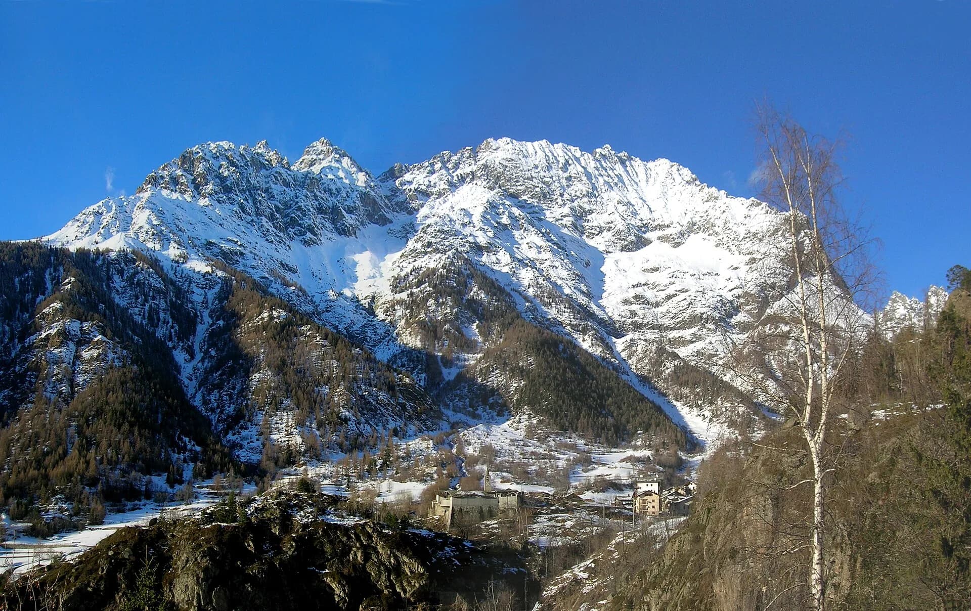
Geology & landscape
The traverse follows the contact between the Austroalpine metamorphic basement and Penninic cover, with garnet micaschists, augen gneiss and chloritic phyllites along the ridge. Col Lasoney displays strongly deformed rocks with shear lineations and isoclinal folds typical of the Alpine orogeny. The Barma Lakes occupy Würmian glacial cirques with rebuilt moraines and lacustrine clay-silt deposits. Polished rock and meltwater potholes attest to Lys glacier erosion. Alpine bogs and wetlands develop on glacial deposits sealed by decantation clays. Distantly toward Gressoney, calcschists and marbles of the lower Penninic stack outcrop.
History & culture
The Barma Lakes are linked to transhumance toward Gaby summer farms. The hut preserves local dairy traditions and the memory of mountain farmers who still use these pastures.
Water sources
Water at Rifugio Coda and Barma. Springs not always marked along the traverse; do not rely on lakes for drinking.
Getting there
Foot access only from Perloz (previous stage) or from Gaby via CAI trails. No direct road access to the huts.
Parking
Non applicabile: tappa point-to-point tra rifugi.
Warnings
- Exposed traverse in thunderstorms
- Bog sections: stay on the marked trail
Nearby peaks
Start & end
Start
Rifugio Coda
2250 m
Finish
Rifugio Barma
2054 m
Refuges & bivouacs
Photo gallery
Flora along the trail
Wildlife to spot
Themes and features
Adjacent stages
ACurated and verified by Andrea
Data source: Catasto Sentieri Regione VdA + gressoneymonterosa.it (km stimati, non verificati da 2 fonti indipendenti) · Open data — DGR 899/2014
Last verified:
Mont Mars — Valle di Gaby
Related trails
Same valley or similar routes — more hikes to explore.
Bassa Valle
High Route 1 — Stage 1: Donnas → Perloz
The start of the High Route of the Giants, from the valley floor up to Perloz meadows through Walser villages and chestnut groves.
Valtournenche — Val Saint-Barthélemy
High Route 1 — Stage 10: Rifugio Jean Barmasse → Rifugio Oratorio di Cuney
The wild heart of the Alta Via: 17 km across Fenêtre de Tsan, Col Terray and on to Rifugio Oratorio di Cuney, with Matterhorn and Grand Combin dominating a horizon of 2700-metre passes.
Valpelline
High Route 1 — Stage 11: Rifugio Oratorio di Cuney → Oyace
From the Sanctuary of Cuney to the Valpelline: a long descent over exposed ridges with short scramble sections, ending at Oyace in the heart of the Aosta Valley's most untouched valley.
Valpelline
High Route 1 — Stage 12: Oyace → Ollomont via Col Brison
The wild Valpelline: Oyace and Ollomont sit at nearly the same elevation, but Col Brison at 2520 m demands over 1100 m of climbing with views to Mont Vélan and Grand Combin on the Swiss border.