Tour du Mont Blanc — Stage 13: Rifugio Elisabetta Soldini → Courmayeur
15.9 km
+461 m
−1532 m
7.5 h
Fitness level
Map & route
GPX track — verify on the ground before hiking
Description
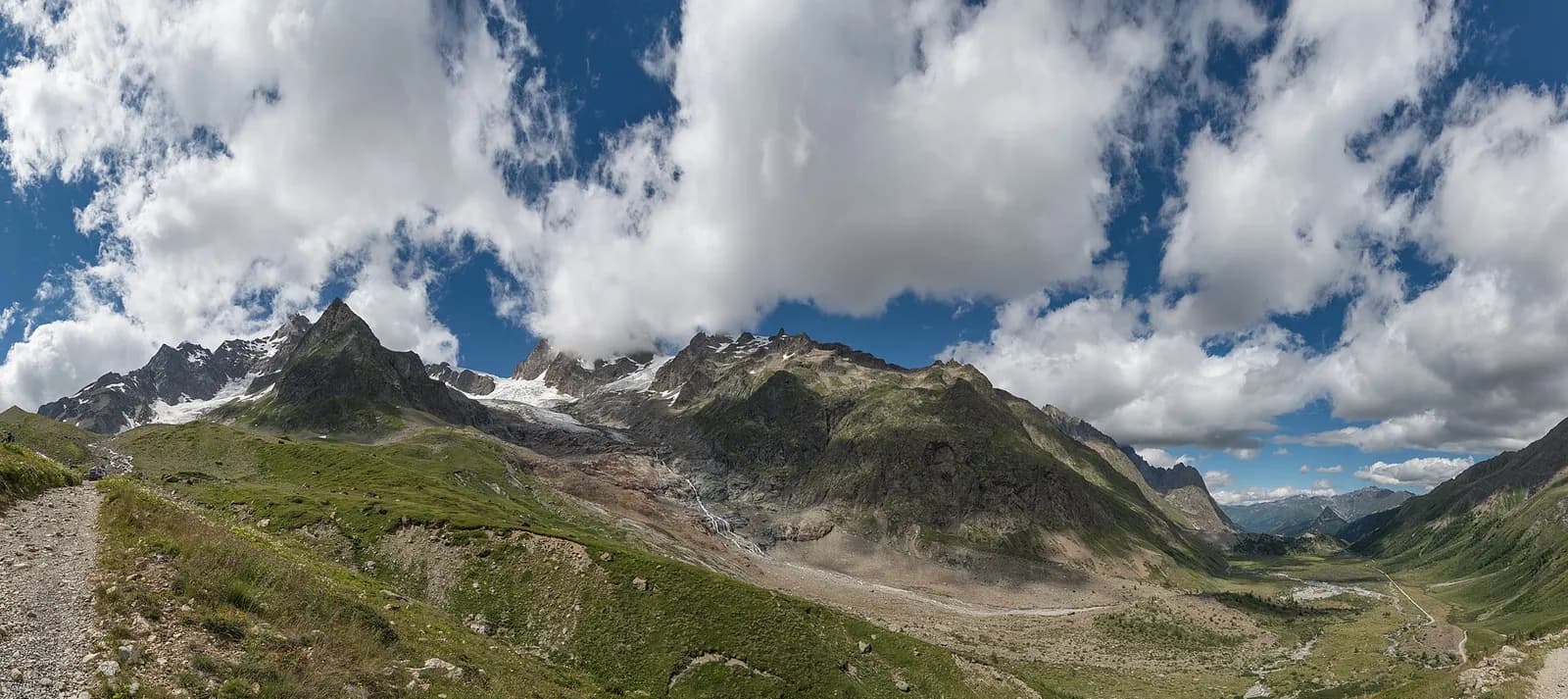
From Rifugio Elisabetta cross the Lac Combal plain, dammed by the Miage glacier moraine, then climb onto the Arp Vieille–Mont Favre balcony with the whole south side of Mont Blanc on parade. Via the Col Chécrouit and Maison Vieille you finally descend to Courmayeur, where the loop closes.
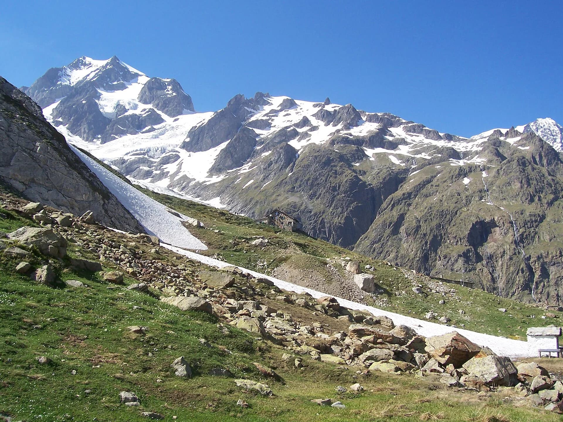
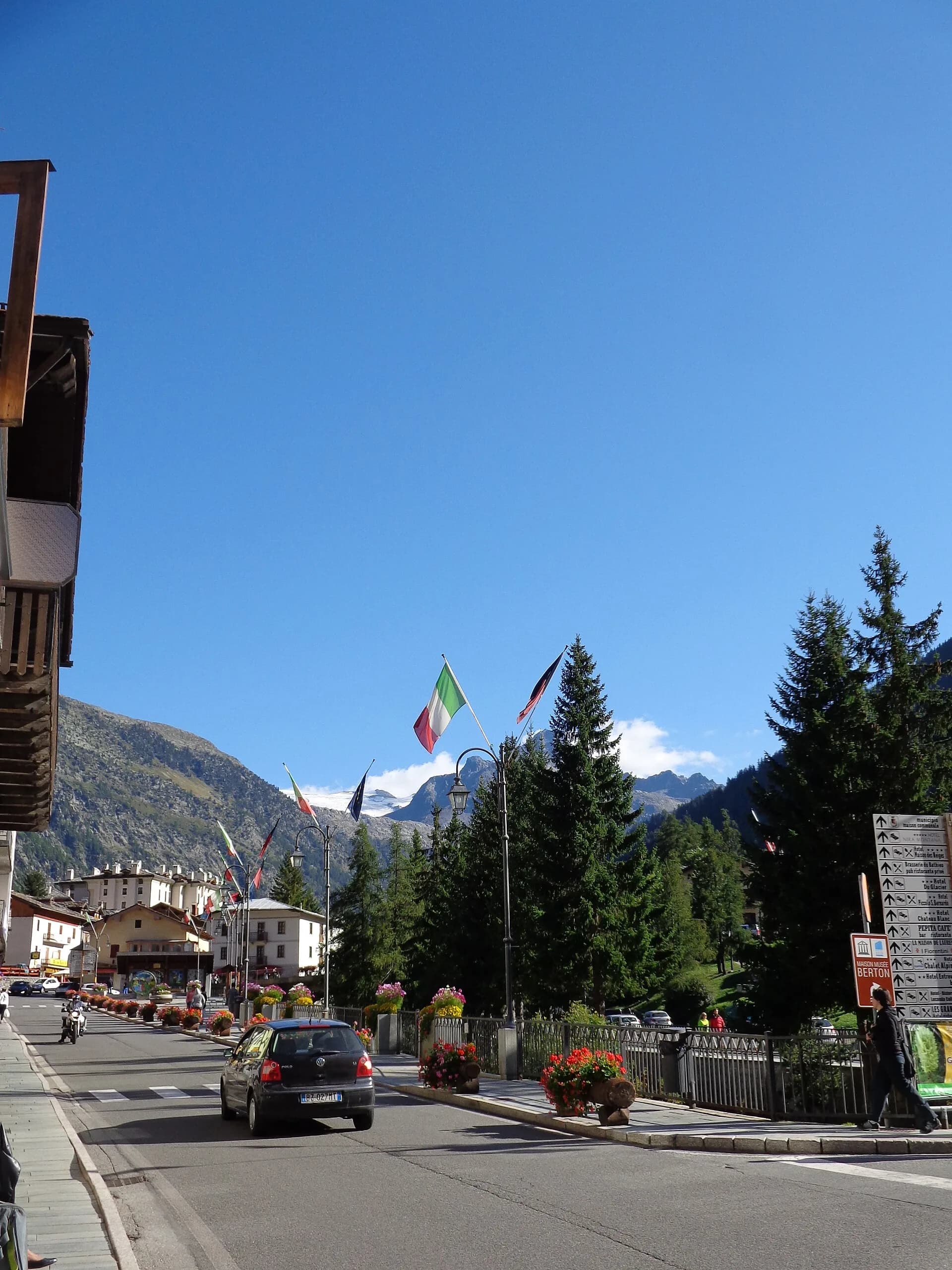
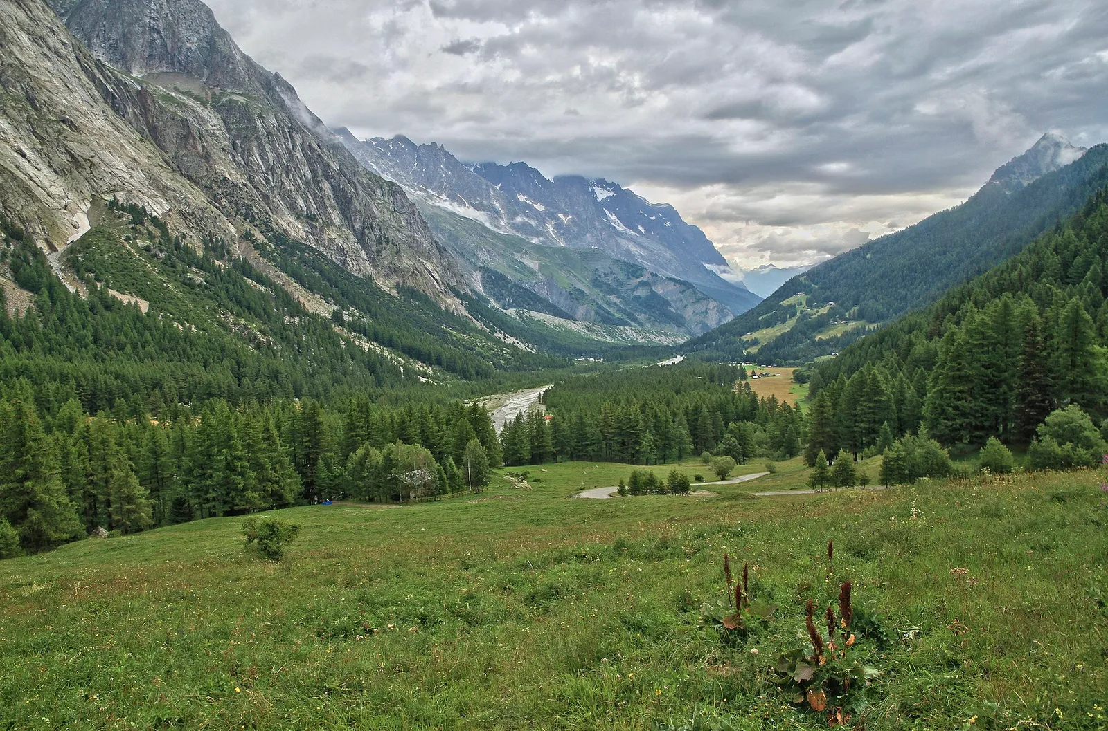
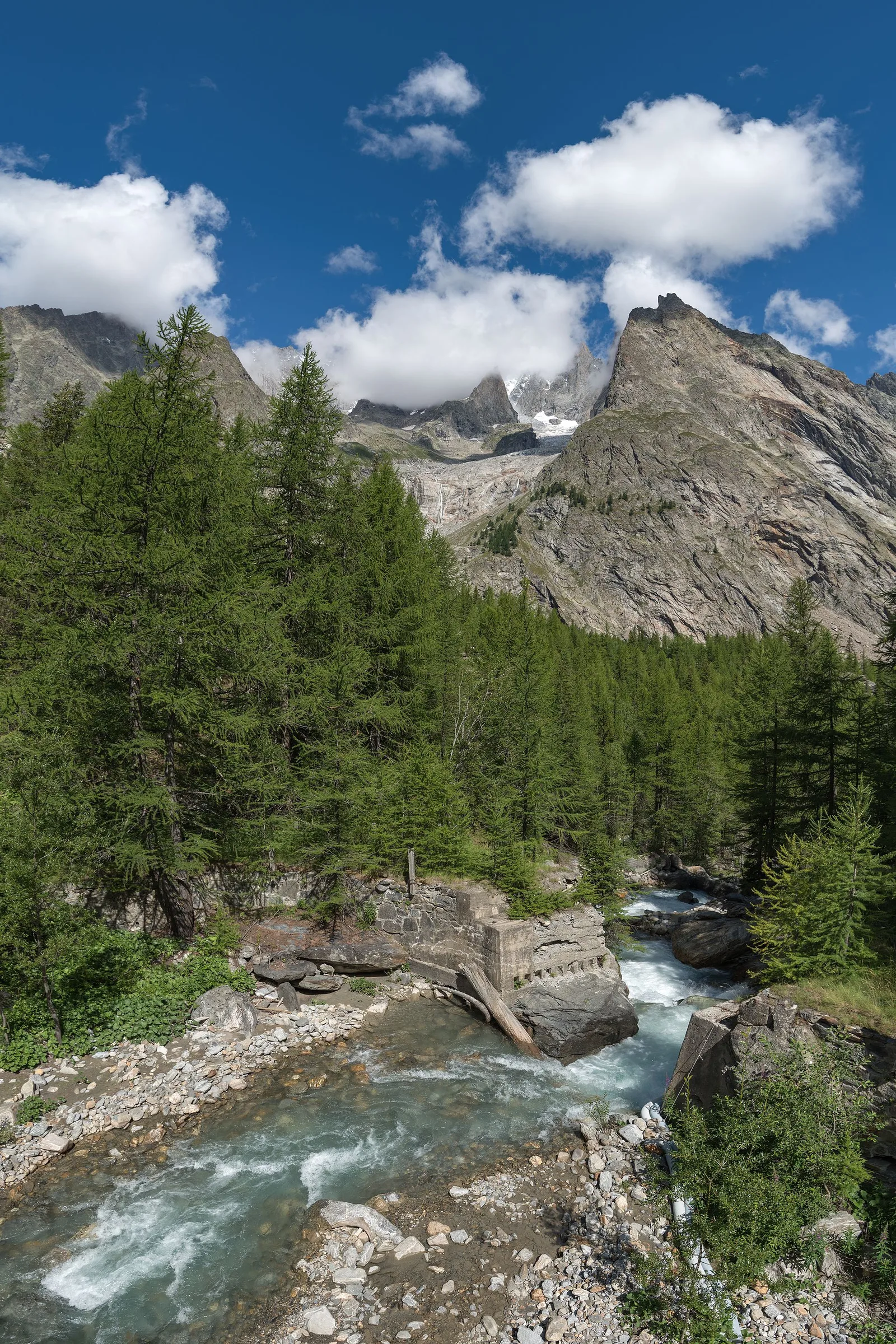
The grand Italian finale. The alluvial plain of Lac Combal, with its milk-coloured braided streams, is one of the loop’s most photogenic spots: the short detour to the moraine-locked Miage lake is worth it. Then climb onto the Arp Vieille balcony, where Mont Blanc’s southern side shows itself whole — Miage, Brouillard, Freney, Peuterey, one name after another. At the Col Chécrouit, Maison Vieille serves the loop’s last polenta; the final steep drop to Courmayeur through the Dolonne woods can be skipped by gondola in season. The circle closes in the square, beneath the bell tower.
Earth sciences
Geology & landscape
The Mont Blanc massif is a Hercynian granite batholith (~300 million years old) uplifted by the Alpine orogeny: the pale Mont Blanc granite — the “protogine” — forms the Peuterey and Géant spires. At its feet the tour walks on older crystalline basement rocks (gneiss and micaschist) and, in Val Veny, on the Mesozoic limestones of the Pyramides Calcaires, a sliver of sedimentary cover pinched between the granites. The Miage and Brenva moraines are textbook examples.
History & culture
Courmayeur is home to Italy’s oldest guides’ company (1850): the Duca degli Abruzzi museum in the village keeps the ropes and axes of the first great climbs on Mont Blanc’s south side.
Water sources
Water at the stage's support points (Rifugio Elisabetta Soldini, Rifugio Maison Vieille, Courmayeur). On the high ground and at the passes springs are not guaranteed: fill bottles in the valley and at the huts.
Getting there
Aosta Valley side served by VITA buses and connections from Aosta; many valley heads have summer shuttles. Check seasonal timetables at arriva.it / vita-vda.com.
Warnings
- Book overnight stops in peak season
Start & end
Start
Rifugio Elisabetta Soldini
2189 m
Finish
Courmayeur
1225 m
Refuges & bivouacs
Photo gallery
Adjacent stages
ACurated and verified by Andrea
Data source: Tour du Mont Blanc — itinerario internazionale segnalato · Traccia calcolata su rete sentieri OpenStreetMap (ODbL); verificare sul terreno
Last verified:
Val Veny
Related trails
Same valley or similar routes — more hikes to explore.
Val Veny
High Route 2 — Stage 1: Courmayeur → Rifugio Elisabetta Soldini
First stage of AV2: from Courmayeur to Rifugio Elisabetta in Val Veny, at the foot of Mont Blanc.
Val Veny
High Route 2 — Stage 2: Rifugio Elisabetta Soldini → La Thuile
Descent from Col des Chavannes to La Thuile across pastures and the La Thuile valley.
Val Veny
Area pic-nic Plan Veny - Lac du Breuillat
3.6 km · +420 m · E — from Area pic-nic Plan Veny to Lac du Breuillat (Great St Bernard Valley).
Val Veny
Area pic-nic Plan Veny - Rifugio Monzino
3.4 km · +997 m · EEA — from Area pic-nic Plan Veny to Rifugio Monzino (Great St Bernard Valley).