Bourg -Herin - Messelod (La Magdeleine)
3 km
+560 m
−0 m
2 h
Nivel físico
Mapa y ruta
Traza GPX — verifica sobre el terreno antes de caminar
Descripción
Puntos clave
Salida
Bourg · 1096 m
Llegada
Messelod · 1600 m
Sendero
S3
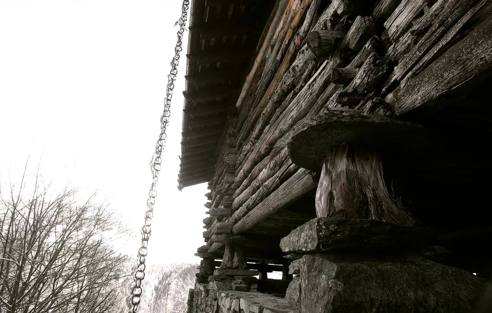
This route climbs 560 metres from Bourg (1096 m) to Messelod (1600 m), weaving through historic hamlets that showcase the rural heritage of the Valtournenche valley. Stone-and-timber houses, granite fountains, votive chapels and traditional hay barns line the path, painting a vivid picture of Alpine pastoral life. As height is gained, views open across the valley floor towards the unmistakable silhouette of the Matterhorn. The gradient is steady throughout, making this an accessible and rewarding half-day walk for anyone wishing to explore the historic built landscape of the Valle d'Aosta.
Aparcamiento
Galería de fotos
Photos are published immediately. JPG/PNG/WebP, max 6 MB.
Fauna que observar
AEditado y verificado por Andrea Rama
Fuente de datos: Catasto Sentieri Regione Autonoma VdA · Open data — DGR 899/2014
Última verificación:
Valtournenche
Senderos relacionados
Mismo valle o rutas similares — más excursiones por descubrir.

Valtournenche
Anello Area sportiva-Fiernaz-Area sportiva
2.9 km · +28 m · T — from Area sportiva to Area sportiva (Valtournenche).

Valtournenche
Anello dei Villaggi di Antey ( Ruvère, Liesse,Fontaney, Villettaz)
A loop through the sunlit hamlets of Antey and Torgnon: traditional Aosta Valley architecture, vineyards and mid-mountain forest, 5.2 km from Ruvère.

Valtournenche
Anello di Champlève
1.9 km · +140 m · E — from Champlève to Champlève (Central Valley).

Valtournenche
Area Pic Nic Champlong - Becca d'Aver e Cima Longhede
6.4 km · +913 m · E — from Area Pic Nic Champlong to Cima Longhede (Valsavarenche).