Chamin - Boregne
3.5 km
+585 m
−0 m
2.5 h
Nivel físico
Mapa y ruta
Traza GPX — verifica sobre el terreno antes de caminar
Descripción
Puntos clave
Salida
Chamin · 1417 m
Llegada
Boregne · 2014 m
Sendero
S13
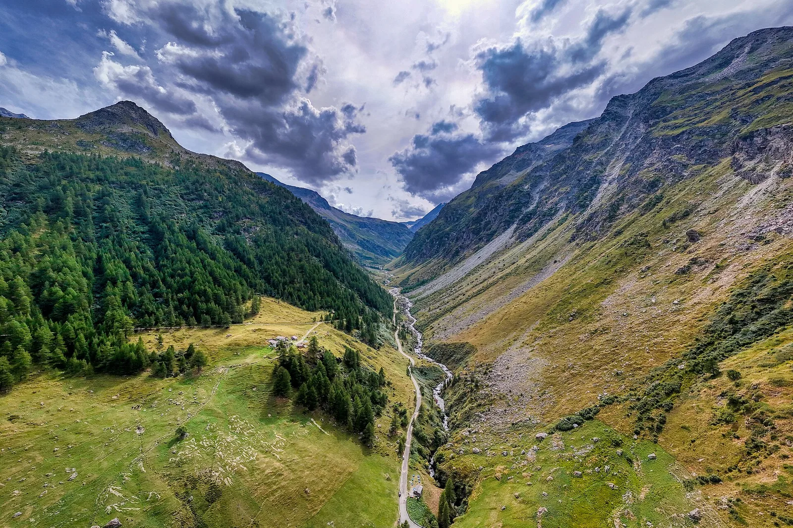
Starting from the small farming hamlet of Chamin (1417 m) in the municipality of Arvier, this 3.5 km trail climbs 585 metres through ancient larch forest to the high-altitude alp of Boregne at 2014 m. The larch woodland is among the finest in the Valgrisenche valley, turning brilliant gold in autumn and casting long pink shadows in spring light. Above the treeline, open pastures lead to a traditional summer dairy settlement where stone barns reflect centuries of pastoral craftsmanship. The Valgrisenche remains one of the least-visited lateral valleys of the Aosta region, lending this walk an atmosphere of genuine Alpine solitude.
Aparcamiento
Galería de fotos
Photos are published immediately. JPG/PNG/WebP, max 6 MB.
Flora del sendero
Fauna que observar
AEditado y verificado por Andrea Rama
Fuente de datos: Catasto Sentieri Regione Autonoma VdA · Open data — DGR 899/2014
Última verificación:
Valgrisenche
Senderos relacionados
Mismo valle o rutas similares — más excursiones por descubrir.

Valgrisenche
Balconata dal Belvedere al lago di San Grato
4.9 km · +705 m · E — from Bois de Grillet to Lago di San Grato (Valtournenche).

Valgrisenche
Bivio strada per Grand Alpe - Col du Mont
5 km · +706 m · E — from Bivio strada per Grand Alpe to Col du Mont (Valtournenche).
Valgrisenche
Bivio strada per Grand Alpe - Lac Saint-Grat
4.7 km · +534 m · E — from Bivio strada per Grand Alpe to Lac Saint-Grat (Valtournenche).
Valgrisenche
Borègne - Plontaz
8 km · +678 m · E — from Borègne to Plontaz (Valtournenche).