Pondel - Petit Poignon
5.7 km
+883 m
−0 m
3.5 h
Nivel físico
Mapa y ruta
Traza GPX — verifica sobre el terreno antes de caminar
Descripción
Puntos clave
Salida
Pondel · 885 m
Llegada
Petit Poignon · 1576 m
Sendero
S3
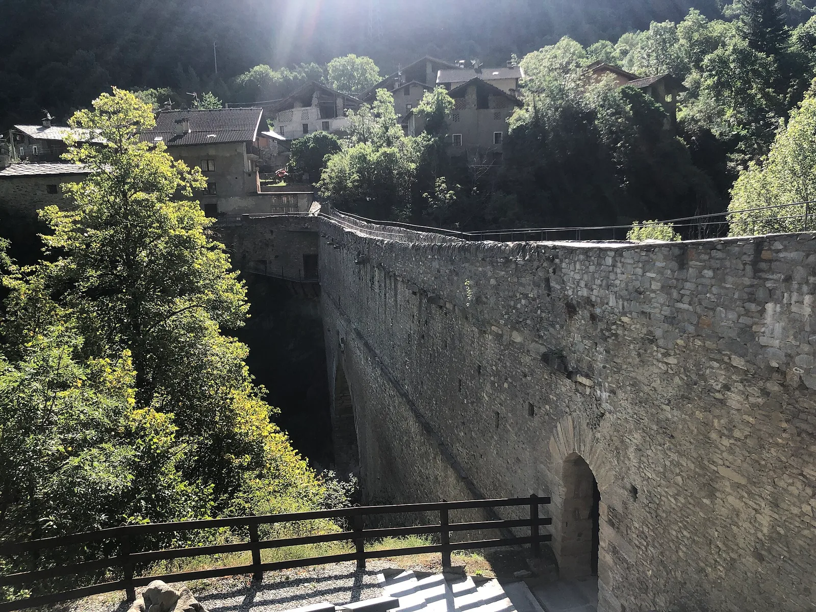
The starting point alone is worth the journey: Pont d'Ael, built in 3 BC, is one of the best-preserved Roman aqueduct bridges in the Alps. Its stone structure still bears the dedicatory inscriptions of its builders and spans the Grand Eyvia gorge with timeless elegance. From here the trail climbs 883 metres over 5.7 kilometres to Petit Poignon at 1576 metres — a sustained E-rated ascent through the wild Grand Eyvia valley within the Gran Paradiso National Park. The route alternates forested stretches with open sections offering glimpses of the deep gorge below. The arrival at Petit Poignon offers a quiet alpine setting away from the more popular Cogne valley circuits.
Historia y cultura
Pont d'Ael is a national monument. Its double-arch structure served simultaneously as an aqueduct (upper level) and a road bridge (lower level). Allow time to explore it before or after the hike.
Aparcamiento
Galería de fotos
Photos are published immediately. JPG/PNG/WebP, max 6 MB.
Flora del sendero
Fauna que observar
AEditado y verificado por Andrea Rama
Fuente de datos: Catasto Sentieri Regione Autonoma VdA · Open data — DGR 899/2014
Última verificación:
Valle centrale
Senderos relacionados
Mismo valle o rutas similares — más excursiones por descubrir.

Valle centrale
Anello del Verrand
2.6 km · +233 m · E — from Château Verrand to Château Verrand (Rhêmes Valley).

Valle centrale
Area giochi Croux - Parleyaz
4.1 km · +476 m · E — from Area giochi Croux to Parleyaz (Central Valley).

Valle centrale
Arlier - Cloutraz (Pontey)
From Arlier (603m) to Cloutraz (1067m) on the Châtillon hillside: 3.5 km E through vineyards, woodland and views over the Dora Baltea.

Valle centrale
Arpilles - Champromenty
2.1 km · +333 m · E — from Arpilles to Champromenty (Lys Valley).