Rifugio Bonatti loop
Advertencias
- Crowded trail in August
- Alternative descent via Pra Sec is steeper
 1 / 2
1 / 29.2 km
+620 m
−620 m
4 h
Nivel físico
~2100 kcal estimadas
Mapa y ruta
Traza GPX — verifica sobre el terreno antes de caminar
Descripción
Puntos clave
Salida
Lavachey · 1642 m
Llegada
Lavachey · 1642 m
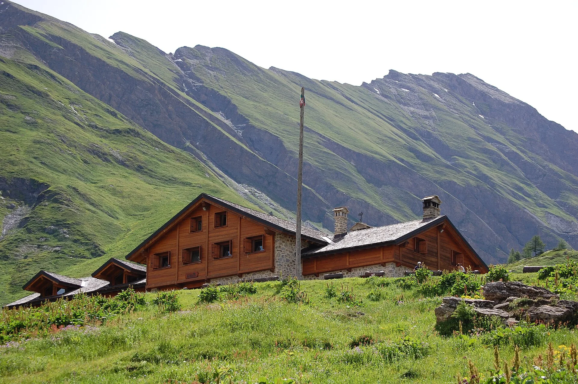
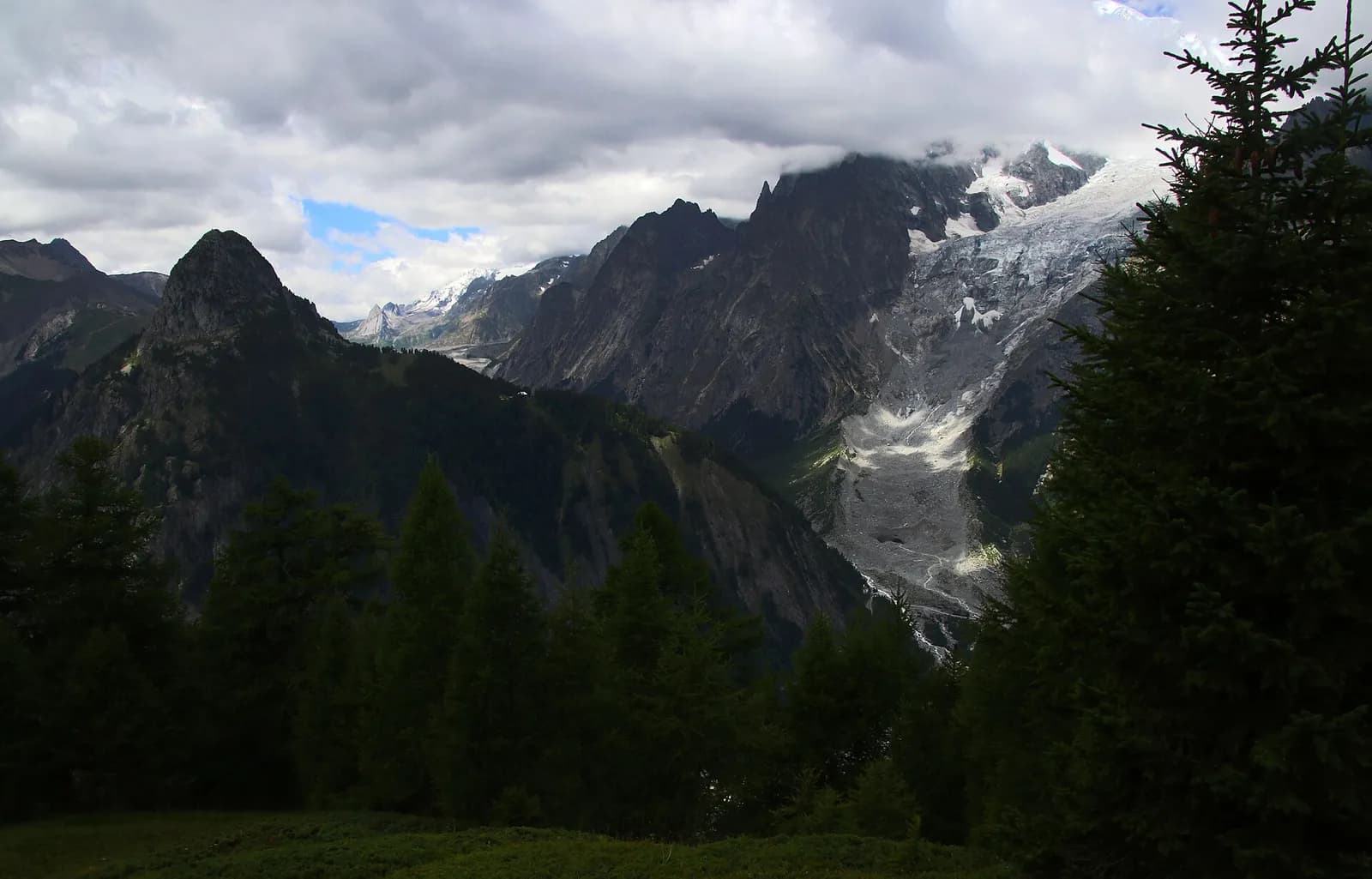
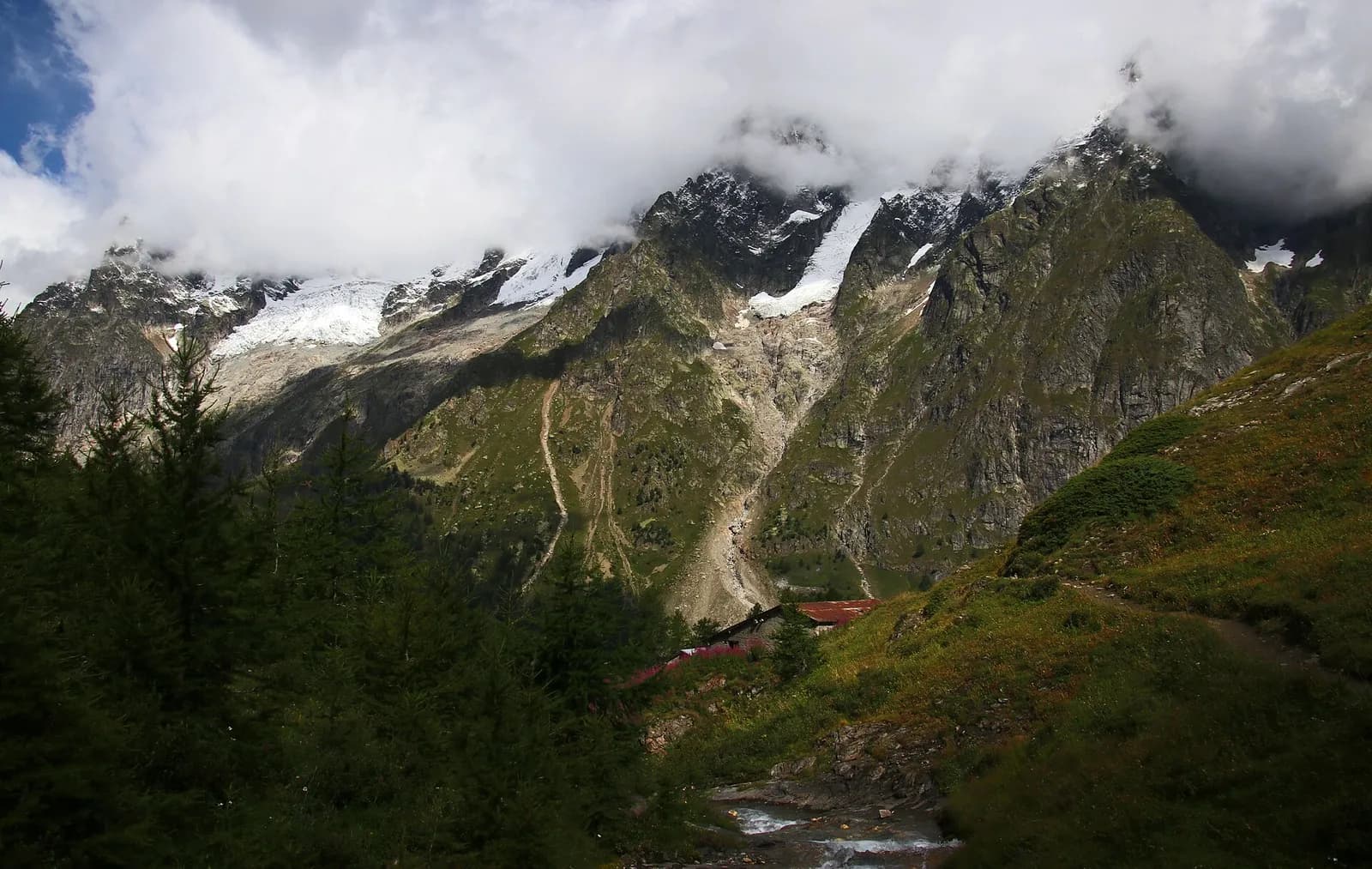
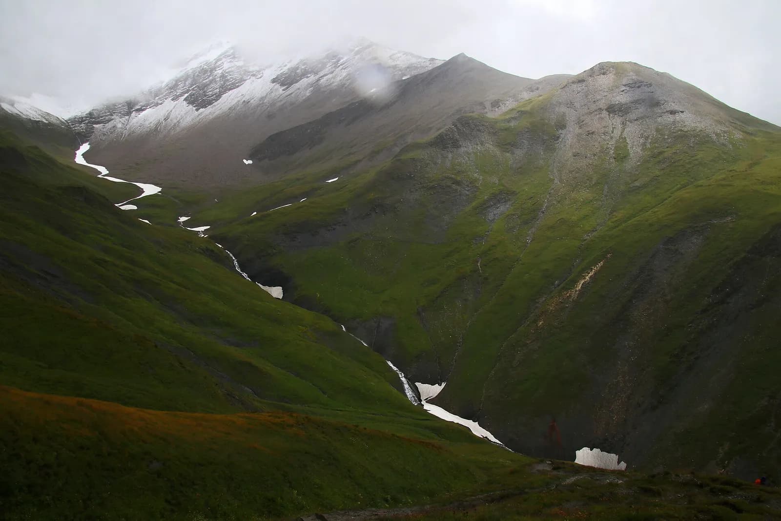
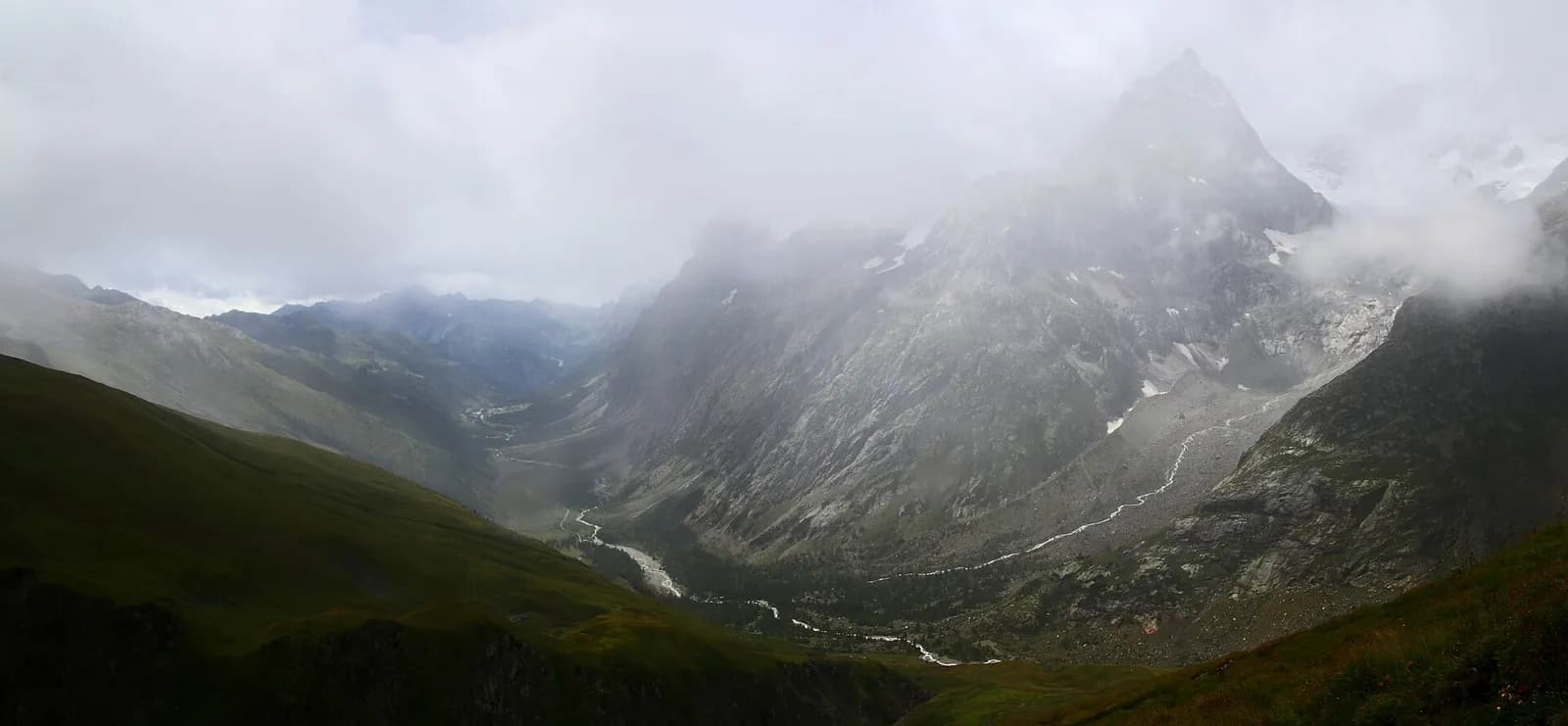
From Lavachey car park the trail climbs to Rifugio Bonatti (2025 m) along the Tour du Mont Blanc route. The view onto Grandes Jorasses, Dent du Géant and Mont Dolent is staggering. Descend via Pra Sec or return the same way. Family-friendly for kids used to walking.
Puntos clave
Lavachey
1642 m · 9.2 km from start
Loop finish
Ciencias de la Tierra
Geología y paisaje
The loop crosses the eastern Mont Blanc massif slope on gneiss and calcschists with deformed granite outcrops. The TMB trail follows Würmian glacial deposits of the Miage glacier with clearly visible lateral moraines. Below 1900 m, Ferret stream alluvial deposits and paleosols on decomposed moraines dominate. Forested slopes show acid soils with larch and rhododendron. The Miage glacier, a monitored glaciological front, shows evident retreat with proglacial lakes and recent lacustrine deposits. Marble and dolomitic limestone outcrops indicate the massif sedimentary cover.
Historia y cultura
The trail follows the Tour du Mont Blanc, a major alpine pilgrimage route. Rifugio Bonatti celebrates Walter Bonatti, pioneer of Italian alpine exploration.
Fuentes de agua
Water at Rifugio Bonatti. Carry a bottle from Lavachey for the climb.
Cómo llegar
Summer Savda bus to Val Ferret from Courmayeur. Local taxi by reservation.
Aparcamiento
Parcheggio a pagamento a Lavachey, punto di partenza anello.
Cumbres cercanas
Refugios y vivacs
Galería de fotos
Photos are published immediately. JPG/PNG/WebP, max 6 MB.
Flora del sendero
Temas y características
Etapas contiguas
AEditado y verificado por Andrea Rama
Fuente de datos: Catasto Sentieri Regione Autonoma VdA · Open data — DGR 899/2014
Última verificación:
Val Ferret
Senderos relacionados
Mismo valle o rutas similares — más excursiones por descubrir.
Val Ferret
Tour du Mont Blanc — Stage 1: Courmayeur → Rifugio Giorgio Bertone
A steady climb from Courmayeur to the Rifugio Bertone balcony.
Val Ferret
Tour du Mont Blanc — Stage 2: Rifugio Giorgio Bertone → Rifugio Walter Bonatti
The Mont de la Saxe balcony, face to face with the Grandes Jorasses.
Val Ferret
Tour du Mont Blanc — Stage 3: Rifugio Walter Bonatti → Rifugio Elena
Towards the head of Val Ferret, below the Pré de Bar glacier.
Val Ferret — Val Ferret svizzera
Tour du Mont Blanc — Stage 4: Rifugio Elena → La Fouly
The Grand Col Ferret: leaving Italy, entering Switzerland.