Tour du Mont Blanc — Stage 2: Rifugio Giorgio Bertone → Rifugio Walter Bonatti
Advertencias
- Book overnight stops in peak season
 1 / 3
1 / 39.9 km
+739 m
−754 m
5.5 h
Nivel físico
Mapa y ruta
Traza GPX — verifica sobre el terreno antes de caminar
Descripción
Puntos clave
Salida
Rifugio Giorgio Bertone · 1989 m
Llegada
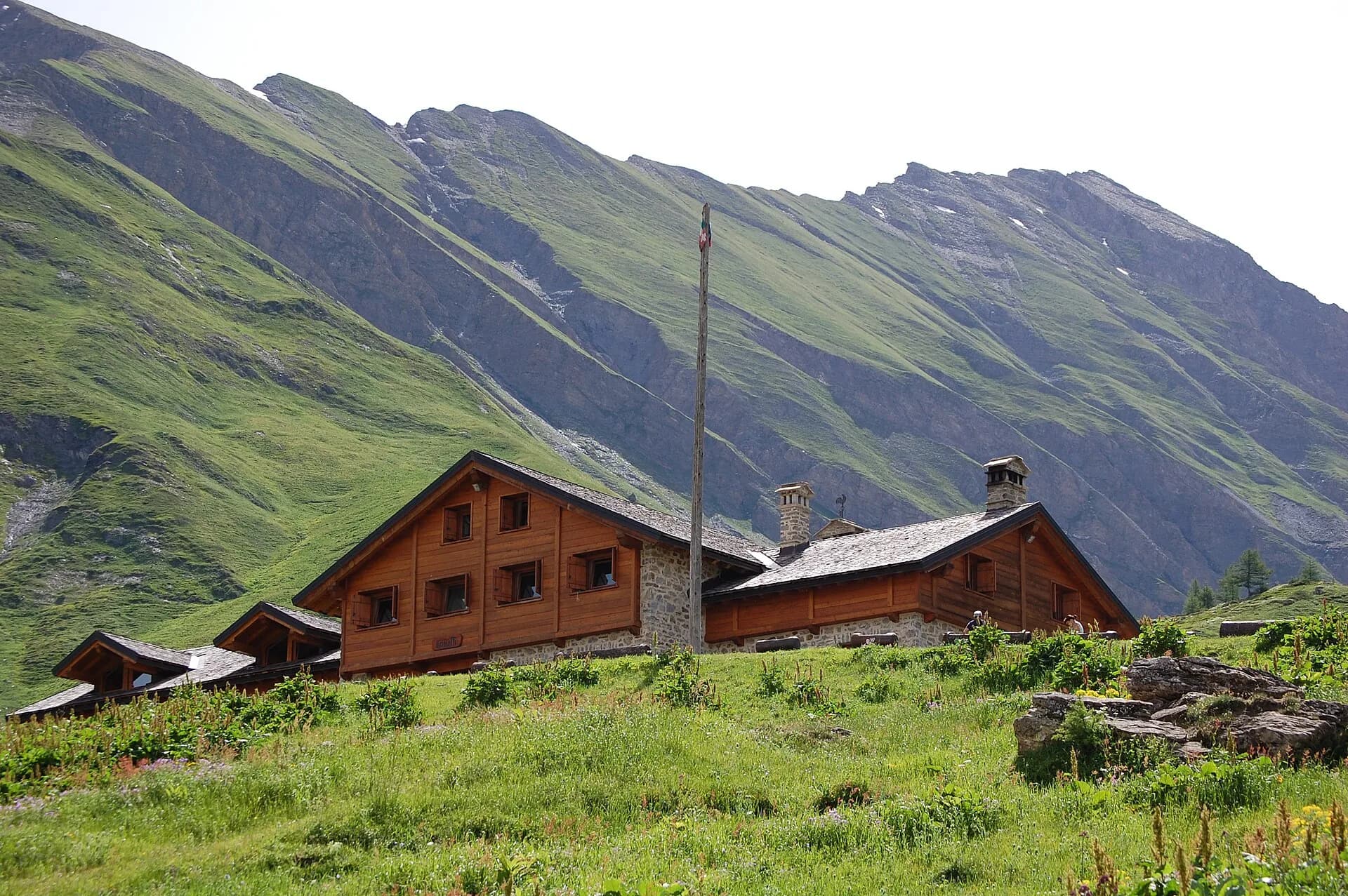
Rifugio Walter Bonatti · 2024 m
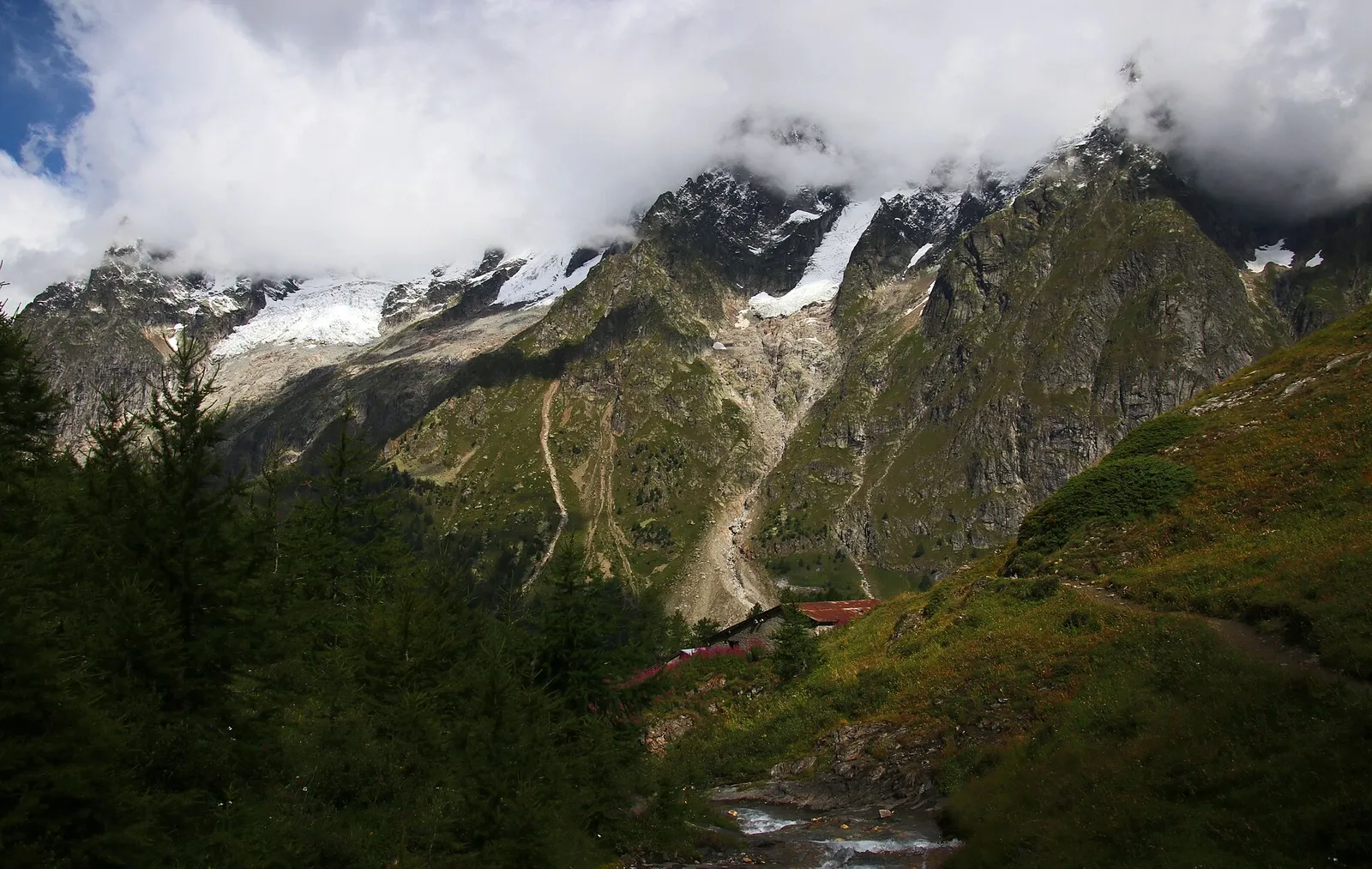
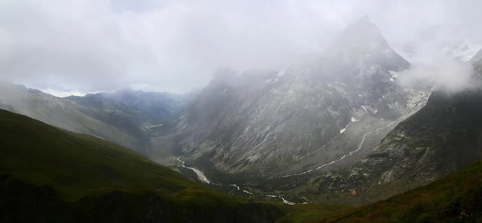
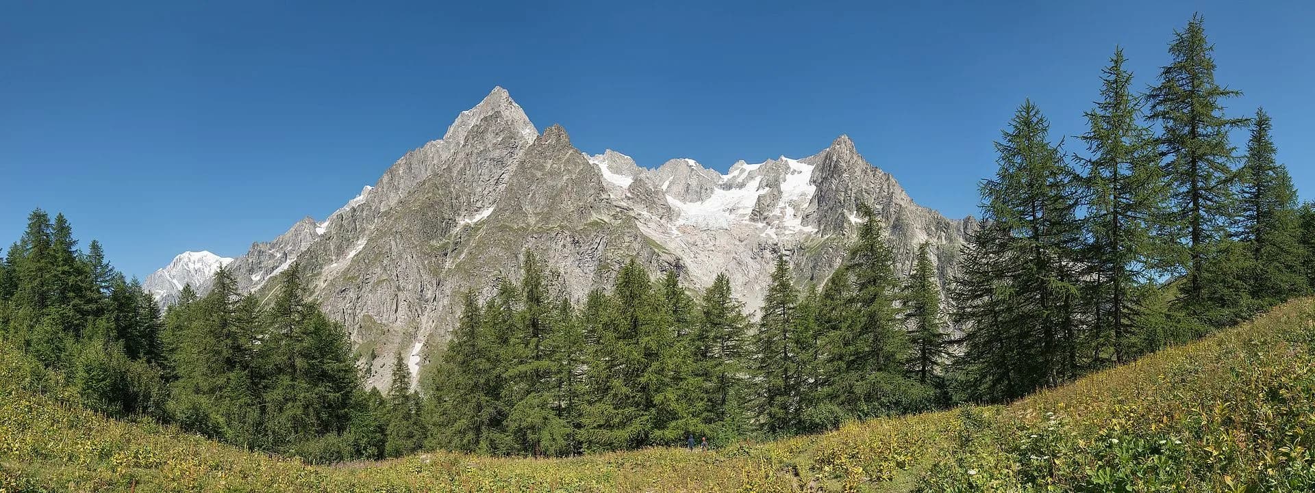
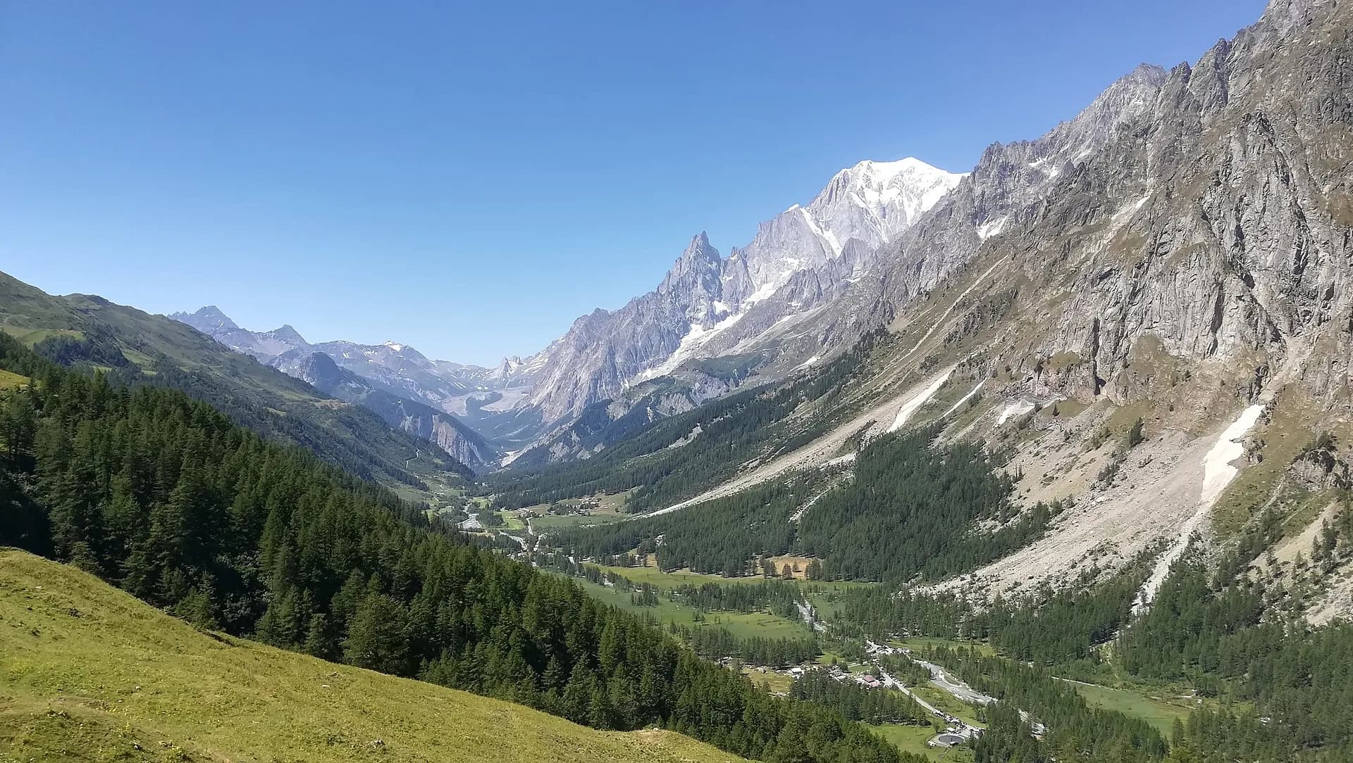
From Rifugio Bertone the trail runs high along the Mont de la Saxe flank, with the Planpincieux glacier and the Grandes Jorasses in sight the whole way to Rifugio Bonatti (2,025 m). One of the most scenic half-stages of the entire TMB.
This is the postcard stage of the Italian TMB: the path runs almost level across the hillside, among juniper and alpenrose, while across Val Ferret the Dent du Géant, the Grandes Jorasses and the hanging Planpincieux glacier file past one by one. The ups and downs are gentle and water points rare: the first real stop is the Bonatti itself, whose terrace ranks among the finest in the Alps. Just before the hut, don’t miss the Malatrà valley opening to the north — the Alta Via 1’s route towards Col Sapin.
Ciencias de la Tierra
Geología y paisaje
Mont Blanc hanging valley: gneiss, granites and Miage moraines; glaciological views of the Italian flank of the massif.
Historia y cultura
The Bonatti, opened in 1998, bears the name of Italy’s most celebrated 20th-century mountaineer: Walter Bonatti, author here of the Drus south-west pillar and the last great first ascent on Mont Blanc.
Fuentes de agua
Water at the stage's support points (Rifugio Giorgio Bertone, Rifugio Bertone, Rifugio Walter Bonatti). On the high ground and at the passes springs are not guaranteed: fill bottles in the valley and at the huts.
Cómo llegar
VITA buses and connections from Aosta; check seasonal timetables at vita.it.
Aparcamiento
Refugios y vivacs
Galería de fotos
Photos are published immediately. JPG/PNG/WebP, max 6 MB.
Flora del sendero
Etapas contiguas
AEditado y verificado por Andrea Rama
Fuente de datos: Tour du Mont Blanc — itinerario internazionale segnalato · Traccia calcolata su rete sentieri OpenStreetMap (ODbL); verificare sul terreno
Última verificación:
Val Ferret
Senderos relacionados
Mismo valle o rutas similares — más excursiones por descubrir.
Val Ferret — Val Ferret svizzera
Tour du Mont Blanc — Stage 4: Rifugio Elena → La Fouly
The Grand Col Ferret: leaving Italy, entering Switzerland.
Val Ferret
High Route 1 — Stage 16: Rifugio Frassati → Rifugio Bonatti via Col Malatrà
Col Malatrà at 2925 m is the rooftop of Alta Via 1: from the panoramic crest above Mont Blanc the trail descends into Val Ferret to the legendary Rifugio Walter Bonatti.
Val Ferret
High Route 1 — Stage 17: Rifugio Bonatti → Courmayeur
The final AV1 stage: the Val Ferret balcony trail with Mont Blanc and Grandes Jorasses always in sight, ending at Courmayeur, Italy's alpine capital.
Val Ferret
Rifugio Bonatti loop
Balcony trail along Val Ferret facing the Mont Blanc massif. Quite possibly Italy's finest panorama.